

Northampton CountyAccomack CountyMathews CountyNorthumberland CountyBrunswick CountyFauquier CountyLancaster CountyPrince William County
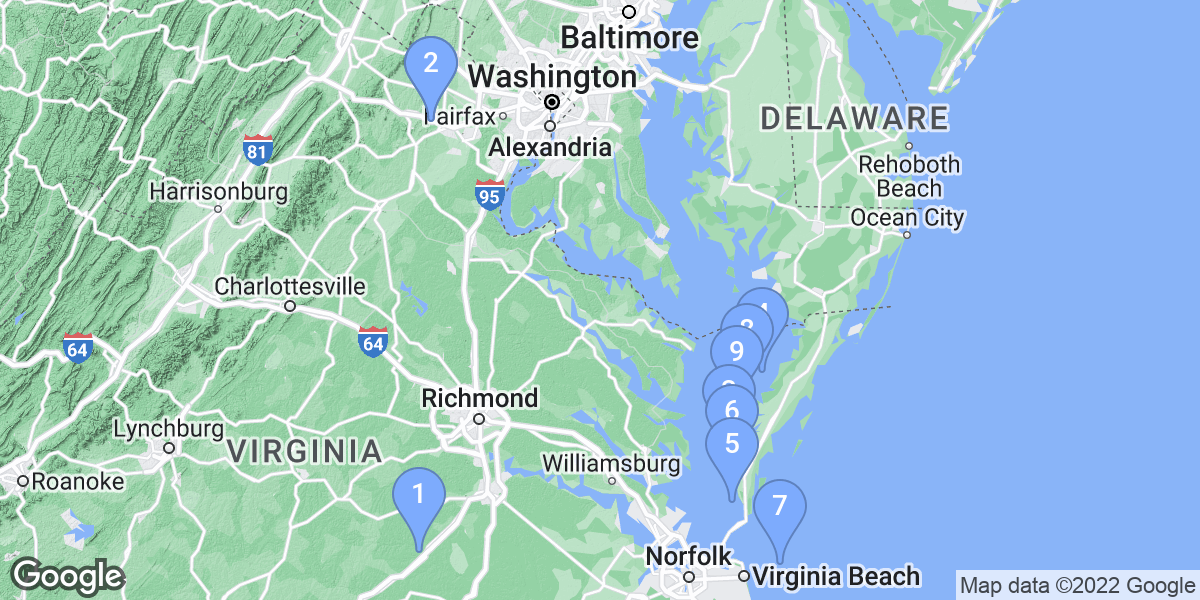
Top Snorkeling and Scuba Diving in Virginia
Ready to check out the best sites in Virginia for scuba diving, snorkeling, shore diving, free diving or other ocean activities? Zentacle has 23 dive sites, snorkel spots, beaches, and more. Discover hand-curated maps, along with reviews and photos from nature lovers like you.
No matter what you're looking for, you can find a diverse range of the best ocean activities in Virginia to suit your needs.


#1 - Gwynn Island Reef
USA, Virginia, Chesapeake Bay
Gwynn Island Reef was reconfigured to a square site located 1.35 nautical miles NE of "Hole in the Wall".
#2 - Lake Phoenix Scuba Park
Virginia, USA East
Lake Phoenix (formerly known as Lake Rawlings) is a good sized beautiful lake that was at one time a granite quarry. Depths up to 65 feet, and all sorts or neat stuff to explore such as two school buses, boats, and lots of special treats.
About 60 miles south of Richmond VA,Take I-95 south to Exit 51, I-85 South (near Petersburg). Take Exit 39 Rawlings and turn right towards the Nottoway Inn. After 0.2 miles, at the "T" intersection, turn left onto Route 1 South. After 1 mile, at the dive flag sign, turn right onto Rawlings Rd/Route 629. After 1.4 miles, turn right onto Quarry Lane (dirt road). Follow Quarry Lane straight to the main gate!
#3 - Millbrook Quarry
Virginia, USA East
About an hour west from Washington D.C. and east from Winchester, Va, Millbrook Quarry is an ideal site for weekend dives. There are multiple sunken attractions including a plane, several boats, and buses, to name a few. They are open Saturday and Sunday only. Water temps can get up to the mid 70's in the summer, but the deepest point is consistently in the 40-50 degree range year round. Thick wetsuits or dry suits are the norm. Visibility can range from 10-20 feet. Entry at the gate is $25, but can be purchased ahead of time at local dive shops for less. For more information see the dive site link listed below.
From Washington D.C. and points east, take I-66 west. Get off on exit 40, Route 15 Haymarket/Leesburg. Turn Left onto Rt. 15. Turn right onto John Marshall Highway/Rt 55 at first traffic light. Follow this road 3.4 miles, you will see a barrel, painted as a dive flag, on the left side of the road marking the entrance to the quarry. From Winchester and points west, I-66 east. Get off on exit 40, Route 15 Haymarket/Leesburg, headed South. Turn right onto John Marshall Highway/Rt 55 at first traffic light. Follow this road 3.4 miles, you will see a barrel, painted as a dive flag, on the left side of the road marking the entrance to the quarry.
#4 - Blackfish Bank Reef
USA, Virginia
40 Armored personnel carriers were scattered at this site as part of "Operation Reef-Ex '98".
In November of 2003, 50 New York City MTA "Redbird" subway cars were added to the site.
In June of 2008, 46 New York City MTA stainless steel subway cars were deployed.
This reef is located 5.8 nautical miles SE of Assateague Beach.
#5 - Anglers Reef
USA, Virginia, Chesapeake Bay
Anglers Reef is located 2.5 nautical miles WNW of the entrance to Onancock Creek.
#6 - Cherrystone Reef
USA, Virginia, Chesapeake Bay
Cherrystone Reef is a circular site located 1.8 nautical miles NNW of Cherrystone Creek, bayside of the Eastern Shore.
#7 - Cabbage Patch Reef
USA, Virginia, Chesapeake Bay
reef is located 5.5 nautical miles SSW of the entrance to Cape Charles Harbor.
#8 - The Cell Reef
USA, Virginia, Chesapeake Bay
The "Cell " Reef is located W of Hungars Creek, bayside of the Eastern Shore.
#9 - Nandua-Pungoteague Reef
USA, Virginia, Chesapeake Bay
Nandua-Pungoteague Reef is located 3.3 nautical miles ENE of the entrance to Pungoteague Creek.
#10 - Nassawadox Reef
USA, Virginia, Chesapeake Bay
This reef is located 2.6 nautical miles NW of the entrance to Nassawadox Creek, bayside of the Eastern Shore.
#11 - Occohannock Reef
USA, Virginia, Chesapeake Bay
Occohannock Reef is located 4 nautical miles WNW of the entrance to Occohannock Creek, bayside of the Eastern Shore.
#12 - Mobjack Bay Reef
USA, Virginia, Chesapeake Bay
This is a rectangular shaped reef located outside of the channel, SW of Mobjack Bay Main Channel Buoy "6MB".
#13 - York Spit Reef
USA, Virginia, Chesapeake Bay
York Spit Reef is square shaped and located east of the entrance to the York River, one-half nautical mile south of the New Point Comfort Shoal.
#14 - Bluefish Rock Reef
USA, Virginia, Chesapeake Bay
This reef is located approximately 4 1/2 nautical miles east of Buckroe Beach and the entrance to Saltponds.
#15 - East Ocean View Reef
USA, Virginia, Chesapeake Bay
This reef, originally referred to as the ODU Reef, was reconfigured to a square shape and is located 2500 yards west of the entrance of Little Creek Harbor, approximately 900 yards off the beach.
#16 - Windmill Point Reef
USA, Virginia, Chesapeake Bay
This square reef site is located 1.4 nautical miles north of Windmill Point Light. The center of the reef is marked with a yellow VMRC buoy designated "WP".
#17 - Asphalt Pile Reef
USA, Virginia, Chesapeake Bay
It is located 4 nautical miles SSE of the entrance to the Great Wicomico River.
#18 - Northern Neck Reef
USA, Virginia, Chesapeake Bay
This reef is located 7 nautical miles E of the Great Wicomico River Light.
#19 - Poquoson Reef
USA, Virginia, Chesapeake Bay
This reef is located approximately 2 1/2 nautical miles east of the Goodwin Islands and northwest of Poquoson River channel buoy "4". The shape of this reef is a rectangle, which runs parallel to the Poquoson River channel.
#20 - Lake Rawlings
USA, Virginia
While many divers wouldn't look toward the Mid-Atlantic for a quality diving location, Lake Rawlings provides suprises for those seeking something different in their adventures.
With a maximum depth of 65 feet, warm water, and good visibility (30 to 60 feet), the lake has many wonders to explore.
From I-95, north of the Lake
(Richmond, VA; Maryland; Pennsylvania)
Take I-95 south to Exit 51, I-85 South (near Petersburg).
Take Exit 39 Rawlings and turn right towards the Nottoway Inn.
After 0.2 miles, at the "T" intersection, turn left onto Route 1 South.
After 1 mile, at the dive flag sign, turn right onto Rawlings Rd/Route 629.
After 1.4 miles, turn right onto Quarry Lane (dirt road).
Follow Quarry Lane straight to the main gate!
From I-95, north of the Lake (alternate route)
We know traveling from Washington, DC or the Baltimore, MD area can be frustrating. Consider this alternate route.
From the outer beltway (I-495) take Route 5 South to US 301 South.
Exit US 301 South at I-295 South.
Exit I-295 South at Route 10 heading west.
After 5 miles, take I-95 South.
Take I-95 south to Exit 51, I-85 South (near Petersburg).
Take Exit 39 Rawlings and turn right towards the Nottoway Inn.
After 0.2 miles, at the "T" intersection, turn left onto Route 1 South.
After 1 mile, at the dive flag sign, turn right onto Rawlings Rd/Route 629.
After 1.4 miles, turn right onto Quarry Lane (dirt road).
Follow Quarry Lane straight to the main gate!
#22 - Newport News Middle Ground
USA, Virginia, Chesapeake Bay
This reef is located at the mouth of the James River around the Newport News Middle Ground Lighthouse. The reef material forms a ring between 200 and 1000 feet from the lighthouse and includes reef balls, concrete rubble, buoy sinkers, piling and pier sections.
#23 - Lake Millbrook
USA, Virginia
This is the local dive site for divers in Northern Virginia. It is an inland fresh water lake that was formed from a flooded quarry. Various ships, air planes, and other structures have been sunk for diver's use. Local dive shops conduct the whole gamut of training here. You must have a c-card to get in, so there are no fishermen, boats, or snorkelers.
From Rt 66 in Virginia, take exit 40 for US 15 South. Take US 15 South to the traffic light at VA 55. Take a right on to VA 55 West. Continue of VA 55 approximately 3.6 miles. Millbrook's entrance will be on your left, immediately after crossing Broad Run. The entrance is marked by a gate and a barrel with a dive flag painted on it. If you arrive before opening, you will also see a line of cars extending both east and west from the gate.
Admission passes are $30.00 at the gate or
$18.00 at a local dive shop. The lake is privately owned, but used by the local SCUBA crowd. It is open weekends, closed weekdays seasonally. Divers can camp overnight from June 2 through Labor Day for $5 extra per person.
There are several beaches around the lake where divers can enter the water.