

Top Snorkeling and Scuba Diving in Charlotte Amalie
Ready to check out the best sites in Charlotte Amalie for scuba diving, snorkeling, shore diving, free diving or other ocean activities? Zentacle has 5 dive sites, snorkel spots, beaches, and more. Discover hand-curated maps, along with reviews and photos from nature lovers like you.
No matter what you're looking for, you can find a diverse range of the best ocean activities in Charlotte Amalie to suit your needs.

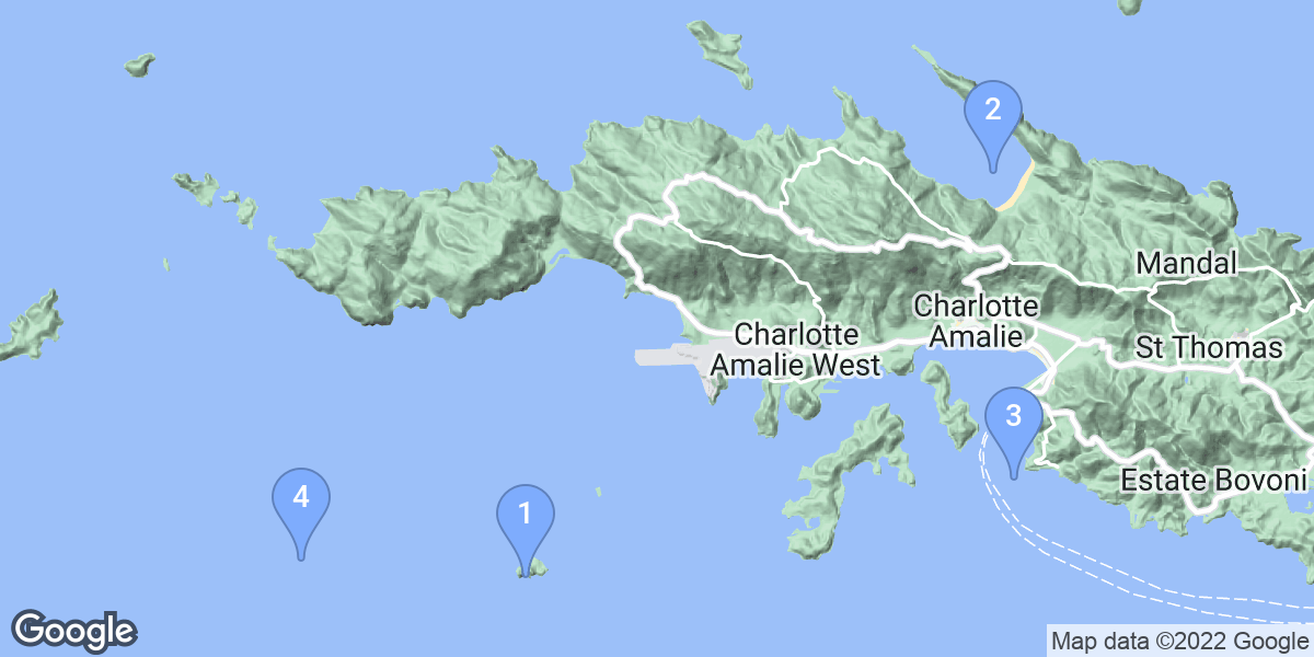


#1 - Saba Island
Virgin Islands, Saint Thomas Island
South side of Saba Island.
No mooring. If anchoring boat on lee (west) side which is usually calmer, it can be a long swim to the best diving in the center of the south side of the island.
#2 - Magens bay
Virgin Islands, Saint Thomas Island
Beautiful Bay. Turtles and many fish.
Direct in from the beach
Magens bay is also known as Megans Bay.
#3 - Sprat
Virgin Islands, Saint Thomas Island
Sprat is a common "second dive" after diving nearby deep wrecks like the WIT Concrete or the Miss Opportunity. Boats anchor moor in approximately 60 feet on the sandy bottom, but then ascend to the shallower reef, where a variety of coral formations lead to trenches, tunnels and small caverns that can be explored.
Sadly the area has been heavily fished, and although the topography is impressive, marine life is in very short supply.
Boat boat only. A few minutes outside of Charlotte Amalie harbor.
#4 - Navy Barges
Virgin Islands, Saint Thomas Island
Navy barges sunk as artificial reef. Maximum depth is 40-50 feet. Marked with a buoy and a tie point so you don't have to drop anchor. Lots of sea life here with spine lobster and eels in abundance.
Navy Barges is also known as Navy Barges at St Thomas USVI.
#5 - WIT Shoal Wreck
Virgin Islands, Saint Thomas Island
Probably the most famous dive in the USVI, the WIT Shoal is a popular deep wreck. Located some miles out from St Thomas, it was illegally sunk in shallower waters when it was supposed to be sunk off the deep dropoff miles further out.
However, the wreck is relatively in tact, and having sunk in 1984 has now attracted a host of marine life. The wreck is fairly large (327 feet), and one can swim through penetration on most of the decks. Because of the large amount of external light, and the lack of confined spaces, pentration training is not normally needed.
It sits on sand at 70 feet (although parts inside the wreck reach deeper). The wheelhouse is at 30 feet.
More info: http://www.caribdiveguide.com/WIT_shoal.htm
By boat only. Divers must "hook into" the wreck, which can only be done if weather conditions permit.
Site is not marked, and so cannot realistically be located without GPS coordinates.
Approximate location shown in map.
WIT Shoal Wreck is also known as WIT Shoal.