

Suffolk CountyWarren CountySchuyler CountySt. Lawrence CountyQueens CountyWayne CountyNassau CountyUlster CountyKings CountyJefferson County
Top Snorkeling and Scuba Diving in New York
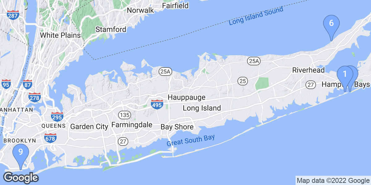
Ready to check out the best sites in New York for scuba diving, snorkeling, shore diving, free diving or other ocean activities? Zentacle has 56 dive sites, snorkel spots, beaches, and more. Discover hand-curated maps, along with reviews and photos from nature lovers like you.
No matter what you're looking for, you can find a diverse range of the best ocean activities in New York to suit your needs.

Recommended dive shops


#1 - The Wreck of the Islander
New York, USA East
One block from restaurants and easy free parking feet from the entry down a short ramp. Swim less than 25 yards and descend on the wreck in about 15 feet. No current. 30 feet viz. Easy as a shore dive can get! Google for more info and start by going here: http://www.1000islands.com/wrecks/
St. Lawrence River, Clayton NY side. This side wheel steamer was built in Rochester, N.Y. in 1871 and launched as James H. Kelly later changed to John Thorn. The Islander measured 125 ft. x 20 ft. x 7 ft. and weighed 118 gross tons. As well as a regular mail carrier between Clayton and Alexandria Bay, the Islander began island and river tours on July 31, 1893. The Islander burnt on Sept. 16, 1909 while at dock at Alexandria Bay. Since the tragedy the Islander has become a favorite dive site for many divers. The Islander is located just off the shoreline of Alexandria Bay. She is angled slightly upstream with a very slight current, which makes this a very pleasurable dive. The stern is in 15 ft. of water with the bow in 60 ft.. The best access to the wreck is to park in the town parking lot in front of the pavilion, just west of the hospital.
#2 - Atlantic Beach Old Bridge
New York, USA East
Atlantic Beach Old Bridge is a 5.0-star rated scuba dive and snorkel destination in New York, USA East which is accessible from shore based on 2 ratings.
#3 - Ponquogue Bridge
New York, USA East
This dive needs to be timed so that you make it at slack tide only due to the strong current. High slack tide will give you the best visibility. There are lobster and lots of other marine life. Late in the season I have even found tropical fish there brought up by the gulf stream.
Take Sunrise Highway to Exit 65 South. Make a left onto Montauk Highway, then a right turn onto Ponquogue Avenue. Take this to the end and make a left on Shinnecock Avenue. Turn right on Foster Avenue, when you see the new bridge you can turn left just before it for the northern side of the bridge. For the southern side drive over the new bridge to the end of the road and make a U-turn onto the service road.
Ponquogue Bridge is also known as Old Ponquogue Bridge.
#4 - Abay Hospital Bottle Dive
New York, USA East
Entry is after the pavilion walk to the right down the hill to the fishing dock, jump in and drop down, the hospital was built on a hotel property so there is a ton of bottles and glassware just waiting for people to dig for and discover. Gentle currents may be an issue so watch it, stay close to the wall and you can swim back, or just drift down to the Islander and get out. Lots of diving to be done right in this general area.
81N to 13E to Alexandria Bay light, go left into the heart of A-bay, go straight until road T's, go left and then right into the park parking lot. Carry gear thru the pavilion and use tables on other side.
#5 - Shoreham Jetty
New York, USA East
Shoreham Jetty is a 5.0-star rated scuba dive and snorkel destination in New York, USA East which is accessible from shore based on 1 ratings.
#6 - Cedar Beach Jetty
New York, USA East
Cedar Beach Jetty is a 5.0-star rated scuba dive and snorkel destination in New York, USA East which is accessible from shore based on 1 ratings.
#7 - Manhattan Beach
New York, USA East
Manhattan Beach is a 5.0-star rated scuba dive and snorkel destination in New York, USA East which is accessible from shore based on 1 ratings.
#8 - Mattituck Jetties
New York, USA East
Mattituck Jetties is a 5.0-star rated scuba dive and snorkel destination in New York, USA East which is accessible from shore based on 1 ratings.
#9 - Shinnecock Jetty
New York, USA East
Shinnecock Jetty is a 5.0-star rated scuba dive and snorkel destination in New York, USA East which is accessible from shore based on 1 ratings.
#10 - Bayville Barge
New York, USA East
Bayville Barge is a 4.5-star rated scuba dive and snorkel destination in New York, USA East which is accessible from shore based on 2 ratings.
#11 - Islander
New York, USA East
With the pavilion and tables it makes it a breeze to suit up. The wreck of the Islander is down the sites steps and swim about 30 feet out straight. She sets with her bow pointed westward and lists starboard to the north. Easy dive from 22 feet to 60 feet in depth, gentle if any current. Fish of the dive would be the mudskippers that seem to be everywhere if you look close in the shallows. Get lucky and catch sight of a sturgeon.
81N to 13E to Alexandria Bay light, go left into the heart of A-bay, go straight until road T's, go right and follow it around to the left, the site is obvious with its pavilion and parking lot.
#12 - HMS Culloden
New York, USA East
HMS Culloden is a 4.0-star rated scuba dive and snorkel destination in New York, USA East which is accessible from shore based on 1 ratings.
#13 - Underwater Restaurant
New York, USA East
The dive starts like the Islander, but upon entry you go east along the rock slope, go past the buoyancy course (or maybe give it a try, never hurt to practice), go past the 20ft training platform, and start to look for the heavy chains from the Uncle Sams boat tour dock (stay low, the boat could leave at anytime, cool to see it go overhead, not cool to get sucked into the screws) follow the chains away from shore or roughly north-northeast. Once you get to the bottom of the chains you should see the restaurant about 60 feet away. Take only pics, leave only bubbles please.
81N to 13E to Alexandria Bay light, go left into the heart of A-bay, go straight until road T's, go right and follow it around to the left, the site is obvious with its pavilion and parking lot.
#14 - USS Ohio
New York, USA East
USS Ohio is a 4.0-star rated scuba dive and snorkel destination in New York, USA East which is accessible from shore based on 1 ratings.
#15 - Montauk Jetties
New York, USA East
You can drive right up to the west jetty and park free in a public lot. The east jetty can be reached through a town beach. Visibility is good with a fair amount of marine life including lobster. Diving is not permitted on the inside of either jetty due to a high volume of boat traffic.
Montauk Jetties is also known as Montauk Twin Jetties.
#16 - Beach 8th Street, Queens
New York, USA East
A Paradise Not Lost
By Bob Sterner (http://www.sternereditorial.com)
http://www.nedivenews.com
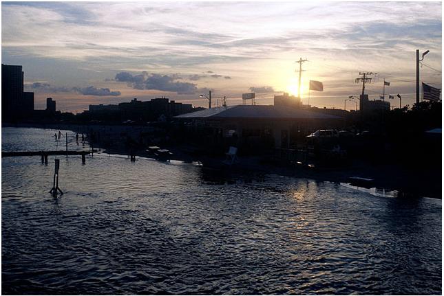
What's old is new is the good news about Almost Paradise. Beach 9th Street, Far Rockaway, Queens, N.Y., is back to being called Beach 8th Street, for the traditional hole in the fence that's given so much pleasure to generations of divers, local fishermen and kids splashing into the cool eddy between the jetties that form the site. Diving here no longer costs $20 a head for everyone in the car to park in the now closed Almost Paradise lot, although I'd still be glad to do so for the showers and facilities to rinse salt out of gear while getting a burger and a soda after a nice dive.
Riding the tide change to the bridge and back is discouraged in post-9/11 days, although serious tautog spear-fishers still return from there with dinner. At least they know what they're bagging. Shore fishers bring home lots of dinner too from this thriving patch of sand just off JFK Airport's runways. When dinner divers miss a shot, they missed it. When shore fishers lose a fish, their bottom tackle stays on the bottom hooking and killing sea creatures for decades.
A fish killed wantonly that Barbara Krooss caught me looking at not long ago tells the story of glittery bottom tackle underwater. It's there to kill generations of fish unless you cut it off and remove it from pilings and other underwater obstructions. It might sound counter-productive, but you can make friends with the shore fishers who hate you for blowing bubbles around their favorite cast sites if you return the bounty of hooks, weights, spinners and other lures that they lost underwater. At the base of the piling where this fish lost its life to a lure we found a horseshoe crab barely alive and hopelessly snarled in a tangle of fishing line. It didn't stick around for a portrait after being freed.
Otherwise little has changed at the humble beach where thousands of divers have earned their c-cards. Divers still queue up a half-hour before high and low slack tide for optimum visibility. Many still avoid the crowd by diving as the current runs by ducking behind pilings. It's great training for low-vis conditions at a place where you can't get lost so long as you can follow a compass needle north to the shore. At mid-channel, high-tide, it is about 40 feet to the surface, but you don't want to go there because of heavy boat traffic. Lobsters, crabs, flounders, bergals, sponges, mussels and plants galore that drew divers to this humble site decades ago are still there for those willing to venture through the hole in the fence to see what's beneath the waves of Reynolds Channel.
See more photos and stories of diving this and other sites at Sterner Editorial (http://www.sternereditorial.com).
Found in the Rockaways, near JFK Airport in New York City
#17 - Clark's Beach
New York, USA East
Clark's Beach is a 3.5-star rated scuba dive and snorkel destination in New York, USA East which is accessible from shore based on 2 ratings.
#18 - Lloyd Neck
USA, New York, Long Island
You can reach this site through Caumsett State Park but you will need to set this up in advance as you need a permit to drive to this site. Shore access is a short walk from the parking lot. Depth changes the further you go off shore and the greater the chance of boat traffic. Area is good for lobster and other local marine life.
From either the LIE or Northern State take the Round Swamp Rd exit north to the end. Turn right on Rt 25, left on Oakwood Rd, left on High St and right on Woodbury Rd. Woodbury Rd turns into West Neck Rd and later into Lloyd Harbor Rd.
Lloyd Neck is also known as Caumsett State Park.
#19 - Sag Harbor Jetty
New York, USA East
Sag Harbor Jetty is a 3.0-star rated scuba dive and snorkel destination in New York, USA East which is accessible from shore based on 1 ratings.
#20 - Throgs Neck Jetty
New York, USA East
Throgs Neck Jetty is a 3.0-star rated scuba dive and snorkel destination in New York, USA East which is accessible from shore based on 1 ratings.
#21 - East Shore Park
New York, USA East
Quite possibly the only place to legally dive Cayuga Lake from the shore. Because of this the Cornell open water SCUBA class will sometimes teach students here. The water remains quite shallow for quite some distance, making it unlikely you can swim to over twenty feet depth.
From downtown Ithaca take the 13 just past Ithaca High School to the 34. Make a left onto the 34, and follow it about a quarter mile. East Shore Park will be on the left.
#22 - Shinnecock Canal Jetty
USA, New York, Long Island
This is a long jetty with very little current except at the end of the jetty where the current can be strong at times and wakes from boat traffic can make it a tough place to swim. You can not dive on the inside of the jetty due to the current and boat traffic. There is lots of marine life with a few lobster. At low tide you can snorkel this site end to end.
Sunrise Hwy. east, after you cross over the canal take the first exit, North Shore Rd. At the end of the exit ramp go straight onto Canal Rd. north, right on Old North Hwy. and make your first left into Meschutt Park.
Shinnecock Canal Jetty is also known as Meschutt Park Jetty.
#23 - Morgan Park Jetty
USA, New York, Long Island
The south side of the jetty is the more sheltered side with better visibility. There is a fair amount of marine life here with some lobsters. Due to the sheltered nature and shallow depth this is also a good site for training and first dives.
Take the Long Island Expressway to Exit 39 North, Glen Cove Road, Rt 107 to the end and turn right, then your first left onto Mill Hill Rd. Mill Hill becomes The Place Rd. Make a left onto McLoughlin Street to the end is Morgan Park.
Morgan Park Jetty is also known as Glen Cove Jetty.
#24 - Shipwreck Cove
USA, New York, Long Island
There is no name for this cove on the chart. The site appears to have been used as a dumping ground for boats. There are a few small barges and many boats sunk here. I made this dive from a sit-on-top kayak that I put in from Cedar Beach.
The site is about 3/4 of a mile east of Cedar Beach and 4 1/4 miles west of Captree. This site can only be reached by boat.
#25 - Duck Pond Pt.
USA, New York, Long Island
This site has a sand and gravel bottom extending out to about 150 yards, after that it is mud bottom. There are large rocks and boulders close in making it good for lobster and spear fishing. There are large rocks to the west for at least a half a mile. The point itself is 1/8 of a mile east of the access point. I would recommend starting at the point towards the end of an incoming tide and drift dive the whole way down and either walk or swim back depending on the current.
LIE exit 71 north on Edwards Ave to Sound Ave east to Depot Ln north. Depot Ln turns into Duck Pond Rd, take it to the end.
#26 - Horton Pt
USA, New York, Long Island
I have made this dive from the beach and from a boat. The bottom is rocky with boulders and a fast moving current. From the beach this site needs to be timed just right. I made this dive from a boat during an outgoing tide and it was like an underwater roller coaster taking you over boulders as big as a two story house.
LIE exit 71, Edwards Ave north to Sound Ave east to Horton Ln north. Bear right onto Old North Rd and left onto Lighthouse Rd to the end. There is parking at the lighthouse and a long stairway down to the beach. The stairway is about 125 steps long so do not attempt this dive if carrying your equipment back up is going to be a problem.
Horton Pt is also known as Horton Pt Lighthouse.
#27 - Radeau
USA, New York
Just an all around cool dive. This is the oldest war ship in North America. Even if you have been diving for awhile, this is a terrific dive.
The 1758 Land Tortoise radeau warship, flagship of "The Sunken Fleet of 1758"
http://www.thelostradeau.com/
Charter Boat
http://www.diveadventuresus.com
Great operation, we use them when we were in the area. Top notch outfit.
#28 - Shoreham Jetties
USA, New York, Long Island
The visibility is great and the current is very low if at all. Lots of marine life and lobster. This is not the easiest place to find or get to but well worth the trip. Over the years this site has filled in with sand so at low tide you can snorkel about 80% of this site.
Long Island Expressway to Exit 68 North, Wm. Floyd Parkway to the end and make a right on to Rt 25A. Make a left onto Randall Rd. Make a right onto North Country Rd. Make a left on Sound Road to the end. Turn left on Creek Road to the end, where you will find a small parking lot. To get to the jetties, you must swim or walk across the creek (Wading River), and then walk to the jetties. Total distance is about a quarter of a mile to the east jetty. I use a sit-on-top kayak to get from the lot to the jetties, this also makes it easy to get to the west jetty where I usually find more lobster.
Shoreham Jetties is also known as Shoreham Power Plant.
#29 - Lake Minnewaska State Park
USA, New York
Short walk from parking lot to water along marked trail. Dress at your car or on shore. Dive along wall to you left or right. Stay out of the swimming area to the right.
Minnewaska State Park Preserve
5281 Route 44-55
Kerhonkson, NY 12446
Diving alowed between 9AM and 4PM daily. Except when ice in on the lake.
Must check in with park office, pay $25 annual fee, have dive buddy, dive flag, and leave your certification card with office. Don't forget to pick it up as you leave. Great training area. Cold water.
#30 - Sag Harbor Jetties
USA, New York, Long Island
The site is made up of two jetties that are the barriers for the harbor. The first starts at the beach and goes out about 350 yards. There is a 30 yard gap between the first and second jetty, the second jetty is about 600 yards long. Other then the jetties the harbor itself can be interesting dating back to the 1600s but there is a lot of boat traffic to deal with once you get away from the jetties.
Montauk Hwy Rt 27 east to Bridgehampton. Take Bridgehampton / Sag Harbor Turnpike north, turns into Main St and ends at the harbor. Though the jetty starts on the beach there is no way to get to it that I know of so this needs to be a boat dive. I have made this dive from a sit-on-top kayak.
Sag Harbor Jetties is also known as Sag Harbor.
#31 - Roanoke Pt Ships
USA, New York, Long Island
There are 4 wood hull boats sunk off the beach. 3 in a line, 1 half buried on the shore and another half buried boat about 200 yards away. The access to the beach is about a half a mile east of the site. I use a sit-on-top kayak to get there and dive but most people will have to walk. Visibility is good with lots of marine life and lobsters.
Long Island Expressway to Rt 24 Exit and go north on Edwards Ave. Turn right onto Sound Avenue, and make a left onto Park Road and take it to the end. The boats are about 1/2 miles down the beach to the west.
Roanoke Pt Ships is also known as Roanoke Barges.
#32 - Sound Beach
USA, New York, Long Island
The site has a rocky bottom with lobster and other marine life.
LIE to exit 63 north to the end, right on 25A, bear left onto Echo, right on Lower Rocky Pt Rd, left on Hegerman Landing Rd to the end. There is no parking at the site itself so you will need to drop your gear there and park else ware.
Sound Beach is also known as Hagerman Landing.
#33 - American
USA, New York
This dive is not recommended for beginners! It is not advised to stay a long time without an air reserve. The crew of the dive boat must have a way to signal you the arrival of a cargo boat for example. Also please take note that if you don't control adequately your buoyancy you may touch the bottom which is covered of crude oil...not easy to clean.
It is extremely important to take note that any cargo ship passing by will create a large water draft. You must be prepared for any situation. For example, if you are 40' deep and you have to make a rapid ascent (for any reason), you may find yourself directly under the propeller!!! If such a situation has to arrive, stick to the bottom!. Dump the air of your BC. Watch your air. Have a reserve of air or a second bottle of air, be near your buddy otherwise, and stay calm! Wait for the boat to pass. If nothing goes wrong then you will have a full bottle of air for your next dive...
#34 - Rogers Rock
New York, USA East
Rogers Rock (or Slide) is a very steep cliff that extends from a mountain deep into Lake George. Lots of boulders, and multiple thermoclines are to be encountered. From the beach at the Association camping area, swim left (north) around the bay and you will encounter Juniper Island. Juniper is a small island that is separated by a 2 or 3 foot deep channel which divers and campers have been alternately filling in or deepening over the years. Depending on who had the last say, you may be able to swim through a shallow cut between the island and the shore, or may have to take a short swim around the island. Once past the island you are at the start of the slide. Huge boulders, lots of vertical rock make this an interesting place to dive. Viz in the 30 foot range is fairly normal.
Rogers Rock is located in the NYS Rogers Rock campground. To reach it take Adirondack Northway to Lake George and take rt 9 up the west side of Lake George to the campground, about 3 mines north of Hague. Shore access is best from the Association area campsite. This is often rented by the week, In September there are often several SCUBA clubs that rent the area and divers are welcome.
#35 - Seneca Lake: FLUPA buoy The Steps
USA, New York
Access to this site is provided by the Finger Lakes Underwater Preservation Association (FLUPA). A map of many wrecks in this area can be found at www.flupa.org. If you dive here, please log your visit on a slate at 15' depth on the mooring line.
Drop to bottom of mooring line and land on remnant of a barge at 30'(The Step Barge).
Head 020N magnetic for 200' to find large barge in 50'-70' of water.
Head south from mooring about the same distance to find a smaller barge lying in 30'-50' of water.
The 50'-70' barge is still in excellent shape, only the stern has collapsed. Visibility can be quite good at times thanks to the zebra mussels which cover the entire area. If there is a strong north or south wind, there may be a moderate current.
This site is marked by a buoy maintained by FLUPA just south of the US Salt Plant, there is a mooring buoy attached.
Seneca Lake: FLUPA buoy The Steps is also known as Seneca Lake Watkins Glen.
#36 - Smithtown Bay Artificial Reef
USA, New York, Long Island
Reef is made up of a barge and tires. Lots of marine life including lobster.
Site is about a mile offshore and can only be reached by boat. The site is sometimes marked by a buoy but due to a fair amount of boat traffic that is not usually the case. Without a GPS you will have a very hard time finding this site.
#37 - Green Point Jetty
New York, USA East
Green Point Jetty is a 0-star rated scuba dive and snorkel destination in New York, USA East which is accessible from shore based on 0 ratings.
#38 - Jones Beach Jetty
New York, USA East
Jones Beach Jetty is a 0-star rated scuba dive and snorkel destination in New York, USA East which is accessible from shore based on 0 ratings.
#39 - Moriches Jetty
New York, USA East
Moriches Jetty is a 0-star rated scuba dive and snorkel destination in New York, USA East which is accessible from shore based on 0 ratings.
#40 - Murphy Wreck
New York, USA East
Murphy Wreck is a 0-star rated scuba dive and snorkel destination in New York, USA East which is accessible from shore based on 0 ratings.
#41 - Rocky Point
New York, USA East
Rocky Point is a 0-star rated scuba dive and snorkel destination in New York, USA East which is accessible from shore based on 0 ratings.
#42 - Roda Wreck
New York, USA East
Roda Wreck is a 0-star rated scuba dive and snorkel destination in New York, USA East which is accessible from shore based on 0 ratings.
#43 - Sea Cliff
New York, USA East
Sea Cliff is a 0-star rated scuba dive and snorkel destination in New York, USA East which is accessible from shore based on 0 ratings.
#44 - Weaks Point Jetty
New York, USA East
Weaks Point Jetty is a 0-star rated scuba dive and snorkel destination in New York, USA East which is accessible from shore based on 0 ratings.
#45 - Oyster Barge Wreck
New York, USA East
Oyster Barge Wreck is a 0-star rated scuba dive and snorkel destination in New York, USA East which is accessible from shore based on 0 ratings.
#46 - Casino Island Drift
New York, USA East
One should walk the park to get the idea before entry. After walking out of the pavilion go left toward the bridge, but go past, down the hill until the fence ends, you will see a nice gentle rock entry point, the idea is to swim out to the island from there, drop down and catch the current across the front of the island, after the island there are 2 options: Drift to the Islander or swim across the canal behind the island to the east side of the fishing dock and exit thru the rocks, look close you see what I mean at the very end of the dock is a set of rock "stairs" to get out. Lots of fun!!!
81N to 13E to Alexandria Bay light, go left into the heart of A-bay, go straight until road T's, go left and then right into the park parking lot. Carry gear thru the pavilion and use tables on other side.
#47 - US Coast Guard Boat 56022
USA, New York
The US Coast Guard Boat 56022 was a converted landing craft (LCM). It sank in a storm December 1, 1977.
Approx 1 mile north of Ontario-on-the-Lake
#48 - Seneca Lake: Watkins Glen Barges
USA, New York
Seneca Lake has constant temp of 39.2 degrees from its springs - COLD! In lake summer, the top 15 feet or so can warm up into the upper 70's, but there's not much to see in the shallow areas due to zebra muscles. Certainly dry suit conditions for that! Max depth of the lake is 618 ft.
A collection of barges on the southwest end of the lake, near the village of Watkins Glen, is being preserved and made accessible for scuba diving by the Finger Lakes Underwater Preserve Association.
#50 - Sunken Cabin Cruiser
USA, New York
Sunken 30' boat harbours rock bass and a few yellow perch
No Buoy: find the site by triangulating yourself using the largest building in the park (south) and the flagpole near the B&B (east); exactly 45' deep.
Seneca lake
Sunken Cabin Cruiser is also known as Cabin crusier.
#51 - A.E. Vickery
USA, New York
Wooden three masted schooner lying in 60 to 150 feet. The Vickery was was built in 1861 and sank on August 17, 1889.
Rock Island Shoal, St. Lawrence River, New York side. There is a buoy just upstream of the Rock Island Lighthouse.
A.E. Vickery is also known as J.B. Penfield.
#52 - Almost Paradise
USA, New York, Long Island
Park by the Rockaway Manor Home for Adults (145 Beach 8th, St Far Rockaway, NY)
Almost Paradise is also known as Beach 8th St, Far Rockaway NY.
#53 - Rocky Point
USA, New York, Long Island
The site has a clean sand, pebble and rocky bottom. Lots of rocks and a fair amount of lobster and other marine life around them. The current is strong here at times and visibility is good. Slack tide would be the best time to dive this site.
LIE to exit 71 north on Edwards Ave, east on Sound Ave, north on Rocky Pt Rd to the end. The site is at the bottom of a 20ft bluff.
Rocky Point is also known as Rocky Pt., East Marion.
#54 - Greenport Jetty
USA, New York, Long Island
This is a great place for a large assortment of marine life including lobster. The area is sheltered from wind in most directions but boat wakes can be a problem on weekends. The current can be a problem at the tip of the jetty during peak tide change. The site is well worth the drive and walk.
LIE to exit 71 north on Edwards Ave, right on Sound Ave [long drive] turn right on Manhanset Ave to the end. Klipp Park Beach is at the end of Manhanset Ave, it is a local beach but you can buy a day pass. You can walk the 1/3 of a mile to the jetty or put a boat in at the Klipp park ramp.
#55 - Gwendolyn Steers Wreck
USA, New York, Long Island
The Gwendolyn Steers is a tugboat that sunk in about 55ft of water. The wreck sits upright and comes to within about 25ft of the surface. It is 96ft long with a 20ft beam. Visibility is usually poor, there is a fair amount of boat traffic and nets have been present in the past.
Access is by boat only.
Gwendolyn Steers Wreck is also known as Gwendolyn Steers.