

Top Snorkeling and Scuba Diving in Leeds and Grenville United Counties
Ready to check out the best sites in Leeds and Grenville United Counties for scuba diving, snorkeling, shore diving, free diving or other ocean activities? Zentacle has 11 dive sites, snorkel spots, beaches, and more. Discover hand-curated maps, along with reviews and photos from nature lovers like you.
No matter what you're looking for, you can find a diverse range of the best ocean activities in Leeds and Grenville United Counties to suit your needs.


#1 - The Rothesay
Ontario, Canada
The Rothesay is a 19th Century wooden side wheeler (193' x 28.8' x 7.9') and was launched in St. John, N.B. on Feb. 2, 1868. Initially she sailed between Fredricton and St. John but was later relocated to serve on the St. Lawrence River. She was carrying passengers between Brockville and Montreal when, on Sept. 12, 1889, she collided with the tug Myra and sank at her present location. Although no-one was lost from the Rothesay two crewmen on the tug were killed. In 1901 members of the Royal Military College in Kingston blew up the wreck amidships in a munitions exercise. The Rothesay was rediscovered on Sept. 25, 1964 by the Underwater Society of Ottawa and remains a very popular dive site. Bring a light to see into the chain locker and hold. Prepare for a 1 to 2 knot current along the surface. there is hardly any current at depth. Shore buoy marks the start of a 300 ft. line out to the wreck along the bottom. Follow the line, you arrive at the smoke stack. Upperwork lies at about 20 feet, maximum depth is 30 feet. Best visibility is early and late in the dive season, and varies from 5 to 10 feet. As with all Marine Historical Sites in Ontario, the Rothesay is property of The Province of Ontario and removal of any material is illegal.
The Rothesay, is located in the St. Lawrence River, west of Prescott. It is accessible both by land and by boat. Follow Highway 401 and take the Highway 18 Exit (#716) to Prescott. Turn west on King St. W (Highway 2) and follow for 1.75 Km until you reach Riverview Heights. There you will see a Historic Marker along the south side of the road commemorating Justus Sherwood. The adjoining grass strip can accommodate about a dozen cars. From the embankment you will see a buoy approximately 300 ft out, marking the actual wreck and a jug closer in that is the beginning of the line.
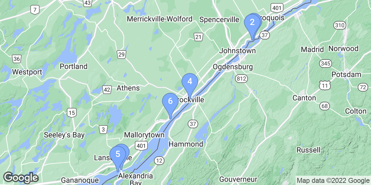
#2 - Conestoga Wreck
Canada, Ontario
The steamship Conestoga (ie SS Conestoga) was a combined passenger/cargo carrying vessel, built in 1878 in Cleveland Ohio. She was sold to a Canadian company in 1919. On 22 May, 1922, she caught fire when loaded with a cargo of wheat and sank where she lies today.
Along side the old canal south wall, near from Cardinal, Ontario.
Conestoga Wreck is also known as The wreck of the Conestoga.
#4 - Ivy Lea Campground Beach
Canada, Ontario
Ivy Lea Campground Beach is a 0-star rated scuba dive and snorkel destination in Canada, Ontario which is accessible from shore based on 0 ratings.
#5 - Kinghorn
Canada, Ontario
Kinghorn is a 0-star rated scuba dive and snorkel destination in Canada, Ontario which is accessible from shore based on 0 ratings.
#6 - The Robert Gaskin
Canada, Ontario
The Robert Gaskin is a 0-star rated scuba dive and snorkel destination in Canada, Ontario which is accessible from shore based on 0 ratings.
#7 - Centeen Park
Canada, Ontario
Centeen Park is a 0-star rated scuba dive and snorkel destination in Canada, Ontario which is accessible from shore based on 0 ratings.
#8 - Ash Island Barge
Canada, Ontario
Ash Island Barge is a 0-star rated scuba dive and snorkel destination in Canada, Ontario which is accessible from shore based on 0 ratings.
#9 - The Lillie Parsons
Canada, Ontario
STRONG CURRENT. I can't emphasize this enough. The only reasonable way to get around this wreck is to drift down it and use hand holds on it or rocks on the bottom to pull yourself towards it's stern ( yes, oddly enough, her stern is pointing INTO the current). If using rocks, be careful what you grab as she was carrying a load of coal and that is akin to grabbing a grain of sand. It's won't hold you.
All that said, she's a neat ship. She sank after striking a rock in 1877 and her cargo shifted. She's a 131 foot schooner that lies inverted on a rock ledge. She's partially over the edge and the only thing holding her on is the current. Eventually, she'll make the plunge to bottom which is 170 feet there. Penetration is possible and the ship's stove is located midships. Many artifacts have been found on the wreck and are located in bins attached to the island side of the vessel. Look, touch but don't take. A unique view of the centre board and it's housing can be found drifting down current over the hull. Once at the bow, drop down into it's lee to explore or begin a hand over hand journey back to the stern using whatever you can hold onto.
If you plan on extending your drift, past the escape lines, be warned. About 4 minutes down stream is some rock formation that causes a down draft. I guarantee, that's you'll be at 130 ft minumum before being able to kick out of it even fully inflated. The good news? You won't get deeper than 170 unless you brought a shovel.
Actual entry is a shore dive, however, the wreck is located beside Sparrow Island, Brockville and requires a boat to land at the public dock on the island. Once on the dock, you'll need to hump it overland with your gear to the entry points. There are two methods of diving this wreck. Drift from shore on the western most tip of the island or follow the anchor chain that's attached to the ship's anchor on the north west edge of the island. STRONG current. Forget finning, use the chain if you chose this entry. If you chose to drift on, stay at 30- 40 feet and hug the island. You'll be on the wreck in 30 seconds so get down quickly. When you're done with the dive, you have two options. Exit on the anchor chain or drift along the wall at 40 feet and be ready to grab one of three of the famous "Lillie Parsons escape lines. Miss these and you'll be in Brockville before you know it unless you're fortunate enough to ascend up and over the wall edge into the lee of Sparrow Island ( you have 30 seconds or so to figure this out). Be wary of boat traffic in this area as it's near the dock.
The Lillie Parsons is also known as The Lilly Parsons.
#11 - The Henry C. Daryaw
Canada, Ontario
STRONG CURRENT throughout this dive.
The Darya is a 219 ft steel freighter that struck a nearby shoal on November 20th, 1941, carrying a load of coal, which is found in relative abundance nearby. The gash she suffered was too great and down she went with the loss of one crew member. She landed on the bottom inverted with bow upstream and is literally against a canyon wall to starboard with a mere ten feet separating them in spots.
Hand over hand it down the line to the props to save your legs for later or, if you're with an experienced charter skipper you can drift onto the wreck from upstream.
If you drift it and want easy recovery, grab the line at the props and make your way to the surface marker.
If you take the line descent, once at the props, you have two choices. Head left down a secondary line and move to the cargo area and duck under and in to have a rest and explore this vast space. Check out the gash that sank her and if you're properly wreck trained, penetration here can be rewarding. The options are towards the bow, there is a hatch to get into the bow spaces ( well lit by port holes) but depending on your size, you may need to doff your gear to squeeze through. The other place to gain entry is via a doorway with inverted stairs, at the aft end of the cargo space, starboard side. Tie your line off on the stairs. You can turn right, go a short distance and then jog left to an electrical room or duck down a deck and emerge between machinery on the starboard side of the wreck. Alternatively, if you're not a mud puppy, you can instead go straight ahead from the doorway and down a corridor that's about 5 feet high and 40 or so feet long. At the end, drop down a stairwell and either exit under the stern ( very low here) or continue down the stairwell to the engine room. CAUTION: Even the best divers will stir something up here. It WILL silt out on you so get your look at the machinery while you can and never lose touch with your line. This wreck has claimed at least one VERY experienced diver in this area of the ship.
Heading outside the wreck from the cargo bay and closest to the bow, swim, grab/haul to the bow and spiderman up to the top (bottom :))and get ready for the flying experience of your life. The current will whisk you almost dead centre down the hull. Grab the prop line or duck under the stern at the end. Personally, I'm usually too pooped to duck under as it will require some effort.
If you chose to explore under the stern ( in the lee) from your descent from the props, there is a hatchway leading up and into the corridor and stairwell I mentioned earlier.
The fish here almost always tend to be Walleye and are in abundance between the wreck and the canyon wall.
By boat: The wreck is marked with a buoy.