

British ColumbiaOntarioNova ScotiaQuebecAlbertaNewfoundland and LabradorSaskatchewanNouveau-Brunswick
Top Snorkeling and Scuba Diving in Canada
Ready to check out the best sites in Canada for scuba diving, snorkeling, shore diving, free diving or other ocean activities? Zentacle has 100 dive sites, snorkel spots, beaches, and more. Discover hand-curated maps, along with reviews and photos from nature lovers like you.
No matter what you're looking for, you can find a diverse range of the best ocean activities in Canada to suit your needs.
Diving in British Columbia is some of the finest in the world. From the shores of Vancouver, North to the Sunshine coast, and then to the inlets of Vancouver Island, there are phenomenal opportunities to view sea life and explore the underwater terrain. Local operators offer their guidance, expertise and advice; rely on their knowledge and understanding of their region. Explore the variety of dive locations and dive safely!


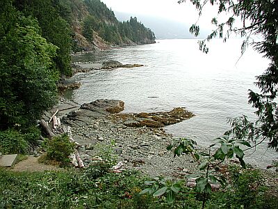
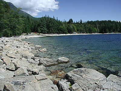
#1 - Ogden Breakwater
Vancouver Island, BC, Canada
Ogden Breakwater is a marine preserve with features created just for divers. A very easy entry marks the start of a diving 'scavenger hunt' for the sunken plaques that line the break water. Each plaque contains information about the area and marine life you'll encounter.
From the inner harbor of Victoria, drive South 1.5km to the end of Government Road, and turn right on Dallas for 1km.
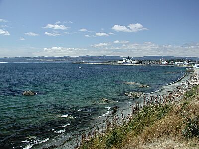
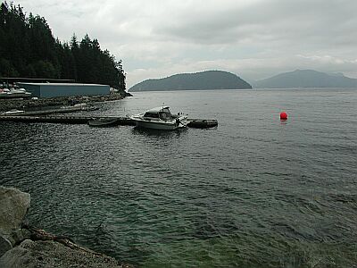
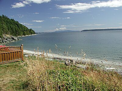
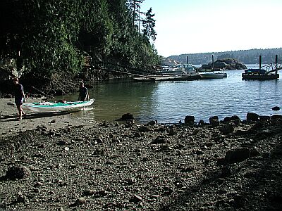
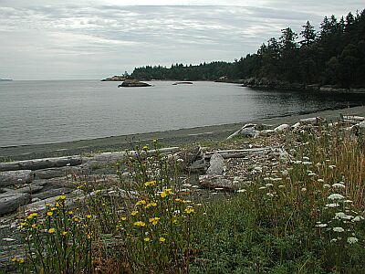
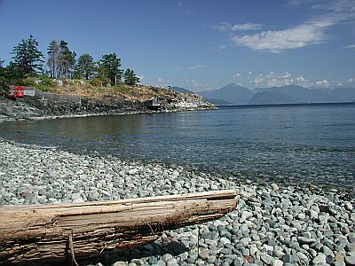
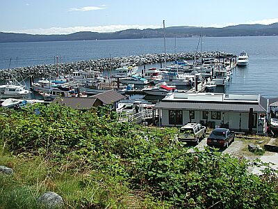
#2 - Mermaid Cove
Sunshine Coast, BC, Canada
Mermaid Cove is a wonderful destination with all the campground facilities you'd expect. Named for a mermaid statue sitting on the bottom at about 15 meters, you'll find a wide variety of sea life lurking nearby. You will most likely see an octopus or two during your dive!
From the ferry terminal at Saltery Bay, the entrance is less than 1km to the North on 101.

#3 - St. Lawrence River
Ontario, Canada
We have some of the best fresh water wreck diving in the world and we want to share that with everyone! Michael and Debra of Diversparadise.net
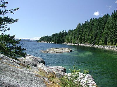
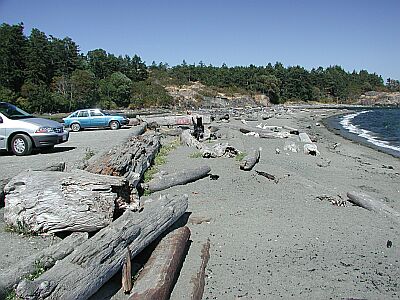
#4 - Tuwanek Beach
Sunshine Coast, BC, Canada
For something completely different, try the Tuwanek Beach dive. You'll be swimming in the very protected Sechelt Inlet, just North of the town of Sechelt. It will be a shallow dive, but worth it for the marine life you may not see elsewhere. You may notice that you can hear a pin drop in this neighborhood. Let's keep it that way!
In the town of Sechelt, head North on Wharf Ave or Xenichen. Turn right on East Porpoise Road, which becomes Sechelt Inlet Road. Travel for 9.7km until you reach the parking below.
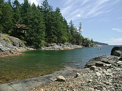
#5 - Lions Bay
Vancouver, BC, Canada
Lions Bay offers an easy access dive for those interested in seeking out smaller creatures to observe. Shallow and rocky, you'll have plenty of time to explore. A dive flag is very important in this area. Give the marina a call (604-921-7510) before you decide to show up. Diving is restricted to certain times of the year.
Heading North from Horseshoe Bay, after about 11km, take the second exit into Lions Bay. Head West toward the water, until you see the tracks below.
#6 - Fathom Five National Park of Canada
Ontario, Canada
Fathom Five offers some of the best freshwater diving opportunities in the world. Clear, clean water, submerged geological formations (cliffs, caves, overhangs) and more than 20 historical shipwrecks offer a variety of underwater experiences. Everyone, from the novice snorkeler to the most advanced diving enthusiast, can find lots to explore and enjoy within the park.
From Tara Harpur at the park: We do have some excellent shore diving in the area of Fathom Five National Marine Park. The only sites that are shore accessible are sites 3, 4, 5 and 23 (The Lighthouse, The Anchor, The Tugs and the Little Cove). The other sites are not shore accessible due to various issues - private property, etc. If you have any questions please let us know! Fathom Five National Marine, Park P.O. Box 189 ,Tobermory, Ontario, Canada ,N0H 2R0, Administration: Phone: (519) 596-2233 Fax: (519) 596-2298, Diver Registration: Phone: (519) 596-2503 Fax: (519) 596-2552
From Tara Harpur at the park: We do have some excellent shore diving in the area of Fathom Five National Marine Park. The only sites that are shore accessible are sites 3, 4, 5 and 23 (The Lighthouse, The Anchor, The Tugs and the Little Cove). The other sites are not shore accessible due to various issues - private property, etc. If you have any questions please let us know! Fathom Five National Marine, Park P.O. Box 189 ,Tobermory, Ontario, Canada ,N0H 2R0, Administration: Phone: (519) 596-2233 Fax: (519) 596-2298, Diver Registration: Phone: (519) 596-2503 Fax: (519) 596-2552
#7 - The Lighthouse
Ontario, Canada
This is an excellent shore dive located in the Scuba Diving capital of Canada. Access is relatively easy for both entry and exit. This site boasts unique large rock formations and depths ranging from 30 feet to 90+ for the experienced diver. Visibility can be pretty good at 30 to 50 feet but can vary due to this location being very exposed to ferry currents and weather. Temperatures can range from 40+ in May/June to 60-70 in August. All in all, an A+ dive spot. Very close to all amenities with 2 reputable dive shops located in Tobermory.
Tobermory, Ontario, Canada
#8 - McNeill Point
Vancouver Island, BC, Canada
McNeill Point is an exciting spot to explore, but only during ideal conditions. The tidal currents through here could ruin your whole day if you're not careful. Check with a local dive shop about seasonal and hourly conditions at this site!
Located 0.4km West of the Victoria Golf Course on Beach Road.
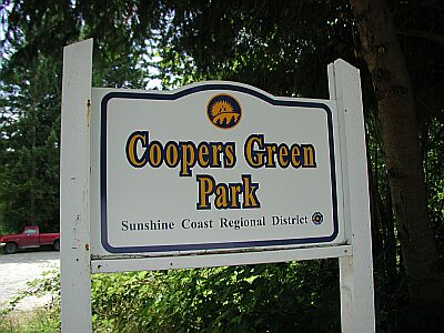
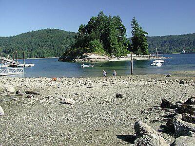
#9 - Coopers Green
Sunshine Coast, BC, Canada
Are you looking for a good beginning dive? How about an advanced dive? Coopers Green has it all in the protection of Halfmoon Bay! Simple entry into the shallows allows easy exploration of the small island just meters off shore. Beyond that, the depth drops off rapidly.
About 7km North of Schelt on 101 make a left on Redrooffs Road. Wind your way about 8.5km to the entrance below.
#10 - Morrison Quarry
Quebec, Canada
Cars, boats and planes can be explored at various depths such as 111, 46, and 26 feet.
Located just north of Ottawa and 4 km south of Wakefield, Quebec. The quarry is better known as the jump point for Great Canadian Bungee. The quarry has a depth greater than 30m (confirmed to 123 feet) and probably reaches a depth of about 40m. The shallow end is 20-25 feet deep. Like most quarries it has a road spiralling down to the deepest part (with a nice drop off in the shallow end). Along the submerged road are numerous attractions, a sunken twin engine plane, a tug boat, small car, picnic table and some jagged pipes sticking straight up at about 20m along the back side wall. All the attractions are marked with buoys. The water is spring feed and cool all the time necessitating a wetsuit if you want to stay in the water for a while.
I found it to be a great training area. There is no supervision/life guard.
The quarry site is on private land. There is a $10.00 fee to help maintain the above-water site in pristine condition.
Washrooms
Cold drink machine
Wood stove
BBQ
30 picnic tables
From Ottawa: Morrison's Quarry is located off highway 105 in Wakefield, Quebec. Take Highway 5 north you will be heading towards Maniwaki, continue on highway 5 till the road ends at a stop sign, here you will turn right then turn left at traffic lights. Now you are on highway 105 north stay on this road for about 8 minutes, you will pass the IGA grocery store on your right about 1 minute later you will see a sign on your right " Morrison's Quarry" turn in here , follow road past the play area and notice parking light on right now you're here. Directions (30 minutes from Ottawa)
#11 - Belcarra Bay
Vancouver, BC, Canada
An excellent park for the kids, with picnic and playground facilities. For you divers, expect a rocky reef just off shore with all the small marine creatures you'd expect!
From South of Vancouver's Second Narrows Bridge, head East on 7A for about 14km, parallel the Burrard Inlet. Wrap around Port Moody by taking a left on Ioco Road. In 4.5km, take a right on 1st Ave, and in 0.7km turn left on Bedwell Bay Road for another 5km. You'll see the park on your left.
#12 - Emmonds Beach
Sunshine Coast, BC, Canada
Emmonds Beach offers another lazy dive for casually exploring the Powell River under-seascape. There are no facilities here, so take your water and lunch, and an extra tank!
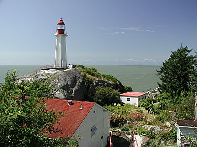
Drive 7km South of Lund, or 14km North of the Powell River bridge, then turn Southwest on Emmonds Road. The preceding roads you'll encounter from Lund are Malaspina, Dinner Rock, Old Mine, then Emmonds. The preceding roads you'll encounter from Powell River are Wilde, Southview, Gifford, Atrevida, Craig, then Emmonds.
#13 - Whytecliff Park
Vancouver, BC, Canada
Whytecliff Park is the premier dive spot for divers of all capabilities. You can find dive classes exploring the inner cove, and advanced divers venturing further out toward the Queen Charlotte Channel. All the classic sea life of this area can be found within an afternoon of touring the slopes and walls. For the non-divers, food and restrooms are found close the parking area.
The original name was White Cliff City. In 1914, Colonel Albert Whyte pressed for the spelling change from White Cliff City to Whytecliff.
The park is currently home to more than 200 marine animal species and is the first Marine Protected Area in Canada. Sea lions can be seen sunbathing on the beach during summer.
Whytecliff park is located near West Vancouver's Horseshoe Bay Neighbourhood. To get there, take Marine Drive west from the Lions Gate Bridge past light house park to Horseshoe Bay and then continue on to 7100 Block Marine Drive.
2014 Note from Chanel MacKay: I am the current operator of the concession at Whytecliff Park and am in the process of reducing my hours of operation for the fall and winter 2014. I thought I would reach out to you to see if there would be any interest in my staying open for coffees, soups, and sandwiches over the park's off season. I know from speaking to divers this summer that the fall and winter are generally better for diving at Whytecliff. Would a hot drink and snack be appreciated by your divers or do they prefer to take off once out of the water and head somewhere warm to shower and dry off properly? Any feedback you could offer would be greatly appreciated as this is my first year in operation and I would like to make sure I'm meeting the needs of park guests. Please email me at foxfoodsvancouver *at* gmail*dot*com. Thank you!!
From the Copper Cove dive site turn right onto Marine Drive. In a short distance you'll see the entrance to Whyte Cliff Park.
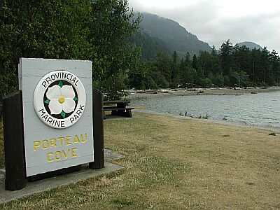
#14 - Porteau Cove
Vancouver, BC, Canada
Porteau Cove should be renamed Diver's Paradise! The park system went all out to make this an appealing marine park for all levels of divers. Easy entry, marine life, marked wrecks, and a stair-side shower for your return make this site a two-tanker!
Heading North from Horseshoe Bay, after about 23km, you'll see the park on your left.
#15 - Ten Mile Point
Vancouver Island, BC, Canada
Ten Mile Point can offer some great sights for the advanced diver. A constant current of varying strength keeps this area alive with sea life. You can stay in the shallows to explore the shore, or quickly drop down to 30 meters to investigate the nearby wall.
Our best advice is to get a map of Victoria once you arrive, and locate the general area of the point in the Cadboro Bay district. Find Tudor Ave which runs the length of the small peninsula, and head Southeast. Tudor will eventually bend to the left; in 300m, take a right on Baynes Road, then a left on White Rock. You'll see the intersection below.
Ten Mile Point is also known as Whiterock Street.
#16 - Whiskey Cove Lane
Vancouver, BC, Canada
Whiskey Cove Lane is one of those spots used by the locals for a relaxing dive of exploration. The rocky walls of the cove and the small island make perfect hiding places for sea life.
From South of Vancouver's Second Narrows Bridge, head East on 7A for about 14km, parallel the Burrard Inlet. Wrap around Port Moody by taking a left on Ioco Road. In 4.5km, take a right on 1st Ave, and in 0.7km turn left on Bedwell Bay Road for another 5km. Then after making a right on Belcarra Bay Road, watch for the parking area below in another 0.7km.
#17 - Wreck of the Gertrude
Alberta, Canada
The Gertrude was a turn of the century steam paddle wheeler, and was purposefully scuttled in Emerald bay in 1918, right behind the famous Prince of Wales hotel. She lies with her stern facing the shore, and her bow in the middle of the bay. The stern is in 7-10m (20'-30') of water and the bow is at ~18m (60'). The exact location of the wreck changes year-to-year, as the winter ice moves the wreck. However, finding the ship is easy. Enter the water beside the water tap and swim directly away from shore until you reach the drop off. Turn right and follow the drop off until you can see the wreck. The stern is shallowest, but unfortunately the wheel is no longer present. As you move towards the bow you'll encounter various machinery, including pistons, drive shafts, and a big boiler. The bow is at about 50', and buried in the silt. Visibility at the stern is usually good (7-10m/20/30'), but this drops off quickly towards the bow. At the bow vis is usually low (often less then 60cm/2'). Much of the wreck has disintegrated - in many places no planking is left. Much of this damage has been caused by SCUBA divers. Please try to not touch the wreck. Around the wreck are some other artifacts, including a small row boat. Little life is present, aside from some fish which live beneath the wreck. Emerald bay does allow boats, so you must carry a flag. Note also that this lake is in the mountains and as such an altitude table, or altitude compatible computer, is required. The water can be extremely cold, particularly in early spring and late fall. Please protect this wreck, as it is one of the only ones in the province.
The following was found by Chris Morrison in the Alberta History Magazine, Vol. 32, No. 2. (You'll note the boat's floating life was only 11 years, but she's a fine example of the value of recycling!! -- Chris)
"The Gertrude was built in 1907 on Maskinonge Lake in Waterton to serve Henry Hanson's sawmill which was located there. She was 100 feet, 6 inches long with a deck length of 85 feet and a width of 18 feet and drew only eight inches of water which allowed her to navigate the shallow river sections between the lakes during high water periods. When a flood damaged Hanson's sawmill in June, 1908 she languished and saw little service. In 1915 the Gertrude became an excursion vessel. In 1916 she was moored on the southeast shore of what is now Emerald Bay and turned into a tea room and restaurant. In 1918 park officials ordered the boat either be removed or scuttled. The owners chose the latter and she has been resting at the bottom of the bay ever since. For many years, the bay was known as Steamboat Bay in her honor." This dive is located in the town of Waterton, in Waterton National Park. This park is located in the south-west corner of Alberta, right across the boarder from Glacier National Park in the USA. To get to the dive site, go to the ranger's station in the town of Waterton (this is near the entrance to the town). Immediately across the road from the station is the entrance to Emerald Bay picnic area. Park in the picnic area. That's it.
WARNING! Motor-boats (and others) are allowed in Emerald Bay as long as they stay below the 10 km/hr speed limit. Divers must have a diving buoy at their dive location, per:
Parks Canada, C. Locke Marshall, Manager Communications and Visitor Services, Waterton Lakes National Park, Box 200, Waterton Park, Alberta T0K 2M0 (403) 859-5121 fax 859-5152
#18 - Bonnie Bay
Vancouver, BC, Canada
A more user-friendly, easy-access park, you'll find Bonnie Bay a quiet dive with wonderful scenery. There are no facilities here, just a nice, grassy trail and park.
Drive South on Marine Drive 1.4km from Horseshoe Bay. Turn right, after the Glen Eagles Golf Course, onto Glen Eagles Drive. Stay on the upper road and wind your way 0.6km to the end of the Drive.
#19 - Spring Bay
Vancouver Island, BC, Canada
Spring Bay is a very easy dive for beginners, but can become quite difficult if you venture too far out. Although mostly protected from the current that plagues Ten Mile Point, the closer you get to Ten Mile, the more you will feel the current. So, stay in the general area of Spring Bay, and swim into any current you encounter.
Our best advice is to get a map of Victoria once you arrive, and locate the general area of the point in the Cadboro Bay district. Find Tudor Ave which runs the length of the small peninsula, and head Southeast. Tudor will eventually bend to the left; continue to the parking lot at the end of the road.
#20 - Martin Cove
Sunshine Coast, BC, Canada
For another remote neighborhood dive, Martin Cove offers plenty to explore. The beach entry makes this dive suitable for all experience levels
In the Pender Harbor area, 14.8km North of Halfmoon Bay on 101, turn left on Frances Peninsula Road. Be prepared for a wonderfully winding road!
#21 - Kelvin Grove
Vancouver, BC, Canada
It looked mighty nice, however you may now find it impossible to dive there. Apparently the neighborhood association decided to 'privatize' the beach, which effectively ended all diving there, unless you can kayak in from elsewhere. We present the site, nonetheless, in the hopes that it will one day reopen to us Marine Explorers. You must go to the marina at Lions Bay and get a parking permit then return back to Kelvin Grove.
Heading North from Horseshoe Bay, after about 10km, take the first exit into Lions Bay. Wind your way South, toward the water. You'll dead end at the park.
#22 - Innerkip Quarry
Ontario, Canada
Cessna, bus! -- from B.E.
Off H'401 exit 250, about 10k west from there. Put-in at the shore.
Innerkip Quarry is also known as Trout Lake.
#23 - Ceder Hill
Ontario, Canada
This is an excellent dive spot for a shore dive. It is located on Georgian Bay approximately 10 minutes east of Wiarton along Colpoys Bay (approximately 50 minutes south of Tobermory). Gearing up is made easy with a covered area and picnic tables located about 30 feet from the water. Access to the water is a rocky beach but easy none the less. Visibility varies to water conditions but usually varies from 20 feet to 55 feet. Water temperatures can range from 40+ degrees in early May to 70+ degrees in August. This location boasts many little "n-sunken"reasures to view at depths ranging from 20 feet to 80+ feet. The deepest I have traveled here is 103 feet but it kept going gradually. Occasionally you do have a moderate current to deal with, so if your dive is planned right, you can enjoy a nice drift dive back to your entry/exit point. Speaking from experience, WATCH OUT FOR BOATS!!! They seem to forget how close you can come to a dive flag (a MUST) in this area for some reason. All in all, this site is an excellent spot for the novice or advanced diver.
Wiarton, Ontario, Canada
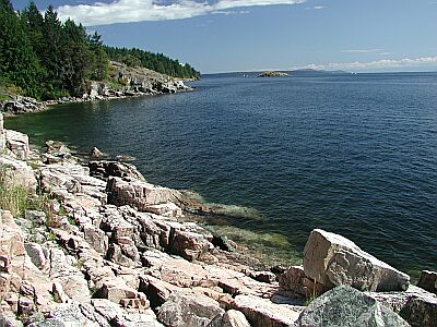
#24 - Ogden Point Breakwater
Canada, British Columbia, Vancouver Island
The Ogden Point Breakwater is an 800-metre long breakwater constructed of stacked granite blocks and concrete. Although the breakwater is a marine sanctuary, line fishing is allowed; be alert for fishing gear on the bottom and overzealous boaters.
There are five dive flags painted near the top of the west side of the breakwater, with corresponding bronze plaques at the bottom stone of the breakwater directly in line with each flag. The plaques provide a description of the marine life in the area, and the compass bearing to the next plaque.
Entry is from the beach, breakwater or dive boat. Caution must be exercised when entering from the breakwater due to the barnacles and concrete blocks obscured by bull kelp.
Beach to Flag 1: Mixed cobble and sand bottom, shallowing slowly to 8 metres.
Flag 1: 8 metres depth, sand bottom.
Flag 2: 8 - 17 metres depth, sand bottom.
Flag 3: 17 - 20 metres depth, sand bottom.
Flag 4: 22 - 25 metres depth, sand bottom, rubble below 9 metres.
Flag 5: 28 - 35 metres depth, mud, sand bottom, tumbled granite blocks.
The marine life in this area is abundant and varied. Expect to see the following: Sleeping Canary, Tiger, Black, Yellowtail, Puget Sound and Quillback Rockfish, Octopus, Harbour Seals, Dogfish, Rat Fish, Wolf Eels, Black Eye Gobys greenling, lingcod, Perch, Flounder, Kelp Greenling, Grunt Sculpins, Decorated Warbonnets, Mosshead Warbonnets, Burrowing Sea Cucumbers, Chitons, Hairy Lithoide Crabs, Brittle Stars, Metrudium and Plumose Anemones, Abalone, Crab, Puget Sound King Crab , Swimming Scallops, Ghost Shrimp, and Nudibranchs.
There is a dive shop, the Odgen Point Dive Shop, located at the end of the breakwater where you can conveniently get air and rental gear.
Odgen Point Breakwater is located at 199 Dallas Rd, Victoria, BC. It is right next to the Helijet airport and the docks where the cruise ships dock. There is a parking lot with paid parking right by the dive shop, with a few stairs to get to the breakwater itself, or follow the path around to the beach.
Your entry and exit points can be anywhere along the breakwater, from a minute's walk to a half hour hike from the end.
#25 - Alexandria
Canada, Ontario, Lake Ontario
From SOS website http://saveontarioshipwrecks.ca.
Built Year:1866
Built Location:Montreal, Quebec
Built By:Auguste Cantin
Wreck Type:Steam, Passenger
Rig:Side wheel
Length:162
Beam:25
Draft:8
Tonnage:350
Sank:1915
Bound from Port Hope to Toronto on August 3, 1915 she grounded during severe weather and eventually broke up.
#26 - Ross Charles Park
Vancouver Island, BC, Canada
For a relatively easy entry and dive, try Ross Charles Park. There are several rocky outcroppings to explore, and a flat bottom otherwise.
From the inner harbor of Victoria, drive South 1.5km to the end of Government Road, and turn left on Dallas for 3.7km. After you pass the cemetery on your left, prepare to turn right on St. Charles Street.
#27 - Belcarra Park
Canada, British Columbia, Lower Mainland
Not much to see here due to the over fishing from the wharf. Some interesting debris and old garbage if you get a bit away from the wharf. Good spot for training dives (I did my Rescue Diver course here).
Large Parking area with short walk to picnic area and beach. Regional Park so check for park hours or drive around park to road on north side (about 10 mins more drive time) and park on roadside. Easy access to water on north side of wharf. Be alert for fishermen and crabbers on wharf.
#28 - McMicking Point
Vancouver Island, BC, Canada
For a very quiet dive through some rock and kelp-laden waters, you'll find this area a joy! You are in the midst of a tightly packed neighborhood, so be courteous and silent. Be very careful of the current!
Located just Southwest of Victoria Golf Course, take the first road to your left off Beach Drive: Radcliffe/Hood Lane.
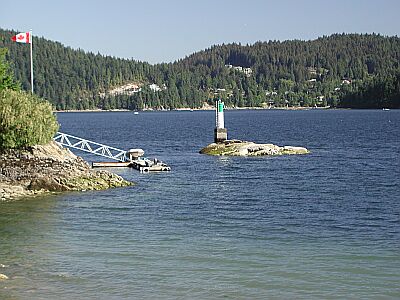
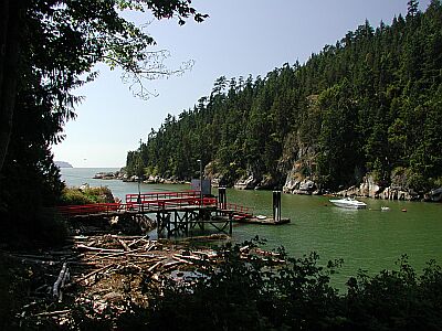
#29 - Egmont
Sunshine Coast, BC, Canada
Located at the mouth of the Sechelt Inlet, this is an exciting dive. Nearby is the Skookumchuck Narrows Provincial Park, where you can observe the famous tidal rapids. Needless to say, you will have to take the current into account on this dive. The current, however, does brings a flood of nutrients for the thriving marine life.
At the North end of the Sechelt Peninsula, just South of the Earls Cove Ferry, take Egmont Road East for 9km until you see the docks below.
#31 - King Koho
Vancouver Island, BC, Canada
Enter the water immediately in front of the parking site, and follow a bearing of 0 degrees (i.e. due north). You should hit the King Koho at about 20m/70' in depth. Local divers have run a line out to the boat - so if you come across a week-encrusted line you can follow it to the wreck. The King Koho is a 10m/30' sail boat that sunk in the late 90's. There are a lot of fish on the wreck, some good sized anenomies, and some octopi make their homes under the wreck. The only hazard here is the fishermen - they seem to think that the divers have hidden all the fish. Apparently 'over fishing' isn't in their vocabulary.
Drive towards the ferry terminal in the town of Comox. Immediately before entering the ferry grounds there will be a road going off to the right, turn onto this road. Follow this road for 2-3 blocks until you hit singing sands road. Turn left onto singing sands road and follow it to the end. There is a bit of space to park at the end of the road. This is a busy site, so don't hog space.
#32 - Albert Head Lagoon
Vancouver Island, BC, Canada
Albert Head Lagoon is another wonderful no-current dive for searching out crabs and skates. This site is really off the beaten path, so bring everything you need for a comfortable day.
From Victoria Harbor, take the Trans-Canada Highway (1) to the North. In 9km go South on Highway 14 (Old Island Highway). In 4.5km turn left on Metchosin Road and travel for 3.6km until you reach Albert Head Lagoon Regional Park.
#33 - Esquinalt Lagoon
Vancouver Island, BC, Canada
For an easy dive, without the hazards of rocks, kelp and strong current, Esquinalt Lagoon offers the chance to see the bottom dwellers you'd expect on a sandy stretch of coast. There are no facilities in the immediate area, so bring water and warmth!
From Victoria Harbor, take the Trans-Canada Highway (1) to the North. In 9km go South on Highway 14 (Old Island Highway). In 1.8km turn left on Ocean Blvd and travel for 1km until you reach the bridge below.
#34 - Egmont Marina Resort
Sunshine Coast, BC, Canada
This is another fine entry to the Sechelt Inlet, and an ideal place to camp for the night. Check-in with the marina, and discuss your dive plans with them. They'll have plenty of recommendations for you!
At the North end of the Sechelt Peninsula, just South of the Earls Cove Ferry, take Egmont Road East for 9km. Turn left on Maple Road, and travel for a short distance until the sign below.
#35 - Henderson Point Dive Site
Vancouver Island, BC, Canada
The best dive spots are on a heading of 255*. There is one smaller reef and two larger ones just past the first. The bottom is sandy until you hit the reefs. Max depth is 80ft but most of the dive will be 30-60ft. Special note for diving in the Inlet: Ceiling / thermicline can make vis only 2ft at the surface but when you descend below 20ft it will "open up" to excellent vis. It may be dark so carry a flashlight for looking at things up close.-- Geoff
Entry: You need to climb down a small drop to get to the beach - use the dead tree for support. To find the site itself swim straight out (west) from the flag pole about 30-50 feet, then drop straight down. This will land you on one of two reefs. Stay on this reef, or continue into deeper water where you'll encounter a second reef. Both reefs have wolf eels, octopi, a large variety of fish, and plenty of other stuff. In summer watch out for large Cyanea jelly fish - they'll give you a nasty sting. First reef is in ~50' of water. Second reef drops down a series of shelves at 60', 80', 130', and possibly deeper. Because this dive is in the Saanich Inlet there is no significant current. IMO this is the best dive in Victoria aftert the Ogden Breakwater. - Bryan H. From Victoria, go north on West Saanich Rd., continue N throughout Brentwood, after passing through the Tsartlip Indian Reserve you will come to a road called Mt.Newton Cross Rd.on you right and Senanus Dr. on your left, turn LEFT. Follow Senanus Dr. all the way to the end where there is a small parking lot. Access is at the left side. Check out the access point before putting on your gear.(200ft walk) There is a tree that you can use to help get onto the beach. - Geoff
How to get there: Head north from Victoria along the Patricia Bay Highway (highway 17). After ~10km turn left (west) onto Keating Cross Road. This road will take you past a Whites dive shop with a map of the site - a good reference if you've never been there before. Follow Keating until you hit West Saanich Rd, where you turn right (north). Follow this road ~5km to Mount Newton Cross Road, where you turn left (west). Follow the road until it ends in a small cul-de-sac. Park here (don't hog space), and follow the footpath to the dive site. --Bryan H.
#36 - Britannia Beach Dock
Vancouver, BC, Canada
Britannia Beach Dock is the site of the old Customs House of years gone by. The area has a lot of history due to the large copper processing plant just across the street, which makes the waters perfect for treasure hunters. While off-gassing, you may want to take a tour of the mine!
Heading North from Horseshoe Bay, after about 32km you'll see a large mining facility to the right, and the railroad crossing below to the left.
#37 - Telegraph Cove
Vancouver, BC, Canada
Telegraph Cove is a nice protected area to get your fins wet. Parking is limited, but the dive is worthwhile.
From the Copper Cove dive site turn-off on Marine Drive, continue heading down Marine Drive past the entrance to Whyte Cliff Park. Turn left on Cliff Road, and continue to the trail head below.
#38 - Brooks Cove (Smuggler Cove Marine Provincial Park)
Sunshine Coast, BC, Canada
Brooks Cove is for the more advanced diver. You'll have quite the swim to get to the prime diving spots, but the effort will be worth it. With depths to over 100 feet, the water clarity will be spectacular!
At 1.3km North of Halfmoon Bay, turn left onto Brooks Road, and follow the signs to Smuggler Cove.
#39 - Monarch
Ontario, Canada
The Monarch (St. Clair River) is a 60 foot, wooden hulled, steam powered tug that sank in 1939. The Monarch is on her starboard side facing up river. Access into the main cabin allows you to get out of the current. The boilers and winches can be seen on the aft deck. Visibility can be up to 70 feet, if the wind has been from the south for a week or more. If there is a stiff north wind blowing, go somewhere else. This is an advanced dive due to the strong currents in the river and the freighter traffic overhead. Don't even think about trying to bring a float & flag with you. Head back when you are down to half of your air.
Located just south of the Blue Water Bridge in Sarnia, Ontario. Entry point is by the large stanchion post about 300 yards south of the bridge. The local dive club maintains a cable that leads out to the wreck. The site can also be reached by diving on The Barge and drifting down river (see The Barge site).
#40 - Conestoga
Ontario, Canada
On the St Laurence River
From the 401 exit at Cardinal and head South to the River. At the river turn right. Find the dirt road behind the building. You will be able to see the parts of the wreck out of the water.
#41 - Ole's Cove
Sunshine Coast, BC, Canada
Ole's Cove is a well kept secret, so don't tell anyone! Located in a beautiful bayside neighborhood, experienced shore divers will find a simple dive.
At 7km North of Halfmoon Bay on 101, turn left on Mercer (this is the Northern access to Mercer). Follow the directions below.
#43 - The Rothesay
Ontario, Canada
The Rothesay is a 19th Century wooden side wheeler (193' x 28.8' x 7.9') and was launched in St. John, N.B. on Feb. 2, 1868. Initially she sailed between Fredricton and St. John but was later relocated to serve on the St. Lawrence River. She was carrying passengers between Brockville and Montreal when, on Sept. 12, 1889, she collided with the tug Myra and sank at her present location. Although no-one was lost from the Rothesay two crewmen on the tug were killed. In 1901 members of the Royal Military College in Kingston blew up the wreck amidships in a munitions exercise. The Rothesay was rediscovered on Sept. 25, 1964 by the Underwater Society of Ottawa and remains a very popular dive site. Bring a light to see into the chain locker and hold. Prepare for a 1 to 2 knot current along the surface. there is hardly any current at depth. Shore buoy marks the start of a 300 ft. line out to the wreck along the bottom. Follow the line, you arrive at the smoke stack. Upperwork lies at about 20 feet, maximum depth is 30 feet. Best visibility is early and late in the dive season, and varies from 5 to 10 feet. As with all Marine Historical Sites in Ontario, the Rothesay is property of The Province of Ontario and removal of any material is illegal.
The Rothesay, is located in the St. Lawrence River, west of Prescott. It is accessible both by land and by boat. Follow Highway 401 and take the Highway 18 Exit (#716) to Prescott. Turn west on King St. W (Highway 2) and follow for 1.75 Km until you reach Riverview Heights. There you will see a Historic Marker along the south side of the road commemorating Justus Sherwood. The adjoining grass strip can accommodate about a dozen cars. From the embankment you will see a buoy approximately 300 ft out, marking the actual wreck and a jug closer in that is the beginning of the line.
#44 - Saxe Point Park
Vancouver Island, BC, Canada
A wonderful beach park for the kids, with hiking trails and facilities, you'll find Saxe Point Park a relaxing spot to spend the day. Bring a couple of tanks and a picnic lunch, and enjoy!
From Victoria, head West over the Johnson Street Bridge onto Esquimalt Road. In 3.1km turn left on Fraser Street and head into Saxe Point Park.
#45 - Octopus City (Saltery Bay Boat Launch)
Sunshine Coast, BC, Canada
For some spectacular diving in some very clear water, try Octopus City. The point offers a good chance to see the namesake. Take a couple of tanks to explore the long coast line out to the point.
From the ferry terminal at Saltery Bay, the entrance is less than 3km to the North on 101.
This dive site is actually the Saltery Bay Boat Launch. Just enter the water, and turn right to explore Octopus City.
#46 - Twin Lake, Winfield
Alberta, Canada
This is mostly a beginner training location. Courses are held here by various dive clubs. The lake is small and easily navigated. It has an incredible depth of 110 feet; yes I said 110 feet! The normal training area is in water of about 25 feet to 50 feet. While most newbies will go into this water using a 7mm wetsuit; they earn the appreciation of their peers using drysuits. Water temperature at the surface is about 62f degrees, while at about 40-50 feet you might find an area that will drop to 38f degrees. This is also a zero to 25 foot visibility dive site; limited visibility. The bottom of this lake is very silty and easily stirred by newbie divers. When diving in these types of conditions it is a great time to work on buoyancy because you only have your computer to tell you your depth or your compass to tell you what direction you are going in. The local dive club has done a great job of mapping out courses for divers. Police tape is used at the bottom to guide divers to an underwater platform at 25 feet. There are plenty of things to see under the water, fish, BBQ, typewriter, small boat, six foot suspended chicken, etc. While this is more of a training location, it does offer unique challenges for intermediate to advance divers alike. Try your navigation techniques in zero to limited visibility. The depth of this lake combined with its chilly temperatures will definitely leave an impression.
North 52 57'00.0 West 114 22'00.0 This site is in central/south Alberta. North-West of Red Deer, South-West of Edmonton, exactly west of Wetaskiwin, and very close to Winfield, Alberta. There are back road possibilities to get to this location, but the easiest to describe is:
1. Take Highway 2 to Wetaskiwin, Go West.
2. Take Highway 13 to Twin Lakes.
When you are getting close you can not help but notice the rollercoaster style of hill you are about to climb. From the bottom of this hill it will be about 11km to the turn. There is one sign for Twin Lakes which is virtually right beside the turn. Chances are that if you are reading the sign and traveling at 100kph, you will miss the turn off. Please be careful when breaking. Turn south onto dirt road. The road is curvy and leads to the lake, stay right. Once you see the lake, stay on the road and keep driving till you see a large mobile trailer on your left. This trailer is from the local dive club. If you are beside the trailer, parking is located between the two trees, and directly in front of you on the grass.
#47 - Dinner Rock
Sunshine Coast, BC, Canada
The Powell River area offers such spectacular diving, and Dinner Rock is no exception. Basic campground facilities are available, so take a couple of tanks and plan on spending the evening.
Drive 4.5km South of Lund, or 15.5km North of the Powell River bridge, then turn Southwest on Dinner Rock Road. The preceding roads you'll encounter from Lund are Malaspina, then Dinner Rock. The preceding roads you'll encounter from Powell River are Wilde, Southview, Gifford, Atrevida, Craig, Emmonds, then Dinner Rock.
#48 - Clover Point
Vancouver Island, BC, Canada
Clover Point is a no-frills park used by most to contemplate the coastline and sea beyond. But what make this area worthwhile for the diver is the point and the surrounding marine life. Kelp and creatures will keep you company on this dive.
From the inner harbor of Victoria, drive South 1.5km to the end of Government Road, and turn left on Dallas for 1.9km.
#49 - Gulliver's Lake
Ontario, Canada
There is a fountain in the middle of the lake ;) There are other items of interest submerged in the lake but I did not have time to investigate since I was with a group getting trained.
Gulliver's Lake RV Resort & Campground approximately 30 minutes NW of downtown Hamilton ON Canada. This is a good location for seasoned and novice divers alike. Many diving schools come here for training and diving. As host of the 2002 Provincial Triathalon, Gulliver's Lake is also a popular training spot for local triathletes. Dive access is walk-in from the shore. Drop off is within a few feet of the shore. There are various submerged platforms @ 15+ feet for practicing skills (e.g., mask clearing and neutral buoyancy). The fine silt/mud bottom can make for poor visibility and sometimes algae also reduces visibility. I saw some small mouth bass from the shore but no fish while diving (Sep 2018).
#50 - Willis Point
Vancouver Island, BC, Canada
Diving here is great! When you finally climb down the rocks using the tree on the right for help. Swim about 100ft from shore then descend. If you swim to the left and out a bit you will come to a sheer wall that drops to 110ft! It is covered in life and in the deeper depths you may find some Cloud sponges. I usually swim on the surface past the 3rd house(left if you are facing away from shore) descend to the wall then to 100ft. I work my way up the wall while going back to the entry point for my safety stop in the kelp beds.(it gives my something to look at) - Geoff
Head north on the Pat Bay Highway (#17) turn off, then left at the Royal Oak Dr. overpass (look for the sign) follow Royal Oak Dr. till you get to West Saanich Road. Follow north 6.5km , turn left onto Wallace a Dr. then when you see Willis Point Rd. turn left (the only way to go) Follow all the way to the end (8.2km) where you will find Mark Lane. Turn right and drive down about 0.6km to a fire lane on the left. Do not park right in the lane and be careful not to block peoples driveways. I believe the address of the last house before the fire lane is 7442.
To find this on a map it is best to enter into Google Maps or Map Quest: Steamer Drive, Brentwood Bay British Columbia - then look for the fire lane as you are driving along. Its beside a black iron fence. If you encounter Steamer Drive itself, you have just gone past the fire lane. Do not block the fire lane as this is for the fire trucks to get water from the ocean. But there is parking for at least 4 cars here.
#51 - Telegraph Bay
Vancouver Island, BC, Canada
A great site for beginners, Telegraph Bay offers a shallow dive with no current. As you swim toward the points of the bay, you are bound to see the local marine life. (Note: to eliminate any confusion, there is a Telegraph Cove on Northern Vancouver Island that has some spectacular diving, as well!)
Our best advice is to get a map of Victoria once you arrive, and locate the general area of the point in the Cadboro Bay district. Close to the intersection of Tudor and Arbutus, you'll find Telegraph Bay Road, which you should follow Northeast into the bay.
#52 - Copper Cove
Vancouver, BC, Canada
Copper Cove is a scenic location, both above and below the water. Located in a quiet residential area, please strive to be unobtrusive.
Located due West of the Horseshoe Bay Ferry Terminal, the following is a minor detour through the scenic Horseshoe Bay. Take the Upper Levels Highway (1) to Horseshoe Bay. Do not get into the ferry lines, but head down to the water, and turn left on Bay Street. Beautiful, eh?! In 0.3km turn left on Nelson Ave. In 0.5km turn right on Marine Ave. Wind your way down 0.6km to the intersection below.
#53 - Sasamat Lake
Vancouver, BC, Canada
For something completely different, try White Pine Beach at Sasamat Lake! This is an easy lake dive, perfect for the beginner or for taking your new gear out for a maiden voyage. The family will enjoy the white sand beach and facilities.
From South of Vancouver's Second Narrows Bridge, head East on 7A for about 14km, parallel the Burrard Inlet. Wrap around Port Moody by taking a left on Ioco Road. In 4.5km, take a right on 1st Ave, and in 0.7km turn left on Bedwell Bay Road. You'll see the entrance in 3km.
#54 - Flintkote Quarry
Canada, Quebec
East part of Thetford Mines
Flintkote Quarry is also known as Flintkote.
#55 - Cates Park
Vancouver, BC, Canada
Cates Park is a nice location for divers and non-divers alike. Facilities, picnic tables, and beach combing will occupy your family while you're exploring the off-shore reef.
From Vancouver, take the Trans Canada Highway into North Vancouver over the Second Narrows Bridge. Make an immediate right, and head East on Dollarton Highway for 5.3km.
#56 - Beach Garden Resort
Sunshine Coast, BC, Canada
There are two very easy dives at the Beach Garden, one to the left and one to the right of the marina. These protected entries are perfect for the beginner, and the breakwaters offer an ideal location to check out new gear and have a relaxing dive.
From the ferry terminal at Saltery Bay, the entrance is 26km to the North on 101, just South of Powell River.
#57 - Chippawa Creek
Ontario, Canada
Lovely drift dive! -- from Bozkurt Eralp
****** WARNING *****
There have recently been two deaths from diving in this area. You may view the 2007 incident report published by the Ontario Underwater Council in our Links section below. We strongly recommend not diving this site until more is known about the causes of the accident.
****** WARNING *****
There have recently been two deaths from diving in this area. You may view the 2007 incident report published by the Ontario Underwater Council in our Links section below. We strongly recommend not diving this site until more is known about the causes of the accident.

#58 - Sargeant Bay
Sunshine Coast, BC, Canada
Sargeant Bay Provincial Park is a nice area for picnicking and easy diving. The shallow dive allows plenty of time for exploration, and the park offers a great place to relax between tanks.
About 7km North of Schelt on 101 make a left on Redrooffs Road, you'll see the park entrance sign below.
#59 - Fort Erie
Ontario, Canada
There's some fun drift diving on the Canadian side of the Niagara River, going from Fort Erie downstream towards Niagara Falls. The Niagara Parkway (a nice two lane road that goes along the river) has lots of places to park and access the water. You'll need a diver down flag, because there's boat traffic. Stay in about 20-25 feet of water to avoid the current that can sweep you around to the New York side (passport needed and the Coast Guard will be really irritated). Viz is about 10 feet, current is relentless...If you get really lucky, you may find old bottles, golf balls, or perhaps relics from the War of 1812 to snatch up before you're dragged downstream...You'll need a tracker car as the current will take you a few miles (oh, yeah, stop before you get to the Falls! If you put in at Fort Erie, you'll run out of air before you get that far). A fun, local dive. Thanks for the great web site!
#60 - Point Atkinson
Vancouver, BC, Canada
Point Atkinson is found at the tip of Lighthouse Park in West Vancouver, entrance to the vast Burrard Inlet. This site is a fantastic vantage point for getting a glimpse of all the indigenous marine life. Along with the impressive trail system, basic facilities are available. See your local dive shop for the seasonal conditions and requirements.
Located on the Southwestern tip of West Vancouver, access is via Marine Drive. From Vancouver, take the Lionsgate Bridge North and exit on Marine Drive West and drive about 11km. The entrance below will be on your left.
#61 - Madrona Point
Canada, British Columbia, Vancouver Island
There are two walls here. One as you enter the water, and a much deeper wall whose top starts at about 40 feet and descends below 100 feet. For first time divers, the left most path to the water gives a good starting point as it's easy to enter and the depth is about 20' or so. Watch your footing as there is lots of seaweed on the rocks when the tide is out. There is a channel cut into the rock and can make entering easier then jumping from the rock edge. The second wall most western end can be found at roughly 360 degrees magnetic north. Follow the path from the vehicles straight out to the water (roughly north)and enter the water in a shallow channel. You will have a surface swim of about 500' or so, head out at a North East heading (you can see a snow covered peak in the distance - aim for that)and then descend.
The two walls have lots of life on them, there are wolf eels on the outer wall and octopus on both. Crab, lingcod, dogfish etc... can also be seen here and at times the seals will visit.
In the spring,summer the visibility can be tough at times (10' or less)but usually at depth it improves. Winter is the best but we have had awsome vis (80' plus)in June. It just depends on the plankton bloom.
Follow the Island Hwy north towards Parksville, at Nanoose Bay you will come across Northwest Bay Road at the set of traffic lights. Make a right on to it. Follow Northwest Bay Rd for a few kilometers, and make a right onto Arbutus Drive, then a left onto Madrona Drive and follow it to the end. About a kilometre. The end of Madrona Drive is the parking lot. There is only room for about four cars here. Once your parked, there is a bit of a hike down to the shore. Follow the path and once through the clearing, turn left to go to the shallow wall or go straight (follow the "V" in the rock) to enter for the far wall.
Madrona Point is also known as Madrona Wall.
#62 - McKenzie Bight
Vancouver Island, BC, Canada
Diving here you go 30-40 ft from shore and descend. There is a wall with some interesting contours along it. The wall starts at about 30ft and goes all the way down over 120ft. If you are lucky in the summer you will find 6 gill sharks but only at 80ft and deeper. This dive site does require a walk of approximately 5 minutes. And a rocky trail leads down to the gravel beach. Once you are in the water there are some walls, but not much life on them. There is more life in the gravel. This site is more well known for one of the few places that the Six Gill Sharks sometimes are spotted here during the summer at depths of around 30 metres [100 feet].
Head north on the Pat Bay Highway (#17) turn off, then left at the Royal Oak Dr. overpass (look for the sign) follow Royal Oak Dr. till you get to West Saanich Road. Follow north 6.5km , turn left onto Wallace a Dr. then when you see Willis Point Rd. turn left (the only way to go) Follow all the way to the end (8.2km) where you will find Mark Lane. Go left and you will find McKenzie Bight. There will be a locked gate. Go down the path a bit and you will find different paths that lead to different beaches and entry points(spot #1 is 200m,spot #2 is 600m and #3 is the end). I usual take the first one I see but check it out in advance. - Geoff
#63 - Prospect - Indian Pt Rd Cove
Canada, Nova Scotia
The coastal trail going past the cove is a popular hiking trail and dog walking trail, so late spring, summer and into early fall parking can be tight if you aren't there early. The dive site is very shallow, so close to high tide is recommended to give an additionl few feet of depth. The flanks and sides of the outer shore and islands over really nice, rich kelp and seaweeds. The bottom is varied from cobble in close changing to gravel with some sand. Granite bedrock ont he cove flanks and surrounding ridges, shoals and little islands makes for rich marine life diving and good photo opportunities.
Drive out to the community of Prospect along the Prospect Road from Halifax, turning left at the large sign directing one to the community. As you come down the last hill into the buildings of the community and can see the water, look for a small paved road on your right named "Indian Point Road". Turn in the road and park on the left side where signs direct. The dive site is a few hundred meters hike over the hill, onto a good coastal trail, down to the small cove.
#64 - Lake Minnewanka
Alberta, Canada
Lake Minniwanka has been dammed 3 times in its history. The most recent dam, built in 1941, flooded the 1912 dam site, as well as an old bridge and town. Both of these sites are located a short distance away from the newest dam. The remnants of an old bridge can be found near the stairs located at the south end of the dam. Swim due east from the plaque on shore. Not much remains of the dam, aside from a few pilings and the bank heads. Depth is 15m(50') at the top, and 24m (80') at the bottom. The dam, pump house, and foundations of some support buildings can be found north of the bridge. The easiest way to find these objects is to park mid-way along the dam, and swim out at an ~60 degree bearing from the #12 sign. This should put you on the dam. If you find yourself in a valley turn to the right (60 degrees usually puts you a little north of the dam), and follow the valley to the dam. The damn itself contains a pump house, which you can swim through. The dam is completely intact, consists of both a concrete dam and wood/rock coffer, and is quite interesting to look at. Dam is usually at 18m (60') at the top and 27m (90') at the bottom. North of the dam are several other things you can look for - the foundations of several old support buildings, a well, an old row-boat, and other artifacts can be found in this region. Water is usually around 18m (60') here. There is also a complete town site located mid-lake. Some divers scooter from shore to this site, but for most divers it is out of reach unless they have a boat. Rumor has it that there is also an old ranger station/dock accessible from shore, although I have never seen the location of that site listed. Lastly, located east of the picnic area are a series of cliffs. Enter at the gravel bay, swim around the point, and follow the cliffs north. Often fish can be spotted here, and its a great place to look for fishing lures/gear. Depths to 21m/70'. Because this is a dammed lake the water levels can vary greatly. The depths listed here are the usual, although they can be up to 3m/10' deeper, and as much as 10m/30' shallower. Vis varies greatly - from >10m/30' in winter/spring, to as little as 15cm/6" during the worst of the run-off. The dam site is located in a protected area, but you should fly a flag if diving the cliffs or bridge. Lots of people fish of the gear - keep an eye out. This site is at 1500m/5000' above sea level - altitude tables are required.
Dangers include cold water, poor visibility and altitude (4500 ft). These are advanced dives.
From the town of Banff take Banff Ave out of town, and follow it to Lake Minnewanka. There are three shore-accessible dive sites. For the bridge site, park at the stairs located on the south end of the dam. For the 1912 dam/foundations park mid-way along the dam, near the bend/#12 sign. The third site is the cliffs - park at the main parking lot and lug your gear to the picnic area.
#65 - MV Zebalous
Vancouver, BC, Canada
In Union Bay there is a 100ft steel barge at 60ft that has been down for many years. This shore dive has tonnes of life including giant octopus. This is the shore dive on the wreck of the MV Zebalous a 60ft Seign wooden boat @ 50ft. The historic site of the government wharf that has been dismantled is between 40 and 20ft us home to many fish, octopus, moon snails and millions of porcelain & glass objects including hand blown opium vials (left by the oriental railway workers) that have been discarded where the old steam ships once docked.
Union Bay
#66 - Strathcona
Vancouver, BC, Canada
This is a nice suburban park with very easy access to two small islands. Take time to circle the islands, watching for boat traffic. You won't find facilities here, but you will find a relaxing atmosphere!
From Cates Park, head North on Dollarton Highway for 1.6km, then right onto Strathcona. Wind around for less than a kilometer until you find the parking below.

#67 - Cattle Point Park
Vancouver Island, BC, Canada
Cattle Point is mainly used for dog walkers and boat launchers, but if you are careful, you can slip down the boat ramp and explore some very scenic coastline. The current is, of course, an issue, so check with your local dive shop for the seasonal conditions.
Located in the Uplands Park of the District of Oak Bay, you'll see the entrance to Cattle Point off Beach Drive.
#68 - Lone Tree Island
Sunshine Coast, BC, Canada
A small island, unofficially known as "lone tree island" (because it has one tree), makes up this dive site. Looking from the entry point, the left side of the island has a small reef with some wolf eels. The middle of the island has some oyster beds and lot of fish. The site has little current to worry about, but boat traffic can be heavy.
From Powell River, take highway 101 north towards Lund. Before you get to Lund you should hit a gravel turnoff, with a school and signs for Lund trailer park on the corner. If you hit the turnoff for Lund itself you've gone too far. Turn left onto this road, and then turn right at the fire station. Follow the road until it ends (less then 1km); park at the end of the road. To the left of the parking area is a trail through the trees which goes down to the water. Follow this trail to the entry; be careful to avoid walking onto the private properties which line this pathway.
#69 - Old Government Wharf
Vancouver Island, BC, Canada
You are diving on the remnants of an old government wharf which was destroyed in a severe storm. The bank head of the wharf is observable from the boat launch, off to your left, on the hill. You want to swim under this, at which point you then submerge and follow the wreckage out. The wharf used to be huge - over 20m/60' high, and 800m/0.5mi long! There is a lot to see as you follow the wreckage - coal cars, pilings, tanks, bottles, and lots of other debris. Not a lot of life, although the sandy regions in-between pieces of wreckage are home to all kinds of crabs, telias, sole, and other sand-feeders. Fish tend to congregate around some of the larger pieces of wreckage. Depth varies from 3m/10' to approx 20m/60'. A large portion of this dive is next to an active boat launch. Fly a flag. This dive is exposed directly to a channel, so be prepared for some current. Best dived at high tide - vis can be very poor at low tide. Also, at high tide you can escape (i.e. 'swim over' the crazy-glue like mud which is exposed at low tide.
Take the old island highway to Union Bay (located mid-way between Comox and Nanaimo). Park at the boat launch. The launch is also your entry point. There is a dive shop on the other side of the road. The owner is very familiar with the local sites, and has some of the cheapest air fills around.
#70 - Argonaut Wharf
Vancouver Island, BC, Canada
This dive is best done on a long slack tide as currents need to be considered. The dive itself is 50-60ft max amongst the pilings. farther out is nothing but sand and a loooong swim back. Locals quite often use this as a night dive site. You will find octo hiding at the base of the pilings, both the giant pacific octo and the tiny ruby octo. Also frequently seen are stubby squid, small orange/pink smooth skinned [these are not ruby octo] as well as lots of the usual marine life, anemones etc.
Located on Campbell River. Turn right [if going north] off coastal island hiway [just after Canadian tire] onto Spit Road, follow short distance [less than a km] wharf is on your right [big wooden pilings]
#71 - Sydney Pier
Vancouver Island, BC, Canada
The town of Sydney has started an artificial reef on both sides of the pier. These reefs consist of concrete "reef balls". These balls are shaped like hollow soccer balls, and make homes for a variety of animals. There isn't too much to see hear - a lot of leaf kelp, a few anemones, some nudibranches and the odd rockfish. The pier is a popular spot for crabbing, although we didn't see too many large crabs.To find the artificial reefs swim out along the pier until you hit the second-last pair of supports for the pier. Descend along the support; this will land you directly on the reef balls. You can then do a circuit - follow the balls east to the end of the pier, then cross the pier to pick up the second set of balls. Follow these balls west, back towards shore. That's it - easy as pie! The dives shallow; at high tide you'll be lucky to hit 10m/30'. Just two things to be concerned about; fishermen on the pier and current. This dive is best done on slack. Fishermen usually don't cast as far as the reef balls, but be prepared for monofilament when you pass under the pier.
From Victoria take highway 17 North until the Beacon Ave turnoff for the town of Sydney (~20km from downtown Victoria). Turn right (east) onto Beacon Ave, and follow it to 2nd Street - at this point turn right (south) onto 2nd, take it for one block and then turn left. This'll put you on Bevan Ave, from here you should be able to see the Pier. Park where possible, gear up, and walk to the pier. You can enter on either side of the pier - careful, both entries are rocky and slippery.
#72 - Lake Street Wreck
Ontario, Canada
-- from Bozkurt Eralp
Port Dalhousie, bit of a swim out. Put-in at the shore.
#73 - Wall Beach
Canada, British Columbia, Vancouver Island
Varied wildlife, Octopi, Wolf Eels, Ling Cod, Anemone.
Park at the end of the street and follow the short path 20 to 30 ft to shore.
#74 - Ansell Place
Canada, British Columbia, Lower Mainland
Ansel Point is largely a sheer wall, so it is a site that is appropriate for those that are very comfortable with their buoyancy in cold water conditions.
Either direction has plenty of wall to explore with critters like squat lobsters, golf ball crabs and the occasional seal to check out. There are a pair of wolf eels that are intermittently spotted under a large rock at approximately 75' (22m) on the wall if you head to the right.
A point of interest to the diver's left as you enter the water is a wall cutting at about 20 meters that goes back into the cliff about 4-5 meters. It tends to be a gathering place for rockfish and ling cod and is a good place to begin your dive.
The access to this site can be slightly difficult as you need to go down 65 steps followed by a climb down high and uneven rock to cross into the tidal area. Occasionally rough water can make entry and exit from the site a challenge. Good fitness is essential.
If you're planning two dives leave your gear at the bottom of the stairs and just replace your tanks.
#75 - The Conestoga
Ontario, Canada
The steamer Conestoga was built by Quale & Son of Cleveland for Anchor Line and launched July 6, 1878. A considerable amount of money, technical design and skill went into construction,, as evidenced by the description in the Cleveland Daily Plain Dealer on July 8, 1878: "Fitted out in all proportions with a care to strength, durability and beauty ... it is estimated that her cost will be near $90,000.00. Two hundred fifty-two feet long, sixteen feet deep with a gross tonnage of 1,226, Consetoga was powered by a steeple compound engine capable of a speed of 8 knots. The upper portion of the steeple engine protrudes above the river, marking the site. She sank on May 22, 1922 outside Lock 28 of the Old Gallop Canal, one mile east of Cardinal, Ontario. A fire broke out in the engine room while awaiting passage at the lock. The ship was flushed from the Lock and allowed to ground and sink in her present position. Loss was estimated at $200,000.00. She was carrying 30,000 bushels of wheat, much of which was salvaged.
From Ottawa, take River Road South to the intersection of Regional Road No. 22 (Shanley Road). Follow Road No. 22 south to Cardinal. Continue straight toward the river, follow the road past the Legion out onto the dirt road on the causeway approximately 1 km. You will see the engine protruding from the water. There is a parking area. Food and lodging can be found in Cardinal. Although the wooden portions of the Conestoga are still in good condition, the upper areas are badly ice damaged and all metal is rusted and deteriorating. Conestoga has suffered greatly from looting and wreck-stripping by sport divers. One blade of the 14-foot propeller was broken off by an exploding dynamite charge during an unsuccessful salvage attempt.
#76 - Mystery Wreck in Deep Cove
Vancouver Island, BC, Canada
Dive off the end of the dock (left side) and swim out to the marker buoy. Descend down the line vis may be bad on the surface but around 20ft it will clear up. Swim along the bottom on a heading of about 90* and you should co to a reef with a sunken speed boat on the side to it swim a little further and the wreck will appear out of the dark (it looks rather eerie). No one knows the name or who owned it. I start by swimming along the side then at the end I swim through the middle with the wreckage coming out of the bottom all around me. There are big schools of fish that may follow you around , plume enimnies , nudeabranks, crabs and other such life. It is a large wreck (165ft long) so it may take two dives to see the whole thing but I have been 6 times I still love going there. When you pay ask which buoy to go to as there are a few and they change places a lot. There is no current to speak of even on large tidal exchanges. Even during not so good weather when you can not dive anywhere else you can dive here! Have fun! - Geoff
Additional Information from Bryan Heit:
1) The ship is a train barge which sunk in the 1950's (not 100 years ago as listed). The barge struck a reef just outside the harbor and limped in - only to sink about 100' away from the dock! No one knows who the owner was, nor the name of the ship.
2) The buoy which you dive to is the faded pick spherical buoy, located at about a 45 degree angle to the right of the dock when standing in the parking lot. This has been the same buoy for several years.
3) At the bottom of the buoy is half of a speed boat. According to the owner of the marina this boat sunk in 2001 when he was towing it - the owner hadn't paid their dockage fees. A great picture opportunity is to get a photo of someone "driving" the boat.
4) The barge itself is in poor condition, and penetration should not be attempted. Large sections of the wreak have collapsed in, making any penetration dangerous. But there's a lot to see on the outside, including ling cod, grenlings and purch.
5) As mentioned the marina owner is really nice, and will fill tanks for $5, including parking.
6) Another (free) entry option: Take highway 17 towards the ferry terminal, to Wain Rd. Take Wain west until it ends, turn right (north) onto the road at the end of wain (mardrona drive). Follow this 3-4 blocks until you reach Setchel Rd. Turn left, follow the road to it's end, and park in the cul-de-sac. Take the path down to the point, and dive from there. The wreak is to the left. If you dive from this spot swim along the bottom to the wreak - there used to be an old Chinese colony here and there is a tone of debris to see, including a lot of old bottles.
7) Dive this dive at the end of high slack. There is too much silt at low tide, but if you wait for high slack vis increases dramatically.
8) As this is a marina you should fly a dive flag. from Victoria take the Pat Bay Highway (#18) towards the ferry terminal but just before it take the Wain Rd. exit. Follow Wain Rd. all the way to a four way stop (Madrona Dr.) turn right onto Madrona Dr. then turn right again and look for the Deep Cove Marina their address is 10990 Madrona. Phone # (250) 656-0060. They charge $3 per diver to dive off the end of the dock (secured parking included). They also have an air station there and last time I was there he charged me $5 to fill my tank but waived the $3 dock/parking fee. You can dive off a near by point but it is a long swim and limited parking. It is well worth the $3! - Geoff
#77 - Union Bay Wreck
Vancouver Island, BC, Canada
Easy to find, easy to access and when you are done the dive shop across the street will fill your tank for FREE.
Union Bay is home to a 100 ft wreck. The wreck is marked with a buoy and the entry point is the breakwater. The wreck has been down a long time so there is lots of life including octopus & ling cod. This area was once a major port for the loading of coal for steamships, many strange and wonderful artifacts have been found. There are picnic tables and a large propeller on display on the breakwater.
#78 - Navy Hall
Ontario, Canada
Great 2-way (almost!) drift; easy return to starting point. -- from Bozkurt Eralp
Ricardo st. South of Collingwood St. Put-in at the dock.
#79 - Wreck of the Malahat
Vancouver, BC, Canada
Entry is to the left of the rock breakwater, on the sandy beach. Simply walk in and swim alongside the breakwater. As you swim, look for a large pipe. When you find this pipe, turn and follow it to its end (bearing ~225 degrees). At the end of the pipe make a 90-degree turn to your right. The remnants of the Malahat should be just a short swim away. The Malahat was a turn-of-the-century schooner, made famous as a rum runner during prohibition in the US. It used to run legal booze from Vancouver to California, where it would become a floating liquor store in international waters. Post-prohibition it became a logging ship, eventually being sunk in Powell River. Not much remains of the ship today, with the exception of a few ribs and some machinery. But the site is covered in life. Lingcod, octopi, wolf eels and more make their home here. An excellent and interesting dive. The Malahat is ~30m/100' long, and lies in 12m-18m (40'-60') of water. The wreck is located in the Malaspina Straight, so current may be an issue. Many people boat in this area - use a flag.
This dive is located in the town of Powell River. Take highway 101 (AKA Marine Ave) to the pulp mill and turn into the mill's access road. Immediately after you turn onto the access road it'll split - take the left-hand roadway. Follow this for ~1km. The dive site is at the bottom of the hill, beside the last small breakwater. There is a small "island" the road loops around - this is a good place to park your vehicle.
#80 - Woodlands
Vancouver, BC, Canada
Do you have time for a scenic drive? Then take a beautiful drive through some wonderful scenic countryside in North Vancouver to dive the Lone Rock at Woodlands.
From Cates Park, head North on Dollarton Highway for 1.3km, then left onto Mount Seymour Parkway for 1.1km, then right onto Mt. Seymour Road for 0.6km, then right onto Indian River Road. If you've made it this far, congratulations! Follow the signs to Woodlands as you wind through the forest for 4.8km to the stop sign below.
#81 - The Cove
Vancouver, BC, Canada
This site is usually explored for artifacts of years gone by, as this was once a major marine thoroughfare. If you enjoy the thrill of treasure hunting, this spot's for you!
Located on the Southwestern tip of West Vancouver, access is via Marine Drive. From Vancouver, take the Lionsgate Bridge North and exit on Marine Drive West and drive about 11km. The entrance to the Cove is located immediately East of Lighthouse Park. Turn left on The Dale, then left again on the one-way Piccadilly Street. Drive slowly, and make a right on Pilot House Road. After 500 meters, you'll see the parking below.
#82 - Wreck of the Adventure
Sunshine Coast, BC, Canada
Walk down the trail to the shore. Swim out from shore at a bearing of 215 degrees. This should take you to a wreck located about 150' from shore. Lots of life around the wreck. If you follow the 215 bearing past the wreck you'll find a long reef with lots of life at ~70' depth. North of the wreck is a cliff in 60' of water which also has lots of life. The current here can be fast, so watch the tide tables. There is some boat traffic, but most of it is west of the dive site.
Get onto Finn Bay Road, located on the outskirts of the town of Lund. Follow the road past where it turns to gravel, and past Finn Bay Farm where it splits into a paved road heading into the hills and a gravel road. Stay on the gravel road, and follow it (it'll turn back towards Lund). About 2 miles in there should be some rocks with dive flags painted on them. Park here.
#83 - Quathiaski Cove Quadra Island
Vancouver Island, BC, Canada
Quathiaski Cove Quadra Island (Campbell River) Great shore dive, easy entry/lots of life/clear water a definite 6/5! Give you something other than Victoria (south island) for 'SECOND BEST DIVING IN WORLD'
#84 - Cranberry cove
Canada, Nova Scotia
Lots of marine life in the summer, mostly lobster, soft coral and lucky tuna
You could see Peggys cove light from a distance. there is 5 minute hike to the side. best dive time is high tide.
#85 - Okeover Provincial Park
Sunshine Coast, BC, Canada
Enter on the south side of the jetty. The jetty itself has a lot of small invertebrates and fish, but the most interesting stuff is the two small wrecks located south of the jetty. The easiest way to find the wrecks is to swim south from the jetty and keep yourself in water ~30' deep. Both wrecks lie between 30-40', and the slope is steep enough here that following the depth contour will take you straight to both wrecks. There is little current in the area, but lots of boat traffic.
From Powell River, head north on highway 101 towards Lund. About 5km before Lund is a turnoff for Okover Provincial Park (Malispina Road). Turn right (east) onto this road and follow it to the park. The best diving is by the jetty found just south of the wharf.
#86 - Octopus Suburbs
Canada, British Columbia, Lower Mainland
Far more boulders and formations than Octo City and far more life. Really a much nicer dive than Octo city and almost guaranteed a big Octo or two.
This dive site is actually the Saltery Bay Boat Launch. Just enter the water, and turn left (south to about 100' at average tide) to explore Octopus Ghetto.
Octopus Ghetto is also known as Saltery Bay Boat Launch South.
#87 - Elliot's Beach Park
Canada, British Columbia, Vancouver Island
This dive site is quite nice as far as the entry goes, and there are out-houses here. This is a nice beach with picnic tables as well.
Swim along the left side of the beach out to the point, and beyond.
This dive site could almost be considered two dive sites. By accessing the water here by Elliot's Beach Park at the end of Elliot Way you can also access the rock structure that is just past the end of the point to the south east of the beach. Use Google Earth to locate this site, which is near Ladysmith in British Columbia.
Elliot's Beach Park is also known as Elliot Way Beach.
#88 - Paddys Head
Canada, Nova Scotia
The site is contained by granite boulders and ridges to the right (norht) and by a long granite point jutting off the island to the left (south). This makes a very protected spot from east winds, and southly winds as well. The flanks of the granite ridges are cloaked in kelp and under story plants as well. The flats straight out have rich eel grass beds. This is a favourite check out spot for courses.
Take the Paddys Head road off the Peggys Cove Road (Route 333), and drive to the little white bridge. Parking is on a crushed rock flat area to the left of the community mailboxes. The small sandy beach is just 10m from the vehicles. There is amble parking for 5 or 6 vehicles.
Paddys Head is also known as St. Margerets Bay, Back Cove.
#89 - Moulds Bay
Vancouver Island, BC, Canada
At high tide there are 2 rocks [at low tide a large notch between these rocks ] that form the sides of the dive site. At the outside of these rocks [+/- 30ft depth] it opens out to a nice wide gentle slope. Follow the rock edge to either side, and you can find octo and wolf eels, as well as many of the usual life. It is used as an open water training site. There is little to no current. Note: at high tide the walk to the water is considerably shorter :-)
Moulds Bay is on Quadra Island, [just across discovery passage from Campbell River]. Take the ferry from Campbell River, follow directions to the Cortes ferry [part way at least] turn left onto Hyacynth Road. Follow to Valdez Road, The dive site is at end of Valdez Road. Park off to side of the road. This is a popular launch site for kayaks, too.
#90 - Rocky Point
Canada, British Columbia, Vancouver Island
The water quality varies here quite a bit. So, this location may only be good some of the time, partly because it is shallow here. If the conditions are not good above 50 feet, then you should dive Neck Point or Dolphin Beach.
If you're starting out from the ferry terminal you need to get on to and follow Hammond Bay Road, and assuming your coming from the south, make a right onto Entwhistle Road and follow it until you can make a right onto Fillinger Crescent. Keep an eye out for the bear statue and the actual address is 5040 Fillinger Crescent. You should see the bears their holding the street address at the entrance of this old boat launch. Plenty of parking at this dive location. The waters here are fairly shallow and most of your diving will probably be above 50 feet [16 metres].
#91 - Emerald Bay
Canada, Alberta
As you follow the area directions you will be driving along side Middle Waterton Lake. You will pass by a tourist information booth on your right and the Prince of Whales Hotel on your left. Take the next left on the road running parallel to the highway and follow it down to the picnic area. There is parking directly in front of the camp kitchen. A grassed area leads down to the rock beach. It is a gentle walk down to the lake side.
The Wreck of the Gertrude lies in Emerald Bay, and is one of the best dive spots in Southern Alberta.
#92 - Wolf Islander II Wreck
Canada, Ontario, Lake Ontario
Easy access to swim through this historical ferry. Features misc items on the deck: bicycle, phone booth, etc.
Kingston, ON. Boat only
Wolf Islander II Wreck is also known as Wolf Islander II.
#93 - Comet
Canada, Ontario, Lake Ontario
Paddle wheels on this wreck still stick up 25' or more. Various items still on-site; boiler, collapsed deck, etc.
2 miles off Simcoe Island, Lake Ontario, Canada
Comet is also known as Comet Paddlewheel.
#94 - Bassin de Montreal
Canada, Quebec
Pool with steps 15, 30 and 50 feet
Stade Olympic de Montreal rue Sherbrooke.
Bassin de Montreal is also known as Bassin Olympic.
#95 - Sandy Hook
Sunshine Coast, BC, Canada
Do not go to this site for abundant life, underwater scenery, or amazing wrecks. All you'll find here is a flat plane of sand with a strip of eel grass in the 4m to 7m (15'-25') depth range. So why dive here? Crabs. A $5 1-day fishing license will let you gather 4 of the buggers (i.e. about $150 worth at any restaurant) - both red rock and Dungeness can be found at this site. Make sure you take only legal sized crabs, and try to take only males. This launch is not heavily used, but none-the-less fly a flag and keep clear of the boat launch. Due to the shallow nature of this dive, and the complete lack of anything worth looking at, this makes a good place to empty the last few hundred PSI out of a tank used on another dive.
Finding this location is easy - from Sechelt follow East Porpoise Road (AKA Sechelt Inlet Road) north 4-5km. You'll see a large blue sign on the left side of the road reading "Sandy Hook". Turn onto this road (left/west), and follow its contorted path to the east (don't turn off at any of the junctions; stay on the main road). You'll find yourself at a boat ramp with a few mooring buoys off in the bay. Enter at the boat ramp.
#96 - Saxe Point
Canada, British Columbia, Vancouver Island
This is a shallow dive site, with lots of parking. To enter the water follow the trail to the north west of the parking lot down to the beach. The wall starts almost at the surface and can be followed both to the left and right once you are in the water.
This dive site is located within Saxe Point Park at the end of Fraser Street within the city of Esquimalt. Which is located just west of Victoria, British Columbia.
Saxe Point is also known as Saxe Point Park.
#98 - City of Sheboygan
Canada, Ontario, Lake Ontario
FANTASTIC, in-tact wooden schooner. Mast is still upright. Buoy maintaintained by POW/Kingston.
Kingston, ON
City of Sheboygan is also known as City of Sheboygan Wreck.
#100 - Tyler rock
Canada, British Columbia, Vancouver Island
Tyler rock is a pinnacle that comes up from surrounding deep waters.It is one of the sites inBC where six gill sharks can be found in the summer. There is always great life and a swimm through covered with anemones. In the shoulder seasons sea lions may come a check you out.
By boat through the Alberni Inlet at the mouth of Barkley Sound