Difficulty
advanced
Viz
N/A
Max Depth
100.1 ft
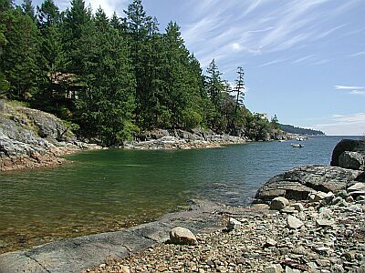
Snorkeling and Scuba Diving at Beachcomber South Wall
The dive: Continue down, the slope steepens until around 85 ft then really steepens, by app 115 ft becomes close to vertical. There is a large fishing net draped over the edges. Some cloud sponges below 160 ft. Imagine a 15 story wall 4 minutes swim from the beach.
Park off road near obvious trail near the Beachcomber Regional Park sign. Walk down trail to beach (nice gravel at high tide, slippery larger rocks at low tide). Enter and swim directly magnetic south, perhaps angling a little left over the clam beds till you find the rocks.
Access
shore
View
Nearby Shops
Tide Report


5
4
3
2
1
(0)
No reviews yet. Be the first!
Other Locations Nearby