

Top Snorkeling and Scuba Diving in Vancouver Island
Ready to check out the best sites in Vancouver Island for scuba diving, snorkeling, shore diving, free diving or other ocean activities? Zentacle has 52 dive sites, snorkel spots, beaches, and more. Discover hand-curated maps, along with reviews and photos from nature lovers like you.
No matter what you're looking for, you can find a diverse range of the best ocean activities in Vancouver Island to suit your needs.
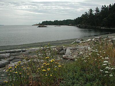
Vancouver Island and environs are internationally recognized as a premiere diving destination. The Jacques Cousteau Society has rated the water surrounding Vancouver Island second only to the Red Sea for clarity and diversity of marine life. In the winter, peak season for diving around the Island(s), the temperate waters provide incredible visibility. Access to the dive sites is available from numerous communities along the East coast of Vancouver Island, from Victoria all the way North to Port Hardy.


#1 - Ogden Breakwater
Vancouver Island, BC, Canada
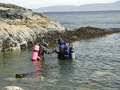
Ogden Breakwater is a marine preserve with features created just for divers. A very easy entry marks the start of a diving 'scavenger hunt' for the sunken plaques that line the break water. Each plaque contains information about the area and marine life you'll encounter.
From the inner harbor of Victoria, drive South 1.5km to the end of Government Road, and turn right on Dallas for 1km.
#2 - McNeill Point
Vancouver Island, BC, Canada
McNeill Point is an exciting spot to explore, but only during ideal conditions. The tidal currents through here could ruin your whole day if you're not careful. Check with a local dive shop about seasonal and hourly conditions at this site!
Located 0.4km West of the Victoria Golf Course on Beach Road.
#3 - Ten Mile Point
Vancouver Island, BC, Canada
Ten Mile Point can offer some great sights for the advanced diver. A constant current of varying strength keeps this area alive with sea life. You can stay in the shallows to explore the shore, or quickly drop down to 30 meters to investigate the nearby wall.
Our best advice is to get a map of Victoria once you arrive, and locate the general area of the point in the Cadboro Bay district. Find Tudor Ave which runs the length of the small peninsula, and head Southeast. Tudor will eventually bend to the left; in 300m, take a right on Baynes Road, then a left on White Rock. You'll see the intersection below.
Ten Mile Point is also known as Whiterock Street.
#4 - Spring Bay
Vancouver Island, BC, Canada
Spring Bay is a very easy dive for beginners, but can become quite difficult if you venture too far out. Although mostly protected from the current that plagues Ten Mile Point, the closer you get to Ten Mile, the more you will feel the current. So, stay in the general area of Spring Bay, and swim into any current you encounter.
Our best advice is to get a map of Victoria once you arrive, and locate the general area of the point in the Cadboro Bay district. Find Tudor Ave which runs the length of the small peninsula, and head Southeast. Tudor will eventually bend to the left; continue to the parking lot at the end of the road.
#5 - Ross Charles Park
Vancouver Island, BC, Canada
For a relatively easy entry and dive, try Ross Charles Park. There are several rocky outcroppings to explore, and a flat bottom otherwise.
From the inner harbor of Victoria, drive South 1.5km to the end of Government Road, and turn left on Dallas for 3.7km. After you pass the cemetery on your left, prepare to turn right on St. Charles Street.

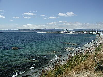
#6 - Ogden Point Breakwater
Canada, British Columbia, Vancouver Island
The Ogden Point Breakwater is an 800-metre long breakwater constructed of stacked granite blocks and concrete. Although the breakwater is a marine sanctuary, line fishing is allowed; be alert for fishing gear on the bottom and overzealous boaters.
There are five dive flags painted near the top of the west side of the breakwater, with corresponding bronze plaques at the bottom stone of the breakwater directly in line with each flag. The plaques provide a description of the marine life in the area, and the compass bearing to the next plaque.
Entry is from the beach, breakwater or dive boat. Caution must be exercised when entering from the breakwater due to the barnacles and concrete blocks obscured by bull kelp.
Beach to Flag 1: Mixed cobble and sand bottom, shallowing slowly to 8 metres.
Flag 1: 8 metres depth, sand bottom.
Flag 2: 8 - 17 metres depth, sand bottom.
Flag 3: 17 - 20 metres depth, sand bottom.
Flag 4: 22 - 25 metres depth, sand bottom, rubble below 9 metres.
Flag 5: 28 - 35 metres depth, mud, sand bottom, tumbled granite blocks.
The marine life in this area is abundant and varied. Expect to see the following: Sleeping Canary, Tiger, Black, Yellowtail, Puget Sound and Quillback Rockfish, Octopus, Harbour Seals, Dogfish, Rat Fish, Wolf Eels, Black Eye Gobys greenling, lingcod, Perch, Flounder, Kelp Greenling, Grunt Sculpins, Decorated Warbonnets, Mosshead Warbonnets, Burrowing Sea Cucumbers, Chitons, Hairy Lithoide Crabs, Brittle Stars, Metrudium and Plumose Anemones, Abalone, Crab, Puget Sound King Crab , Swimming Scallops, Ghost Shrimp, and Nudibranchs.
There is a dive shop, the Odgen Point Dive Shop, located at the end of the breakwater where you can conveniently get air and rental gear.
Odgen Point Breakwater is located at 199 Dallas Rd, Victoria, BC. It is right next to the Helijet airport and the docks where the cruise ships dock. There is a parking lot with paid parking right by the dive shop, with a few stairs to get to the breakwater itself, or follow the path around to the beach.
Your entry and exit points can be anywhere along the breakwater, from a minute's walk to a half hour hike from the end.
#8 - King Koho
Vancouver Island, BC, Canada
Enter the water immediately in front of the parking site, and follow a bearing of 0 degrees (i.e. due north). You should hit the King Koho at about 20m/70' in depth. Local divers have run a line out to the boat - so if you come across a week-encrusted line you can follow it to the wreck. The King Koho is a 10m/30' sail boat that sunk in the late 90's. There are a lot of fish on the wreck, some good sized anenomies, and some octopi make their homes under the wreck. The only hazard here is the fishermen - they seem to think that the divers have hidden all the fish. Apparently 'over fishing' isn't in their vocabulary.
Drive towards the ferry terminal in the town of Comox. Immediately before entering the ferry grounds there will be a road going off to the right, turn onto this road. Follow this road for 2-3 blocks until you hit singing sands road. Turn left onto singing sands road and follow it to the end. There is a bit of space to park at the end of the road. This is a busy site, so don't hog space.
#9 - McMicking Point
Vancouver Island, BC, Canada
For a very quiet dive through some rock and kelp-laden waters, you'll find this area a joy! You are in the midst of a tightly packed neighborhood, so be courteous and silent. Be very careful of the current!
Located just Southwest of Victoria Golf Course, take the first road to your left off Beach Drive: Radcliffe/Hood Lane.
#10 - Esquinalt Lagoon
Vancouver Island, BC, Canada
For an easy dive, without the hazards of rocks, kelp and strong current, Esquinalt Lagoon offers the chance to see the bottom dwellers you'd expect on a sandy stretch of coast. There are no facilities in the immediate area, so bring water and warmth!
From Victoria Harbor, take the Trans-Canada Highway (1) to the North. In 9km go South on Highway 14 (Old Island Highway). In 1.8km turn left on Ocean Blvd and travel for 1km until you reach the bridge below.
#11 - Albert Head Lagoon
Vancouver Island, BC, Canada
Albert Head Lagoon is another wonderful no-current dive for searching out crabs and skates. This site is really off the beaten path, so bring everything you need for a comfortable day.
From Victoria Harbor, take the Trans-Canada Highway (1) to the North. In 9km go South on Highway 14 (Old Island Highway). In 4.5km turn left on Metchosin Road and travel for 3.6km until you reach Albert Head Lagoon Regional Park.
#12 - Henderson Point Dive Site
Vancouver Island, BC, Canada
The best dive spots are on a heading of 255*. There is one smaller reef and two larger ones just past the first. The bottom is sandy until you hit the reefs. Max depth is 80ft but most of the dive will be 30-60ft. Special note for diving in the Inlet: Ceiling / thermicline can make vis only 2ft at the surface but when you descend below 20ft it will "open up" to excellent vis. It may be dark so carry a flashlight for looking at things up close.-- Geoff
Entry: You need to climb down a small drop to get to the beach - use the dead tree for support. To find the site itself swim straight out (west) from the flag pole about 30-50 feet, then drop straight down. This will land you on one of two reefs. Stay on this reef, or continue into deeper water where you'll encounter a second reef. Both reefs have wolf eels, octopi, a large variety of fish, and plenty of other stuff. In summer watch out for large Cyanea jelly fish - they'll give you a nasty sting. First reef is in ~50' of water. Second reef drops down a series of shelves at 60', 80', 130', and possibly deeper. Because this dive is in the Saanich Inlet there is no significant current. IMO this is the best dive in Victoria aftert the Ogden Breakwater. - Bryan H. From Victoria, go north on West Saanich Rd., continue N throughout Brentwood, after passing through the Tsartlip Indian Reserve you will come to a road called Mt.Newton Cross Rd.on you right and Senanus Dr. on your left, turn LEFT. Follow Senanus Dr. all the way to the end where there is a small parking lot. Access is at the left side. Check out the access point before putting on your gear.(200ft walk) There is a tree that you can use to help get onto the beach. - Geoff
How to get there: Head north from Victoria along the Patricia Bay Highway (highway 17). After ~10km turn left (west) onto Keating Cross Road. This road will take you past a Whites dive shop with a map of the site - a good reference if you've never been there before. Follow Keating until you hit West Saanich Rd, where you turn right (north). Follow this road ~5km to Mount Newton Cross Road, where you turn left (west). Follow the road until it ends in a small cul-de-sac. Park here (don't hog space), and follow the footpath to the dive site. --Bryan H.
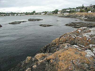
#13 - Saxe Point Park
Vancouver Island, BC, Canada
A wonderful beach park for the kids, with hiking trails and facilities, you'll find Saxe Point Park a relaxing spot to spend the day. Bring a couple of tanks and a picnic lunch, and enjoy!
From Victoria, head West over the Johnson Street Bridge onto Esquimalt Road. In 3.1km turn left on Fraser Street and head into Saxe Point Park.
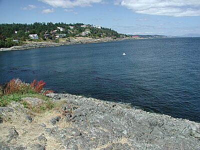
#14 - Clover Point
Vancouver Island, BC, Canada
Clover Point is a no-frills park used by most to contemplate the coastline and sea beyond. But what make this area worthwhile for the diver is the point and the surrounding marine life. Kelp and creatures will keep you company on this dive.
From the inner harbor of Victoria, drive South 1.5km to the end of Government Road, and turn left on Dallas for 1.9km.
#15 - Telegraph Bay
Vancouver Island, BC, Canada
A great site for beginners, Telegraph Bay offers a shallow dive with no current. As you swim toward the points of the bay, you are bound to see the local marine life. (Note: to eliminate any confusion, there is a Telegraph Cove on Northern Vancouver Island that has some spectacular diving, as well!)
Our best advice is to get a map of Victoria once you arrive, and locate the general area of the point in the Cadboro Bay district. Close to the intersection of Tudor and Arbutus, you'll find Telegraph Bay Road, which you should follow Northeast into the bay.
#16 - Willis Point
Vancouver Island, BC, Canada
Diving here is great! When you finally climb down the rocks using the tree on the right for help. Swim about 100ft from shore then descend. If you swim to the left and out a bit you will come to a sheer wall that drops to 110ft! It is covered in life and in the deeper depths you may find some Cloud sponges. I usually swim on the surface past the 3rd house(left if you are facing away from shore) descend to the wall then to 100ft. I work my way up the wall while going back to the entry point for my safety stop in the kelp beds.(it gives my something to look at) - Geoff
Head north on the Pat Bay Highway (#17) turn off, then left at the Royal Oak Dr. overpass (look for the sign) follow Royal Oak Dr. till you get to West Saanich Road. Follow north 6.5km , turn left onto Wallace a Dr. then when you see Willis Point Rd. turn left (the only way to go) Follow all the way to the end (8.2km) where you will find Mark Lane. Turn right and drive down about 0.6km to a fire lane on the left. Do not park right in the lane and be careful not to block peoples driveways. I believe the address of the last house before the fire lane is 7442.
To find this on a map it is best to enter into Google Maps or Map Quest: Steamer Drive, Brentwood Bay British Columbia - then look for the fire lane as you are driving along. Its beside a black iron fence. If you encounter Steamer Drive itself, you have just gone past the fire lane. Do not block the fire lane as this is for the fire trucks to get water from the ocean. But there is parking for at least 4 cars here.
#17 - McKenzie Bight
Vancouver Island, BC, Canada
Diving here you go 30-40 ft from shore and descend. There is a wall with some interesting contours along it. The wall starts at about 30ft and goes all the way down over 120ft. If you are lucky in the summer you will find 6 gill sharks but only at 80ft and deeper. This dive site does require a walk of approximately 5 minutes. And a rocky trail leads down to the gravel beach. Once you are in the water there are some walls, but not much life on them. There is more life in the gravel. This site is more well known for one of the few places that the Six Gill Sharks sometimes are spotted here during the summer at depths of around 30 metres [100 feet].
Head north on the Pat Bay Highway (#17) turn off, then left at the Royal Oak Dr. overpass (look for the sign) follow Royal Oak Dr. till you get to West Saanich Road. Follow north 6.5km , turn left onto Wallace a Dr. then when you see Willis Point Rd. turn left (the only way to go) Follow all the way to the end (8.2km) where you will find Mark Lane. Go left and you will find McKenzie Bight. There will be a locked gate. Go down the path a bit and you will find different paths that lead to different beaches and entry points(spot #1 is 200m,spot #2 is 600m and #3 is the end). I usual take the first one I see but check it out in advance. - Geoff

#18 - Cattle Point Park
Vancouver Island, BC, Canada
Cattle Point is mainly used for dog walkers and boat launchers, but if you are careful, you can slip down the boat ramp and explore some very scenic coastline. The current is, of course, an issue, so check with your local dive shop for the seasonal conditions.
Located in the Uplands Park of the District of Oak Bay, you'll see the entrance to Cattle Point off Beach Drive.
#19 - Old Government Wharf
Vancouver Island, BC, Canada
You are diving on the remnants of an old government wharf which was destroyed in a severe storm. The bank head of the wharf is observable from the boat launch, off to your left, on the hill. You want to swim under this, at which point you then submerge and follow the wreckage out. The wharf used to be huge - over 20m/60' high, and 800m/0.5mi long! There is a lot to see as you follow the wreckage - coal cars, pilings, tanks, bottles, and lots of other debris. Not a lot of life, although the sandy regions in-between pieces of wreckage are home to all kinds of crabs, telias, sole, and other sand-feeders. Fish tend to congregate around some of the larger pieces of wreckage. Depth varies from 3m/10' to approx 20m/60'. A large portion of this dive is next to an active boat launch. Fly a flag. This dive is exposed directly to a channel, so be prepared for some current. Best dived at high tide - vis can be very poor at low tide. Also, at high tide you can escape (i.e. 'swim over' the crazy-glue like mud which is exposed at low tide.
Take the old island highway to Union Bay (located mid-way between Comox and Nanaimo). Park at the boat launch. The launch is also your entry point. There is a dive shop on the other side of the road. The owner is very familiar with the local sites, and has some of the cheapest air fills around.
#20 - Argonaut Wharf
Vancouver Island, BC, Canada
This dive is best done on a long slack tide as currents need to be considered. The dive itself is 50-60ft max amongst the pilings. farther out is nothing but sand and a loooong swim back. Locals quite often use this as a night dive site. You will find octo hiding at the base of the pilings, both the giant pacific octo and the tiny ruby octo. Also frequently seen are stubby squid, small orange/pink smooth skinned [these are not ruby octo] as well as lots of the usual marine life, anemones etc.
Located on Campbell River. Turn right [if going north] off coastal island hiway [just after Canadian tire] onto Spit Road, follow short distance [less than a km] wharf is on your right [big wooden pilings]
#21 - Sydney Pier
Vancouver Island, BC, Canada
The town of Sydney has started an artificial reef on both sides of the pier. These reefs consist of concrete "reef balls". These balls are shaped like hollow soccer balls, and make homes for a variety of animals. There isn't too much to see hear - a lot of leaf kelp, a few anemones, some nudibranches and the odd rockfish. The pier is a popular spot for crabbing, although we didn't see too many large crabs.To find the artificial reefs swim out along the pier until you hit the second-last pair of supports for the pier. Descend along the support; this will land you directly on the reef balls. You can then do a circuit - follow the balls east to the end of the pier, then cross the pier to pick up the second set of balls. Follow these balls west, back towards shore. That's it - easy as pie! The dives shallow; at high tide you'll be lucky to hit 10m/30'. Just two things to be concerned about; fishermen on the pier and current. This dive is best done on slack. Fishermen usually don't cast as far as the reef balls, but be prepared for monofilament when you pass under the pier.
From Victoria take highway 17 North until the Beacon Ave turnoff for the town of Sydney (~20km from downtown Victoria). Turn right (east) onto Beacon Ave, and follow it to 2nd Street - at this point turn right (south) onto 2nd, take it for one block and then turn left. This'll put you on Bevan Ave, from here you should be able to see the Pier. Park where possible, gear up, and walk to the pier. You can enter on either side of the pier - careful, both entries are rocky and slippery.
#22 - Mystery Wreck in Deep Cove
Vancouver Island, BC, Canada
Dive off the end of the dock (left side) and swim out to the marker buoy. Descend down the line vis may be bad on the surface but around 20ft it will clear up. Swim along the bottom on a heading of about 90* and you should co to a reef with a sunken speed boat on the side to it swim a little further and the wreck will appear out of the dark (it looks rather eerie). No one knows the name or who owned it. I start by swimming along the side then at the end I swim through the middle with the wreckage coming out of the bottom all around me. There are big schools of fish that may follow you around , plume enimnies , nudeabranks, crabs and other such life. It is a large wreck (165ft long) so it may take two dives to see the whole thing but I have been 6 times I still love going there. When you pay ask which buoy to go to as there are a few and they change places a lot. There is no current to speak of even on large tidal exchanges. Even during not so good weather when you can not dive anywhere else you can dive here! Have fun! - Geoff
Additional Information from Bryan Heit:
1) The ship is a train barge which sunk in the 1950's (not 100 years ago as listed). The barge struck a reef just outside the harbor and limped in - only to sink about 100' away from the dock! No one knows who the owner was, nor the name of the ship.
2) The buoy which you dive to is the faded pick spherical buoy, located at about a 45 degree angle to the right of the dock when standing in the parking lot. This has been the same buoy for several years.
3) At the bottom of the buoy is half of a speed boat. According to the owner of the marina this boat sunk in 2001 when he was towing it - the owner hadn't paid their dockage fees. A great picture opportunity is to get a photo of someone "driving" the boat.
4) The barge itself is in poor condition, and penetration should not be attempted. Large sections of the wreak have collapsed in, making any penetration dangerous. But there's a lot to see on the outside, including ling cod, grenlings and purch.
5) As mentioned the marina owner is really nice, and will fill tanks for $5, including parking.
6) Another (free) entry option: Take highway 17 towards the ferry terminal, to Wain Rd. Take Wain west until it ends, turn right (north) onto the road at the end of wain (mardrona drive). Follow this 3-4 blocks until you reach Setchel Rd. Turn left, follow the road to it's end, and park in the cul-de-sac. Take the path down to the point, and dive from there. The wreak is to the left. If you dive from this spot swim along the bottom to the wreak - there used to be an old Chinese colony here and there is a tone of debris to see, including a lot of old bottles.
7) Dive this dive at the end of high slack. There is too much silt at low tide, but if you wait for high slack vis increases dramatically.
8) As this is a marina you should fly a dive flag. from Victoria take the Pat Bay Highway (#18) towards the ferry terminal but just before it take the Wain Rd. exit. Follow Wain Rd. all the way to a four way stop (Madrona Dr.) turn right onto Madrona Dr. then turn right again and look for the Deep Cove Marina their address is 10990 Madrona. Phone # (250) 656-0060. They charge $3 per diver to dive off the end of the dock (secured parking included). They also have an air station there and last time I was there he charged me $5 to fill my tank but waived the $3 dock/parking fee. You can dive off a near by point but it is a long swim and limited parking. It is well worth the $3! - Geoff
#23 - Union Bay Wreck
Vancouver Island, BC, Canada
Easy to find, easy to access and when you are done the dive shop across the street will fill your tank for FREE.
Union Bay is home to a 100 ft wreck. The wreck is marked with a buoy and the entry point is the breakwater. The wreck has been down a long time so there is lots of life including octopus & ling cod. This area was once a major port for the loading of coal for steamships, many strange and wonderful artifacts have been found. There are picnic tables and a large propeller on display on the breakwater.
#24 - Quathiaski Cove Quadra Island
Vancouver Island, BC, Canada
Quathiaski Cove Quadra Island (Campbell River) Great shore dive, easy entry/lots of life/clear water a definite 6/5! Give you something other than Victoria (south island) for 'SECOND BEST DIVING IN WORLD'
#25 - Johnstone Reef
Canada, British Columbia, Vancouver Island
Johnstone Reef is a 0-star rated scuba dive and snorkel destination in Canada, British Columbia, Vancouver Island which is accessible from shore based on 0 ratings.
#26 - Saxe Point
Canada, British Columbia, Vancouver Island
This is a shallow dive site, with lots of parking. To enter the water follow the trail to the north west of the parking lot down to the beach. The wall starts almost at the surface and can be followed both to the left and right once you are in the water.
This dive site is located within Saxe Point Park at the end of Fraser Street within the city of Esquimalt. Which is located just west of Victoria, British Columbia.
Saxe Point is also known as Saxe Point Park.
#27 - Fulford Reef
Canada, British Columbia, Vancouver Island
Fulford Reef is a 0-star rated scuba dive and snorkel destination in Canada, British Columbia, Vancouver Island which is accessible from shore based on 0 ratings.
#28 - Brinn Rock
Canada, British Columbia, Vancouver Island
Brinn Rock is a 0-star rated scuba dive and snorkel destination in Canada, British Columbia, Vancouver Island which is accessible from shore based on 0 ratings.
#29 - Chain Islet
Canada, British Columbia, Vancouver Island
Chain Islet is a 0-star rated scuba dive and snorkel destination in Canada, British Columbia, Vancouver Island which is accessible from shore based on 0 ratings.
#30 - Moulds Bay
Vancouver Island, BC, Canada
At high tide there are 2 rocks [at low tide a large notch between these rocks ] that form the sides of the dive site. At the outside of these rocks [+/- 30ft depth] it opens out to a nice wide gentle slope. Follow the rock edge to either side, and you can find octo and wolf eels, as well as many of the usual life. It is used as an open water training site. There is little to no current. Note: at high tide the walk to the water is considerably shorter :-)
Moulds Bay is on Quadra Island, [just across discovery passage from Campbell River]. Take the ferry from Campbell River, follow directions to the Cortes ferry [part way at least] turn left onto Hyacynth Road. Follow to Valdez Road, The dive site is at end of Valdez Road. Park off to side of the road. This is a popular launch site for kayaks, too.
#31 - GB Church
Canada, British Columbia, Vancouver Island
This wreck is mostly protected from the island that it resides beside. Portland Island. Although you may feel current at the surface, once below 10 metres [30 feet] there is usually very little or no current.
This dive site can only be accessed by boat. Two buoys exist at the wreck, but sometimes only one is visible.
GB Church is also known as MV G.B. Church.
#32 - Henderson Point
Canada, British Columbia, Vancouver Island
This site may not look the best initially, but over the course of a year many species can be found here. Access is fairly easy, but the last few feet to the water is steep decent of about 10 feet.
This dive site is basically at the end of Senanus Drive in North Saanich, British Columbia, Canada. With parking for about 5 cars.
Henderson Point is also known as Senanus Drive.
#33 - Forest Island - North End
Canada, British Columbia, Vancouver Island
This dive site is located at the north end of Forest Island, and a boat is required. Current is an issue here. The best site here is between 75 and 200 metres north of the end of the island.
Forest Island - North End is also known as Forest Island.
#35 - Beechey Head
Canada, British Columbia, Vancouver Island
Beechey Head is a 0-star rated scuba dive and snorkel destination in Canada, British Columbia, Vancouver Island which is accessible from shore based on 0 ratings.
#36 - Little Group Islands
Canada, British Columbia, Vancouver Island
Little Group Islands is a 0-star rated scuba dive and snorkel destination in Canada, British Columbia, Vancouver Island which is accessible from shore based on 0 ratings.
#37 - Joan Rock
Canada, British Columbia, Vancouver Island
Joan Rock is a 0-star rated scuba dive and snorkel destination in Canada, British Columbia, Vancouver Island which is accessible from shore based on 0 ratings.
#38 - Brotchie Ledge Wreck
Canada, British Columbia, Vancouver Island
Brotchie Ledge Wreck is also known as San Pedro.
#39 - Canoe Rock
Canada, British Columbia, Vancouver Island
Canoe Rock is a 0-star rated scuba dive and snorkel destination in Canada, British Columbia, Vancouver Island which is accessible from shore based on 0 ratings.
#40 - Dyer Rocks
Canada, British Columbia, Vancouver Island
Dyer Rocks is a 0-star rated scuba dive and snorkel destination in Canada, British Columbia, Vancouver Island which is accessible from shore based on 0 ratings.
#41 - Arachne Reef
Canada, British Columbia, Vancouver Island
Arachne Reef is a 0-star rated scuba dive and snorkel destination in Canada, British Columbia, Vancouver Island which is accessible from shore based on 0 ratings.
#42 - Arbutus Island
Canada, British Columbia, Vancouver Island
Arbutus Island is a 0-star rated scuba dive and snorkel destination in Canada, British Columbia, Vancouver Island which is accessible from shore based on 0 ratings.
#43 - Cooper Reef
Canada, British Columbia, Vancouver Island
Cooper Reef is a 0-star rated scuba dive and snorkel destination in Canada, British Columbia, Vancouver Island which is accessible from shore based on 0 ratings.
#44 - Esquimalt Lagoon
Canada, British Columbia, Vancouver Island
Esquimalt Lagoon is a 0-star rated scuba dive and snorkel destination in Canada, British Columbia, Vancouver Island which is accessible from shore based on 0 ratings.
#45 - Graham`s Wall
Canada, British Columbia, Vancouver Island
Graham`s Wall is a 0-star rated scuba dive and snorkel destination in Canada, British Columbia, Vancouver Island which is accessible from shore based on 0 ratings.
#46 - Imrie Island
Canada, British Columbia, Vancouver Island
Imrie Island is a 0-star rated scuba dive and snorkel destination in Canada, British Columbia, Vancouver Island which is accessible from shore based on 0 ratings.
#47 - Discovery Island Western Wall
Canada, British Columbia, Vancouver Island
It is best to go with someone who has dove this site before. The top of this wall is interesting as well, but it can be difficult to anchor here and then to find the wall.
This location is best found by using Google Earth with the given GPS coordinates. The wall here bends around this point, and has an abundance of life. But current is a problem here.
Discovery Island Western Wall is also known as Discovery Island.
#48 - Mosses Point
Canada, British Columbia, Vancouver Island
This dive site despite is shallowness, can sometimes be worth it. But it depends on the season and weather conditions.
This dive site is found near the end of Mosses Point Road. A trail leads off to the solid rock beach. It is best dove at high tide, as at low tide it can be risky going down the solid rock. It might look easy, but the rock can be slippery.
#49 - Sidney Waterfront
Canada, British Columbia, Vancouver Island
This dive site is hard to predict slack current for. An artificial reef exists here, of hollow concrete half spheres. There is also the wreck of a small sail boat. But despite this dive sites problems this can be an interesting dive.
This dive site is located right downtown in Sidney at the end of Beacon Avenue. There is a park here at the water front. Just look for the beach, and the stairs leading into the water. This is also one of the few dive locations where there is a wheel chair ramp. But this is best used at high tide. As they did not seem to account for low tide for it.
Sidney Waterfront is also known as Sidney.
#50 - Deep Cove
Canada, British Columbia, Vancouver Island
There are a couple of rock outcroppings that start at about 10 feet [3 m] deep and one descends to about 50 feet below the surface, and the other descends to over 90 feet below the surface. There is also the bay to the east to explore.
To get to Setchell Road in North Saanich. You need to follow the Pat [Patricia] Bay Highway from Victoria and just after you pass Sidney, turn off to the left onto Wain Road. Follow Wain until you are forced to go left or right. Make a right onto Madrona Drive. Setchell Road is just a short distance after this to the left.
Deep Cove is also known as Setchell Road Beach Access.
#51 - Braemar Avenue
Canada, British Columbia, Vancouver Island
This dive site is very good for beginners. Not good for wheel chairs as you need to take the stairs down to the beach. But from the parking area to the beach is less than 50 feet.
This dive site is located at the west end of Braemar Avenue. To get to this dive site, if you are traveling from the south follow West Saanich Road north, and turn off onto Ardmore Road and follow it until it becomes Ardmore Drive. Braemar Avenue intersects Ardmore Drive.
Braemar Avenue is also known as Braemar Beach.