

Top Snorkeling and Scuba Diving in Metro Vancouver
Ready to check out the best sites in Metro Vancouver for scuba diving, snorkeling, shore diving, free diving or other ocean activities? Zentacle has 25 dive sites, snorkel spots, beaches, and more. Discover hand-curated maps, along with reviews and photos from nature lovers like you.
No matter what you're looking for, you can find a diverse range of the best ocean activities in Metro Vancouver to suit your needs.
Vancouver is a city with cultural diversity as well as beautiful vistas from virtually every corner. In addition, dive sites are within an easy 'commute' for your underwater pleasure. We have highlighted those we believe to be of special interest. As always, please check with the local service providers for correct tidal information as well as current conditions.

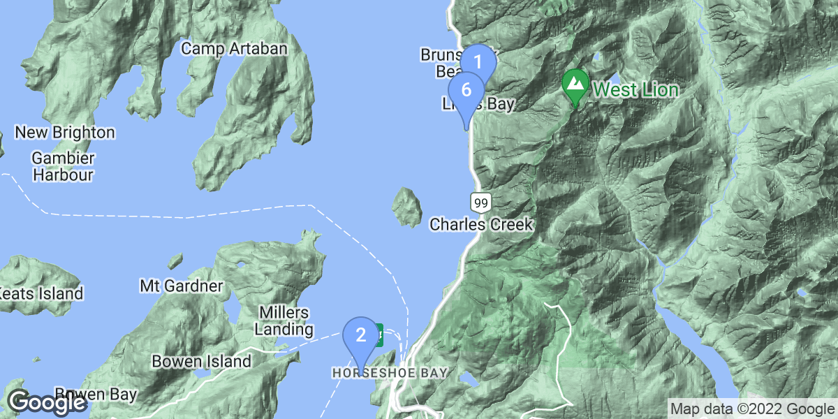

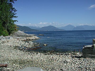
#1 - Lions Bay
Vancouver, BC, Canada
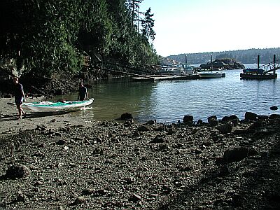
Lions Bay offers an easy access dive for those interested in seeking out smaller creatures to observe. Shallow and rocky, you'll have plenty of time to explore. A dive flag is very important in this area. Give the marina a call (604-921-7510) before you decide to show up. Diving is restricted to certain times of the year.
Heading North from Horseshoe Bay, after about 11km, take the second exit into Lions Bay. Head West toward the water, until you see the tracks below.
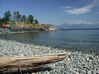
#2 - Belcarra Bay
Vancouver, BC, Canada
An excellent park for the kids, with picnic and playground facilities. For you divers, expect a rocky reef just off shore with all the small marine creatures you'd expect!
From South of Vancouver's Second Narrows Bridge, head East on 7A for about 14km, parallel the Burrard Inlet. Wrap around Port Moody by taking a left on Ioco Road. In 4.5km, take a right on 1st Ave, and in 0.7km turn left on Bedwell Bay Road for another 5km. You'll see the park on your left.
#3 - Whytecliff Park
Vancouver, BC, Canada
Whytecliff Park is the premier dive spot for divers of all capabilities. You can find dive classes exploring the inner cove, and advanced divers venturing further out toward the Queen Charlotte Channel. All the classic sea life of this area can be found within an afternoon of touring the slopes and walls. For the non-divers, food and restrooms are found close the parking area.
The original name was White Cliff City. In 1914, Colonel Albert Whyte pressed for the spelling change from White Cliff City to Whytecliff.
The park is currently home to more than 200 marine animal species and is the first Marine Protected Area in Canada. Sea lions can be seen sunbathing on the beach during summer.
Whytecliff park is located near West Vancouver's Horseshoe Bay Neighbourhood. To get there, take Marine Drive west from the Lions Gate Bridge past light house park to Horseshoe Bay and then continue on to 7100 Block Marine Drive.
2014 Note from Chanel MacKay: I am the current operator of the concession at Whytecliff Park and am in the process of reducing my hours of operation for the fall and winter 2014. I thought I would reach out to you to see if there would be any interest in my staying open for coffees, soups, and sandwiches over the park's off season. I know from speaking to divers this summer that the fall and winter are generally better for diving at Whytecliff. Would a hot drink and snack be appreciated by your divers or do they prefer to take off once out of the water and head somewhere warm to shower and dry off properly? Any feedback you could offer would be greatly appreciated as this is my first year in operation and I would like to make sure I'm meeting the needs of park guests. Please email me at foxfoodsvancouver *at* gmail*dot*com. Thank you!!
From the Copper Cove dive site turn right onto Marine Drive. In a short distance you'll see the entrance to Whyte Cliff Park.
#4 - Whiskey Cove Lane
Vancouver, BC, Canada
Whiskey Cove Lane is one of those spots used by the locals for a relaxing dive of exploration. The rocky walls of the cove and the small island make perfect hiding places for sea life.
From South of Vancouver's Second Narrows Bridge, head East on 7A for about 14km, parallel the Burrard Inlet. Wrap around Port Moody by taking a left on Ioco Road. In 4.5km, take a right on 1st Ave, and in 0.7km turn left on Bedwell Bay Road for another 5km. Then after making a right on Belcarra Bay Road, watch for the parking area below in another 0.7km.
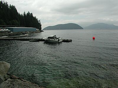
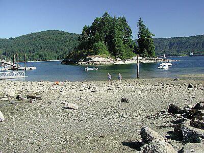
#5 - Bonnie Bay
Vancouver, BC, Canada
A more user-friendly, easy-access park, you'll find Bonnie Bay a quiet dive with wonderful scenery. There are no facilities here, just a nice, grassy trail and park.
Drive South on Marine Drive 1.4km from Horseshoe Bay. Turn right, after the Glen Eagles Golf Course, onto Glen Eagles Drive. Stay on the upper road and wind your way 0.6km to the end of the Drive.
#6 - Kelvin Grove
Vancouver, BC, Canada
It looked mighty nice, however you may now find it impossible to dive there. Apparently the neighborhood association decided to 'privatize' the beach, which effectively ended all diving there, unless you can kayak in from elsewhere. We present the site, nonetheless, in the hopes that it will one day reopen to us Marine Explorers. You must go to the marina at Lions Bay and get a parking permit then return back to Kelvin Grove.
Heading North from Horseshoe Bay, after about 10km, take the first exit into Lions Bay. Wind your way South, toward the water. You'll dead end at the park.

#7 - Belcarra Park
Canada, British Columbia, Lower Mainland
Not much to see here due to the over fishing from the wharf. Some interesting debris and old garbage if you get a bit away from the wharf. Good spot for training dives (I did my Rescue Diver course here).
Large Parking area with short walk to picnic area and beach. Regional Park so check for park hours or drive around park to road on north side (about 10 mins more drive time) and park on roadside. Easy access to water on north side of wharf. Be alert for fishermen and crabbers on wharf.
#8 - Britannia Beach Dock
Vancouver, BC, Canada
Britannia Beach Dock is the site of the old Customs House of years gone by. The area has a lot of history due to the large copper processing plant just across the street, which makes the waters perfect for treasure hunters. While off-gassing, you may want to take a tour of the mine!
Heading North from Horseshoe Bay, after about 32km you'll see a large mining facility to the right, and the railroad crossing below to the left.
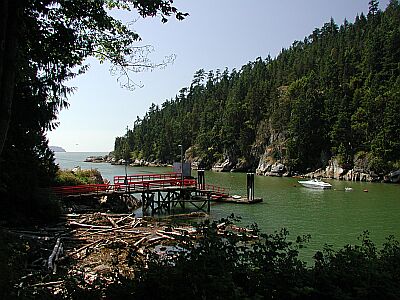
#9 - Telegraph Cove
Vancouver, BC, Canada
Telegraph Cove is a nice protected area to get your fins wet. Parking is limited, but the dive is worthwhile.
From the Copper Cove dive site turn-off on Marine Drive, continue heading down Marine Drive past the entrance to Whyte Cliff Park. Turn left on Cliff Road, and continue to the trail head below.
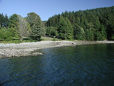
#10 - Copper Cove
Vancouver, BC, Canada
Copper Cove is a scenic location, both above and below the water. Located in a quiet residential area, please strive to be unobtrusive.
Located due West of the Horseshoe Bay Ferry Terminal, the following is a minor detour through the scenic Horseshoe Bay. Take the Upper Levels Highway (1) to Horseshoe Bay. Do not get into the ferry lines, but head down to the water, and turn left on Bay Street. Beautiful, eh?! In 0.3km turn left on Nelson Ave. In 0.5km turn right on Marine Ave. Wind your way down 0.6km to the intersection below.
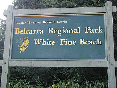
#11 - Sasamat Lake
Vancouver, BC, Canada
For something completely different, try White Pine Beach at Sasamat Lake! This is an easy lake dive, perfect for the beginner or for taking your new gear out for a maiden voyage. The family will enjoy the white sand beach and facilities.
From South of Vancouver's Second Narrows Bridge, head East on 7A for about 14km, parallel the Burrard Inlet. Wrap around Port Moody by taking a left on Ioco Road. In 4.5km, take a right on 1st Ave, and in 0.7km turn left on Bedwell Bay Road. You'll see the entrance in 3km.
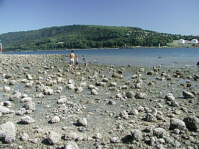
#12 - Cates Park
Vancouver, BC, Canada
Cates Park is a nice location for divers and non-divers alike. Facilities, picnic tables, and beach combing will occupy your family while you're exploring the off-shore reef.
From Vancouver, take the Trans Canada Highway into North Vancouver over the Second Narrows Bridge. Make an immediate right, and head East on Dollarton Highway for 5.3km.
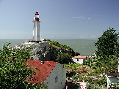
#13 - Point Atkinson
Vancouver, BC, Canada
Point Atkinson is found at the tip of Lighthouse Park in West Vancouver, entrance to the vast Burrard Inlet. This site is a fantastic vantage point for getting a glimpse of all the indigenous marine life. Along with the impressive trail system, basic facilities are available. See your local dive shop for the seasonal conditions and requirements.
Located on the Southwestern tip of West Vancouver, access is via Marine Drive. From Vancouver, take the Lionsgate Bridge North and exit on Marine Drive West and drive about 11km. The entrance below will be on your left.
#14 - MV Zebalous
Vancouver, BC, Canada
In Union Bay there is a 100ft steel barge at 60ft that has been down for many years. This shore dive has tonnes of life including giant octopus. This is the shore dive on the wreck of the MV Zebalous a 60ft Seign wooden boat @ 50ft. The historic site of the government wharf that has been dismantled is between 40 and 20ft us home to many fish, octopus, moon snails and millions of porcelain & glass objects including hand blown opium vials (left by the oriental railway workers) that have been discarded where the old steam ships once docked.
Union Bay
#15 - Strathcona
Vancouver, BC, Canada
This is a nice suburban park with very easy access to two small islands. Take time to circle the islands, watching for boat traffic. You won't find facilities here, but you will find a relaxing atmosphere!
From Cates Park, head North on Dollarton Highway for 1.6km, then right onto Strathcona. Wind around for less than a kilometer until you find the parking below.
#16 - Ansell Place
Canada, British Columbia, Lower Mainland
Ansel Point is largely a sheer wall, so it is a site that is appropriate for those that are very comfortable with their buoyancy in cold water conditions.
Either direction has plenty of wall to explore with critters like squat lobsters, golf ball crabs and the occasional seal to check out. There are a pair of wolf eels that are intermittently spotted under a large rock at approximately 75' (22m) on the wall if you head to the right.
A point of interest to the diver's left as you enter the water is a wall cutting at about 20 meters that goes back into the cliff about 4-5 meters. It tends to be a gathering place for rockfish and ling cod and is a good place to begin your dive.
The access to this site can be slightly difficult as you need to go down 65 steps followed by a climb down high and uneven rock to cross into the tidal area. Occasionally rough water can make entry and exit from the site a challenge. Good fitness is essential.
If you're planning two dives leave your gear at the bottom of the stairs and just replace your tanks.
#17 - Wreck of the Malahat
Vancouver, BC, Canada
Entry is to the left of the rock breakwater, on the sandy beach. Simply walk in and swim alongside the breakwater. As you swim, look for a large pipe. When you find this pipe, turn and follow it to its end (bearing ~225 degrees). At the end of the pipe make a 90-degree turn to your right. The remnants of the Malahat should be just a short swim away. The Malahat was a turn-of-the-century schooner, made famous as a rum runner during prohibition in the US. It used to run legal booze from Vancouver to California, where it would become a floating liquor store in international waters. Post-prohibition it became a logging ship, eventually being sunk in Powell River. Not much remains of the ship today, with the exception of a few ribs and some machinery. But the site is covered in life. Lingcod, octopi, wolf eels and more make their home here. An excellent and interesting dive. The Malahat is ~30m/100' long, and lies in 12m-18m (40'-60') of water. The wreck is located in the Malaspina Straight, so current may be an issue. Many people boat in this area - use a flag.
This dive is located in the town of Powell River. Take highway 101 (AKA Marine Ave) to the pulp mill and turn into the mill's access road. Immediately after you turn onto the access road it'll split - take the left-hand roadway. Follow this for ~1km. The dive site is at the bottom of the hill, beside the last small breakwater. There is a small "island" the road loops around - this is a good place to park your vehicle.
#18 - Woodlands
Vancouver, BC, Canada
Do you have time for a scenic drive? Then take a beautiful drive through some wonderful scenic countryside in North Vancouver to dive the Lone Rock at Woodlands.
From Cates Park, head North on Dollarton Highway for 1.3km, then left onto Mount Seymour Parkway for 1.1km, then right onto Mt. Seymour Road for 0.6km, then right onto Indian River Road. If you've made it this far, congratulations! Follow the signs to Woodlands as you wind through the forest for 4.8km to the stop sign below.
#19 - The Cove
Vancouver, BC, Canada
This site is usually explored for artifacts of years gone by, as this was once a major marine thoroughfare. If you enjoy the thrill of treasure hunting, this spot's for you!
Located on the Southwestern tip of West Vancouver, access is via Marine Drive. From Vancouver, take the Lionsgate Bridge North and exit on Marine Drive West and drive about 11km. The entrance to the Cove is located immediately East of Lighthouse Park. Turn left on The Dale, then left again on the one-way Piccadilly Street. Drive slowly, and make a right on Pilot House Road. After 500 meters, you'll see the parking below.
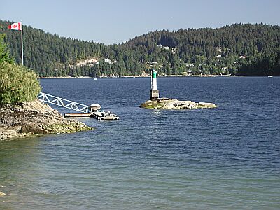
#20 - Whiskey Cove
Canada, British Columbia, Lower Mainland
This was my first "uninstructed" dive site and was chosen specifically for the diversity of life and terrain as well as the relative safety of this location. Low current, low waves, and well documented (call "Langley Diving" for a fantastic orientation map). It has since become my "home field" and is an excellent choice for an easy access, easy dive with plenty to see in a (relatively) controlled environment. Also, an excellent location for practicing skills and photgraphy/videography.
Access to dive site is about 1 km north Belcarra Park in Port Moody. Parking is limited to 3 or 4 vehicles and access is limited to daylight hours unless special permission is granted. About 100 meters of gently sloping, forested, marked trail from parking to entry point. Wall dives to both North and South of the Cove (under the privately owned docks) reveals much wildlife. The middle of the bay is about 60 - 100 ft and bottomed by sandy floor and sea grass. Nice whips as you get deeper and the October Jellyfish Bloom is spectacular for Moon Jellies.
#21 - Bowyer Island
Canada, British Columbia, Lower Mainland
Bowyer Island is a 0-star rated scuba dive and snorkel destination in Canada, British Columbia, Lower Mainland which is accessible from shore based on 0 ratings.
#22 - Seymour Bay
Canada, British Columbia, Lower Mainland
Seymour Bay is a 0-star rated scuba dive and snorkel destination in Canada, British Columbia, Lower Mainland which is accessible from shore based on 0 ratings.
#23 - Lookout Point
Canada, British Columbia, Lower Mainland
Most divers do the right wall, follow it and go around rocky peninsula and return back to the bay. If you breathe very well, stay shallow and current helps you a bit - you can end your dive at famous WhyteCliff "The Cut" or in WhyteCliff bay. However, this dive is only for experienced divers - if you not sure - DO NOT try it.
There is usually a strong (sometimes very strong) current at the Lookout Point bay's entry (from right side). Sometimes it's very hard to go back into the bay - specially when high/low tide begins.
There is not too much things to see in the middle of the bay - sea bottom is flat, sandy, and gently goes into deep. However, right wall has enough marine life for an interesting dive - seastars, kelp, crabs, shells, fish, etc...
A relatively big bay with instant public access to the water near WhyteCliff park. It's around 100 meters far from it.
#24 - Racoon Island
Canada, British Columbia, Lower Mainland
Boat launch at Rocky Point Marina in Port Moody. Launch Kayak from Belcarra park or Deep Cove. Racoon Island is about 1 km Northwest of the mouth of Bedwell Bay. Anchor in 60 to 100 feet of water (sand bottom) to north of Island. Formations run in undulations toward island from here and average about 30 - 40 ft. Beautiful terrain and several nudis, crabs, lithodids, and anemones as well as large leaf seaweeds in greens and reds. If kayaking there is a nice protected beach on this small island from which to shore dive.