

Los Angeles CountyMonterey CountyOrange CountySan Diego CountySonoma CountySanta Barbara CountyMendocino CountySan Luis Obispo CountySiskiyou CountyEl Dorado CountyMono CountyShasta CountyPlacer CountyVentura County
Top Snorkeling and Scuba Diving in California
Ready to check out the best sites in California for scuba diving, snorkeling, shore diving, free diving or other ocean activities? Zentacle has 242 dive sites, snorkel spots, beaches, and more. Discover hand-curated maps, along with reviews and photos from nature lovers like you.
No matter what you're looking for, you can find a diverse range of the best ocean activities in California to suit your needs.
California has three beautiful diving regions.
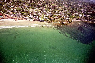
The North coast region is renowned for lush, moist forests of the world's tallest trees, coastal bluffs, secluded coves and wildlife areas. From the pristine beaches and coves of Carmel by the Sea and Monterey Bay, the coastline includes numerous dive locations North of San Francisco, all the way to Mendocino and Crescent City. Each site offers its unique underwater topography and associated marine life.
The California mid region includes diving locations from South of Pt. Lobos State Park (Carmel by the Sea) to Laguna Beach. This long stretch of beautiful beaches can be categorized as open-water diving, with some protected coves and inlets. Capitalizing on optimal weather as well as observing tides and current conditions are crucial to an enjoyable dive experience.
The California South listings include the greater San Diego area (Pt. Loma North to La Jolla) continuing up through Orange County to Laguna Beach. Each ShoreDiving location has unique conditions -- and beauty!
As always, check with your local resources for exact local conditions for the ultimate safe and rewarding dive experience.

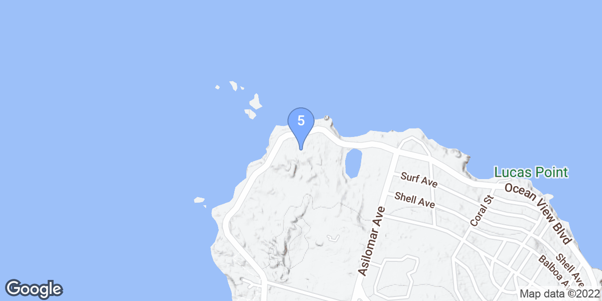

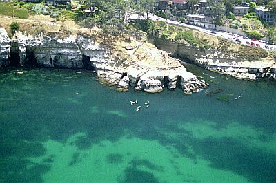
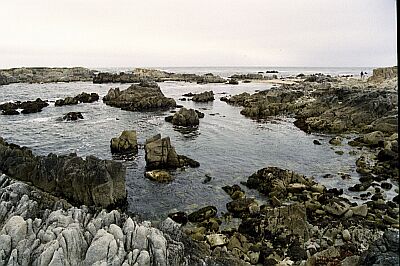
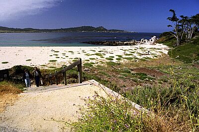
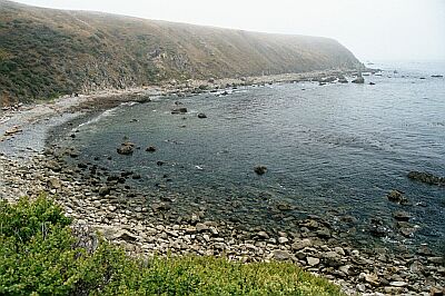
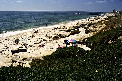
#1 - Monastery Beach South
California North, USA West
The most picturesque dive site in the Carmel area, Monastery Beach offers spectacular diving in the rocky, kelp-packed coastline. Do not attempt this dive unless you are advanced, and are comfortable in heavy surf.
Head South on Highway 1 out of Carmel. Park at the Southern end of the first roadside beach.
#2 - Mackerricher State Park
California North, USA West
Mackerricher State Park has an excellent cove for a relatively sheltered dive. The park area itself is open year-round with 140 campsites for tent and RV's. The board walk that winds through the area allows easy access to wildlife and tide pool viewing.
Located 3 miles North of Fort Bragg, off Highway 1. For more information on California parks, call 1-800-444-7275 or go to their website here.
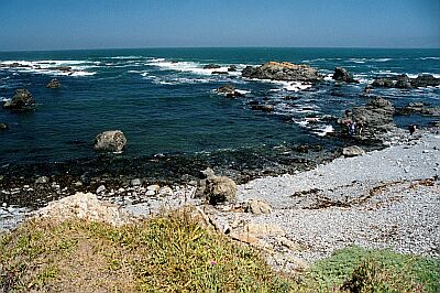
#3 - Aliso Beach Park
California South, USA West
Are you a new diver looking to get your fins wet in a forgiving environment? This is the place! Bring a couple of tanks, a picnic lunch, and sunscreen, and you'll be set for a very relaxing day.
Located 1.8 miles North of South Laguna, and 2 miles South of Laguna Beach.
#4 - The Cave
California South, USA West
This dive was recommended by a certified Gorilla. We've only included The Cave to show how difficult it can be to access. If you aren't comfortable climbing on sandy rocks, try a kayak dive instead! Located in the heart of La Jolla, this entry accesses some very nice coastline.
11 miles North of San Diego, take the Ardath Road exit to the West. In 1.4 miles bear left on Torrey Pines Road. In 0.85 mile, turn right on Prospect Place. In 0.2 miles, bear right down Coast Blvd, and turn right into the parking.
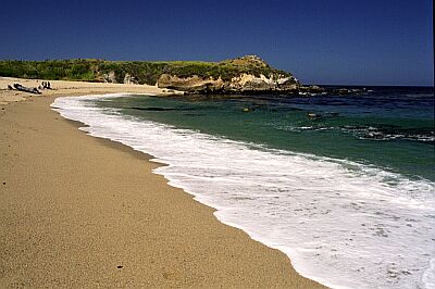
#5 - Morro Rock South
California Mid, USA West
If the conditions are not good at Morro Rock North, they'll be good here. This is a relatively easy site to dive, but is a little less interesting than what you'd find on the other side of the rock. You will find kelp beds to explore, and various creatures-of-the-sand.
Follow the instructions for Morro Rock North, but continue driving on the road on the South side of the Rock.
#6 - Breakwater Cove
California North, USA West
Breakwater Cove is another popular dive site. Parking can be limited, so get there early. This is a wonderful place to get a glimpse of sea lions, octopus, and other marine creatures. The best diving is on the outer side of breakwater. Beware of kelp and boats!
In Monterey, heading West on Del Monte, bear right onto Lighthouse Ave, then bear right onto Foam St. Make a right onto Cannery Row.
#7 - Marine Room
California South, USA West
A lesser known dive spot just to the South of La Jolla Shores is the Marine Room, named after the adjacent restaurant. This site provides better access to the Northern reef area.
11 miles North of San Diego, take the Ardath Road exit to the West. In 1.4 miles bear left on Torrey Pines Road. In 0.3 mile, turn right on St. Louise Ter. Turn right on Spindrift Drive, and look for the Marine Room on your left.

#8 - LA - Wreck of the Valiant
California Mid, USA West
www.cawreckdivers.org/Wrecks/Valiant.htm -- From Christian Schulz
In Avalon on Santa Catalina Island
#10 - Point Pinos (Sewer Plant Beach)
California North, USA West
This site is as close to Gorilla diving as you get in Monterey. Rocky entry, ocean currents, kelp beds, surf and breakers are your obstacles. Do not dive unless you have ideal conditions. Double check your dive plan with a local dive shop or guide. Once you've navigated the gauntlet, you'll be rewarded with nudibranches, starfish, anemones, and a variety of fish life.
In Monterey, heading West on Del Monte, bear right onto Lighthouse Ave, then bear right onto Foam St. Make a right onto David Ave, then a left onto Ocean View Blvd. Continue past Lover's Point Park, and about 1 mile beyond, past Asilomar Blvd, you'll see the water treatment plant on your left and the beach on your right.
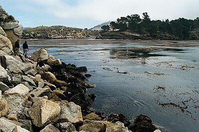
#11 - Hospital Point
California South, USA West
If you enjoy exploring the nooks and crannies of rocky channels, this is the place! Because of the rugged nature of this site, however, wait for very calm conditions before trying an entry. Otherwise, you may find out why they call it Hospital Point!
0.8 mile South of La Jolla Cove on Coast Blvd. (See driving directions for La Jolla Cove)
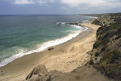
#12 - Crystal Cove State Park
California Mid, USA West
Crystal Cove is one of those areas that you could spend years exploring. This large stretch of beach has several entry points, and depending upon how far you want to hike, you can choose a different entry for every day of the year!
Drive 4.5 miles South of the Newport Bridge. You'll see the miles of wild beachfront, and the entrance to the park.
#13 - Children's Pool Beach
California South, USA West
Children's Pool Beach, also known as Casa, has a very easy entry to some spectacular diving. The local Sea Lion population sometimes uses the beach for sunning during the Winter months, but during the Summer, you might just have the whole beach to yourself!
500 yards South of La Jolla Cove. (See driving directions for La Jolla Cove)
#14 - Divers Cove
California South, USA West
When Neptune is cooperating, this becomes one of the most popular dive sites in the area. Because the marine life is protected here, you'll find a wide variety of fish, friendlier than usual.
Make a left on Myrtle Street about 1/2 mile North of Broadway and Pacific Coast Highway in Laguna. Turn right on Cliff.
#15 - LA - Casino Point
California Mid, USA West
from Christian Schulz
In Avalon on Santa Catalina Island
#16 - Coral Street Beach
California North, USA West
Coral Street can be a technical dive if the conditions aren't just right. The kelp growth in August and September can be daunting, and the currents can catch you by surprise. Plan this dive with a dive shop, and take a buddy with you who has been here before. Do take your camera, as the macro life is spectacular! Entry can be tricky at low tide, with exposed shallow rocks and abundance of kelp and sea grasses. Once in deeper water you will find a large kelp forest fringing sand channels and walls and pinnacles. Look for remnants of John Denver's airplane.
In Monterey, heading West on Del Monte, bear right onto Lighthouse Ave, then bear right onto Foam St. Make a right onto David Ave, then a left onto Ocean View Blvd. Continue past Lover's Point Park, and about 1/2 mile beyond, you'll find the Ocean View and Coral Street intersection.
#17 - McAbee Beach
California North, USA West
McAbee Beach can be used by beginners and experts, alike. The easy entry leads to a large kelp bed just a minute off shore. Several old pipelines create an artificial reef, making this a complete site for marine viewers!
In Monterey, heading West on Del Monte, bear right onto Lighthouse Ave, then bear right onto Foam St. Make a right onto Hoffman Ave. At the intersection of Cannery Row, you'll see the trail head.
#18 - Shaws Cove
California South, USA West
More rocky coastline and spectacular canyons await you at Shaw's cove. The diving is a breeze during good sea conditions.
Make a left on Fairview Street about 3/4 mile North of Broadway and Pacific Coast Highway in Laguna. The entrance is at the intersection with Cliff.
#19 - Monastery Beach North
California North, USA West
This is an easy-access site toward the Southern end of Carmel River State Beach. Come here when the main beach, just to the South, is packed. Because this shoreline is wide open to the Pacific swells, you should consider yourself an advanced diver before negotiating the entry. Head South on Highway 1 out of Carmel. Just as you start to see the first roadside beach, you're there!
#20 - Van Damme State Park
California North, USA West
The dive site at Van Damme is directly across the street from the State Park entrance. The park has 74 campsites with all the amenities, and a riverside foot trail. Check out the park's visitor center while off-gassing.
The entrance to Van Damme is 3 miles South of Mendocino on Highway 1. The road curves right around the beach. For more information on California parks, call 1-800-444-7275 or go to their website here.
#21 - Casino Point
USA, California, LA County, Catalina Island
Casino Point is one of the most popular dive sites in California and deservingly so. The city of Avalon has done a great job making the city and Dive Sites very Diver friendly.
The Dive Site itself is easily accessible via the stairway leading directly into the water from the walkway. Once in the water, the surf is usually calm or near calm and visibility is always pretty good (15-100'). Sea life is abundant and generally easily approachable. You'll find a lot of great photo opportunities at Catalina, so bring a camera if you have one.
You'll find several small wrecks within easy swimming distance of the stairs and lots of other points of interest throughout the Underwater Park. My advise is to just Dive and enjoy the view, you'll come across many interesting things on every dive!
Concrete steps and rails right into the water
#22 - Stillwater Beach
California North, USA West
Stillwater Beach is found within the Stillwater Cove County Park, and offers possibilities for the beginner through the advanced. The site opens to the Southwest, so it is mostly protected from the Pacific swells.
Just a couple of miles South of Salt Point State Park, and North of Fort Ross.
#23 - Heisler Park
California South, USA West
If you have non-divers with you, this is a wonderful park for them to hang out; they will soak in as much beauty above water, as you will below!
Make a left on Cliff Drive about 1/4 mile North of Broadway and Pacific Coast Highway in Laguna. Drive to the Western end of the park.
#24 - Carmel River North
California North, USA West
This is the Northern most dive site of the Carmel River State Beach, and is slightly protected from the Northern swells. Watch the current as your round the rocky point.
Carmel Point is located at the Southern end of the Carmel. From Highway 1, take Ocean Ave or 13th Ave toward the sea. Turn left on Scenic Road, and continue to the Southern intersection of Ocean View Ave. You will overlook the beach to your right.
#25 - Whalers Cove (Point Lobos)
California North, USA West
Located in Point Lobos State Reserve, Whalers Cove is the most coveted dive location is this area. The highly restricted access of the Park creates an environment teaming with marine life. You must make reservations well in advance to enter, and must register with the gate before diving in. A complete set of rules and regulations, diving locations, and a reservation form may be found here.
Drive South on Highway 1 from Carmel, past Monastery beach. You will see the entrance on your right.
#26 - Cannery Park
California North, USA West
Cannery Park (also called San Carlos Beach) is just West of the Breakwater dive site. This is a nice place for a second dive, and to get away from the crowd at Breakwater. The dive area is mainly sandy, so expect to see the occasional Halibut.
In Monterey, heading West on Del Monte, bear right onto Lighthouse Ave, then bear right onto Foam St. Make a right onto Cannery Row.
#27 - Gerstle Cove
California North, USA West
Gerstle Cove is found within the Salt Point State Park, and offers some of the finest Abalone hunting in this area.
About 6 miles North of Fort Ross, you'll find the campground entrance.
#28 - Robert Badham
California Mid, USA West
On a good day, you'll find this site worth the effort. Reefs, rocks, sand and kelp line this beach. All levels of divers will find something of interest.
Drive 2.9 miles South of the Newport Bridge, and turn right on Poppy Ave. Head straight to the water where you'll see the intersection below.
#29 - Wood Cove
California South, USA West
If the crowds are unbearable in the previous sites, try this location further South in Laguna. You'll find everything here, with perhaps fewer fish as this area is not protected.
Make a right on Diamond Street about 1.4 miles South of Broadway and Pacific Coast Highway in Laguna. The entrance is at the end of Diamond.
#30 - Russian Gulch State Park
California North, USA West
With all the amenities you'd expect of a California State Park, this is an excellent place to dive for the day and camp overnight. The area has endless underwater photography opportunities along the rocky coast line.
8 miles South of Fort Bragg, and 2 miles North of Mendocino on Highway 1. For more information on California parks, call 1-800-444-7275 or go to their website here.
#31 - La Jolla Shores
California South, USA West
This is the most popular beach in La Jolla. Sunners, surfers, picnickers, divers and dive classes use this area extensively during the weekends. The area is a fantastic underwater park, with fish hanging around for a handout. This can be an easy or a technically-advanced dive, depending upon your skill level.
11 miles North of San Diego, take the Ardath Road exit to the West. In 1.4 miles turn right on La Jolla Shores Drive. Turn left on Avenida De La Playa, and you'll find the park in 1/2 mile.
#32 - South Crescent Bay
California South, USA West
South Crescent Bay offers a protected cove area worthy of two tanks! Rocky points, canyons, and reefs make this an ideal habitat for the area's marine life.
Make a left on Cliff about 1 mile North of Broadway and Pacific Coast Highway in Laguna. You'll see the sign below.
#33 - Fort Ross South
California North, USA West
The Southern site at the Historic Park is a much easier site for entry, but you'll need to kick out a bit to reach the more interesting rocky cliff area.
For a scenic ride, take Highway 116 off 101 to the town Jenner. Head North for about 13 miles, and turn left into the Fort Ross State Historic Park. When you reach the actual Fort, turn right down a gravel road heading to the bluffs, and wind your way down to the beach.
#34 - Gaviota State Beach
California Mid, USA West
For camping, hiking, fishing and diving, you'll find Gaviota has it all. A nice beach will all the facilities, this is a great weekend get-away!
27 miles West of Santa Barbara, as Highway 101 starts to bear North, you'll see the entrance seaward.
#35 - LA - Pt. Vicente Fishing Access
California Mid, USA West
Pt. Vicente Fishing Access is another site where you can watch lights under water move all over the place on opening night.
#36 - Mesa Lane
California Mid, USA West
Mesa Lane is a well-kept secret with the locals of Santa Barbara. You won't find any facilities here, just a nice stretch of beach with good access.
In Santa Barbara off Highway 101, take Las Positas Road exit (Highway 225) to the South for 1.7 miles. Turn left (East) on Cliff Drive; in 1/2 mile turn right onto Mesa Lane and go to the end.
#37 - LA - Cabrillo Beach
California Mid, USA West
Cabrillo Beach does not offer any good diving, except when the rare chocolate lobsters are in the area.
#38 - Shell Beach
California South, USA West
Shell Beach offers a little more protection for entry than Breakers. Again, this site should only be dived on a calm day.
200 yards South of La Jolla Cove. (See driving directions for La Jolla Cove)
#39 - LA - Honeymoon Cove
California Mid, USA West
The visibility here averages about ten feet better than the West side of the peninsula. There are numerous pinnacles offshore from Whale Rock at Pt. Vicente. The rocky reefs rise from depths of 80-100 feet+ to within five feet of the surface in places. It's not Farnsworth, but a very nice dive.
#41 - Arroyo Burrow Park
California Mid, USA West
Arroyo Burrow is a popular place for both dive classes and experienced divers. Mostly protected from the Pacific swell (as is most of the Santa Barbara coastline), you'll find this a pleasant dive. There is a restaurant in the park, as well as all other expected facilities.
In Santa Barbara off Highway 101, take Las Positas Road exit (Highway 225) to the South for 1.7 miles. Turn right (West) on Cliff Drive, and you'll find the entrance in 1/4 mile.
#42 - Garibaldi Reef
USA, California, LA County, Catalina Island
East end of Catalina Island, just north of Seal Rocks
#43 - Reverse Cove
California North, USA West
A shallow cove that is relatively well protected from a northern swell. The climb is rough, but the fish and plant life is impressive for a shore dive. Because of the shallow water and hard hike down, this site is better as a free diving site than a SCUBA site, although both are possible.
From Carmel or Monterey take the 1 South to Garrapata State Beach. Landmarks get scarce, but you will hit a grove of cypress trees on your left. From there continue a half mile to a dirt turnout on your right. Once you get there, a steep dirt trail takes you into the cove
#44 - Morrow Canyon
California Mid, USA West
Morrow Canyon is at the Southern reaches of Crystal Cove State Park, and is provided to show the length of rocky shoreline you have to explore.
Drive 1.3 miles South of the previous dive site.
#45 - Meek's Bay, Tahoe
California North, USA West
The beach area is marked off to keep out boat traffic, and while Scuba is allowed in the swim area, Viz is much better outside the swim area. Bring a float to warn boat traffic. The depth outside the swim area is about 15-20 feet, and there is a gradual slope that continues down into the abyss. There is a rocky area along the north side of the bay, along with some petrified trees. Not many fish, but a few crawdads in the area. Temperatures are low, but during summer a thick wetsuit is enough. Visibility typically over 30 feet. It's a common training site because of the ideal conditions. There is a wreck in the bay, but it is located close to the boat lanes.
Meek's Bay is located north of Emerald bay on the west side of Lake Tahoe. The dive site is located inside a park/campground called Meek's Bay. It's about a 45 minute drive from the south lake area.
#46 - Morro Rock North
California Mid, USA West
What a beautiful dive site! With a nice beach and facilities for the non-divers, you will find a technically challenging adventure at Morro Rock. The entry can be difficult and the swim can be long, so talk to the local dive shop before attempting this one.
Found in Morro Bay just 12 miles North of San Louis Obispo on Highway 1. Take the Morro Bay Blvd exit to the West; turn right on Main Street; Left on Harbor Street; right on Front Street to parallel the bay; merge onto Embarcadero; then merge onto Coleman Drive, and continue around the bay. If you get lost, just drive toward the big rock-- you can't miss it!
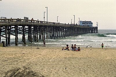
#47 - Newport Pier
California Mid, USA West
The Newport Pier offers an interesting dive for the adventurer. You can dive to 100 feet or more if you want to go beyond the pier; you can traverse the bottom looking for the creatures-of-the-sand; or you can explore under the pier for piling creatures or artifacts from the fishermen above!
Head down to New Port Beach. Off the Pacific Coast Highway, turn South on West Balboa Blvd. After 1.2 miles, you should run into the Pier!
#48 - Cape Cortes
USA, California, LA County, Catalina Island
Rays, kelp, gorgonians, Horn Sharks
West of Cat Harbor
#49 - Rubicon Point, Tahoe
California North, USA West
60' - 100' Viz! ~800' depth. Giant granite walls and lots of fish. 6,223' above sea level. 40-50 degF, so bring your dry suit!
Lake Tahoe. Contacts: Sierra Diving Center 775-825-2147 (Reno) or Adventure Scuba 775-826-5333 (in Reno) or Tropical Penguins 775-828-3483 (Reno) or Strictly Scuba 775-884-3483 (Carson City)
#50 - Veteran's Park
USA, California, LA County, Redondo Palos Verdes
Swim straight out from the stairs near the restrooms until you are parallel to the end of the pier. Dropping down here will put you within just a few kicks of the drop-off. About 100 feet north of the stairs in 45 feet is an area known as the Salad Bowl. There is kelp and detritus where you can find dozens of nudibranchs, shrimp, isopods, octopus and many small fish.
At the south end of the beach are submerged pier pilings coverd with anemones and invertebrates.
Located at the intersection of Pearl Street and Esplanade, the parking lot at Veteran's Park has plentiful metered spaces. Stairs to the beach are located at the Southwest end of the lot.
#51 - Sand Harbor, Tahoe
California North, USA West
60' - 100' Viz! ~800' depth. Giant granite walls and lots of fish. 6,223' above sea level. 40-50 degF, so bring your dry suit!
Lake Tahoe. Contacts: Sierra Diving Center 775-825-2147 (Reno) or Adventure Scuba 775-826-5333 (in Reno) or Tropical Penguins 775-828-3483 (Reno) or Strictly Scuba 775-884-3483 (Carson City)
#52 - Deer Creek Beach
California Mid, USA West
This dive site is well off the beaten path, and relatively undisturbed. A reef and some kelp are found close to shore with excellent diving just beyond.
Just East of Point Mugu State Park; 3.2 miles West of Mulholland Highway intersection with the Pacific Coast Highway (1); and 18 miles West of Malibu.
#53 - Stillwater Cove
California North, USA West
Stillwater cove is recognized for its relatively undisturbed marine environment. Due to the sensitivity of this habitat, only 10 divers a day are allowed access. Sorry, there is no night diving. The Beach and Tennis Club provides the coastal access from sunrise to sunset, and there is a $10 gate fee to gain access into Pebble Beach.
Located in the heart of Pebble Beach, the drive here is worth the effort, even if you are not going to dive! Drive South of Carmel on Highway 1 to Ocean Ave. Take Ocean Ave West and turn right on San Antonio Ave. Wind your way North until you find yourself on Carmel Way. You will soon intersect with the famous 17 Mile Drive. A gate guard will welcome you and relieve you of some money for the privilege of hobnobbing with the Rich and Famous. Travel North West for about 1 mile, and turn left on Palmero Way. Travel approximately 1/2 mile and then make a left on to Cypress Drive for about 1/8 of a mile which ends at Stillwater Cove.
#54 - Monterey State Beach
California North, USA West
Monterey State Beach (also called Del Monte, named after the adjacent road) is a perfect place for new divers. Restrooms, showers, and picnic areas make this a great place to spend the day. You may want to dive this site on a weekday, or arrive very early on a weekend. The parking can be almost impossible otherwise. Be prepared to spot octopus and flounder!
From Highway 1 in Monterey, take the Camino Aguajito exit North. You'll see the Park at the intersection of Del Monte Ave.
#55 - Veteran's Park, Redondo Beach
California Mid, USA West
Vet's Park is one of the easiest shore dives in California. There is plentiful parking (bring lots of quarters), restrooms, bottled water vending machines and fresh water showers to rinse off after the dive. Redondo Canyon begins very close to shore here, so access to deep water is only minutes away. Most divers swim straight out from the stairs adjacent to the restrooms until you are parallel to the end of the pier. Dropping down here will put you within just a few kicks of the drop-off. Depths range from 0-40 feet in the shallows to well beyond recreational diving depths in the canyon. During Winter, squid runs bring in mating squid and nearly every animal in the food chain follows them. It is not uncommon to see thousands of mating squid during a big run. Bat rays, blue sharks, sea lions and large Sheep crabs can also be seen here. South of the canyon is the Topaz Street jetty. This can be a productive lobster spot on occasion. The conditions at Vet's are usually better than sites just a few hundred yards south. Flat surf is the norm here, so entry and exit is fairly easy.
Located at the intersection of Pearl Street and Esplanade, the parking lot at Veteran's Park has plentiful metered spaces. Stairs to the beach are located at the Southwest end of the lot.
#56 - Malaga Cove
California Mid, USA West
Malaga Cove contains reefs, kelp, sand and rock creatures. Take two tanks, if you have the time and energy!
Located in the posh Palos Verdes area, grab your street map and follow along: From the Pacific Coast Highway, head South on Palos Verdes Blvd for 1.4 miles. Turn right on Palos Verdes Drive West. In 1/4 mile, turn right on Via Corta which soon becomes Via Almar. Take your next right (Via Arroyo) to the view below.
#57 - Mendocino Bay
California North, USA West
This dive site may be found on the North coast of Mendocino Bay. This wonderful diving beach is also known as The Blow Hole, due to a large hole in a cave to the right of the beach. The cave itself is known for a spectacular collection of nudibranches. Other critters can, of course, be found in the kelp field just off shore.
At the South end of Mendocino, take Main Street toward the ocean.
#58 - Christmas Tree Cove
California Mid, USA West
Steep hike over slippery sand, then entry over shallow, slippery rocks. There is nice snorkeling available along the shoreline and a small kelp forest in the middle of the cove. The best diving is on the reef beyond the cove. The high spot breaks the surface at low tide. Follow this reef south and you will find overhangs, walls, lobsters, sponges, fish and nudibranchs. The east side of the reef has vertical walls as high as fifteen feet. The reef continues to eighty feet where it ends at the sand.
Located in the posh Palos Verdes area, grab your street map and follow along: From the Pacific Coast Highway, head South on Palos Verdes Blvd for 1.4 miles. Turn right on Palos Verdes Drive West. In 3.8 miles, turn right on Paseo Lunado which becomes Paseo Del Mar. You'll see the park on your right.
#59 - Moss Street Point
California South, USA West
Another out-of-the-way dive spot to beat the crowds is at Moss Street Point. Although usually well protected throughout the year, this area offers a good challenge to the seasoned diver.
Make a right on Moss Street about 1.6 miles South of Broadway and Pacific Coast Highway in Laguna. The entrance is at the end of Moss.
#60 - La Jennelle Park
California Mid, USA West
This is a good dive for the adventurers among you! After a long drive through areas you have never been before, you'll find sandy parking and a rocky entry. But beyond that, you'll discover some excellent diving for all skill levels.
From Highway 101 near Oxnard, take the Victoria Exit South toward Port Hueneme. Drive 6.7 miles to a stop sign. Turn left onto Roosevelt, which becomes Island View Ave. In 3/4 mile turn right on Sawtelle Ave. You'll soon arrive at the picture below.
#61 - LA - Marineland
California Mid, USA West
Marineland has a lot to offer, but is not known as a producer of many large bugs. There are a few here and there. The landslide caused by the Ocean Trails golf course has temporarily ruined a lot of diving in the area between Abalone Cove and White Point. Try diving here after a few days of Santana winds. The diving from White Point to Pt Fermin is mostly 20-40' with sand, rocks and kelp. Visibility can be good a few days out of the year, but it averages between five feet to fifteen feet most of the time.
#62 - Glass Beach
California North, USA West
The history of Glass Beach is as colorful as the surf-polished glass that covers it. Once the site for glass bottling factory, it also served as the town dump many years ago. There are still many treasures to uncover on this dive!
At the North end of Fort Bragg, turn West from Highway 1 on Elm Street (the Northern-most stop light).
#63 - Laguna Beach
USA, California, Orange County
Sandy bottom with Rays and sand sharks
Direct from beach
#64 - Cardiac Hill
California North, USA West
Here are two of my favorite dive spots, in between Christmas Tree Cove and White Point.
As you head south on Palos Verdes Drive West from Lunada Bay (where Christmas Tree cove) is located, right after the Coast Guard's Pt. Vincente lighthouse, you will come to a tall hill, and "Palos Verdes Drive West" becomes "Palos Verdes Drive South". On the Southside of that hill is a parking lot, with restrooms, marking the "Pt. Vincente Fish Access", known to the locals as "Cardiac Hill" There is a steep, but wide, trail to the bottom of the cliff, and a good dive once you get to the beach. Similar to Christmas Tree, but it gets more people-pressure because of the easier access.
And further East along Palos Verdes Drive South is the entrance to Old Marineland. A truly wonderful dive spot, with some well-populated rock reefs. There is a gradual, dirt road down to an easy-entry beach on the East end, or for the more advanced/experienced (and depending on the swells), a rock entry on the West end. Developers have their eye on this property, so I don't know how much longer it will stay open, but we should enjoy it while it is.
#65 - Moby Ling Cove
California North, USA West
Getting its name from an old story of a diver's once in a lifetime encounter with a grey whale this is an out of the way dive site that should only be visited during excellent conditions. On those days when it is not too stormy you can find dives that are untouched in comparison to the more popular Monterey and Carmel dives.
From Carmel, or Monterey take the 1 south to Garrapata State Beach. Once in the park look for a grove of cypress trees on your left. Parking is under these trees.
#66 - Cardiff State Beach
California South, USA West
For an easy dive, with an interesting reef to explore, try Cardiff State Beach. You'll find the basic facilities here, plus a relatively uncrowded environment.
Located 12 miles South of Oceanside, and 24 miles North of San Diego in Cardiff-By-The-Sea.
#67 - Butterfly House
California North, USA West
The access path leads down the cliff to a rocky staging area just above the dive site. The dive site is a tricky rocky entry for intermediate to advanced divers only. This is an OCEAN EXPOSED dive site, so, conditions can change rapidly. Be prepared for anything, and, don't get in on a questionable day. However, once you're in the water, this dive site is well worth the effort. Rocky reefs, deep shore diving (60-90 feet) and a rich giant kelp forest are all within easy reach once you are in the water at this site. Bring two or three tanks, and, take your time getting your gear down to the staging area in multiple trips before suiting up to avoid injuries.
See http://www.saintbrendan.com/cdnsept00/mont9.html for additional information. This site is located just south of Carmel Proper, on Scenic Drive just north of Stewart Way. Proceed South on HWY 1 to Carpenter. Turn right on Carpenter to the For Way Stop at Ocean Avenue. Turn right on Ocean Ave. and follow it all the way down to Scenic. If you miss the left turn onto Scenic, one of two things will happen. Either your car will become hopelessly trapped in the sand, or you will need a regulator to exit your car. (In other words, if you go too far on Ocean, you will be in the ocean). Follow Scenic around until you can see a house that has a roofline that looks like a giant butterfly. That is the dive site. The access path is about 100 feet back towards Carmel.
#69 - Carmel Point
California North, USA West
Carmel Point can be a difficult dive if the conditions are not perfect. For the best diving, you will need to swim for the point where current and swells could greet you. Plan your dive with someone experienced.
Carmel Point is located at the Southern end of the Carmel Beach City Park, which lines the whole city front. From Highway 1, take Ocean Ave. West to sea. Turn left on Scenic Road, and continue to the end of the beach.
#70 - Corona del Mar
California Mid, USA West
Looking for a good jetty to dive? Well, this is the place! Corona Del Mar State Beach has everything you need to enjoy a full day of diving and sunning.
Drive 2.5 miles South of the Newport Bridge, and turn right on Jasmine Ave. Head straight to the water. There are also lots of signs pointing you to the park. If all else fails, pull out your GPS!
#71 - Caspar Bay
California North, USA West
Caspar Bay is an easy dive on all levels. If you're looking for Abalone, try the Southern side of the bay.
About 5 miles South of Fort Bragg on Highway 1, head West on Point Cabrillo Drive (located on the South side of the Cabrillio River Bridge)
#72 - The Cliff
California Mid, USA West
The Cliff is nice dive with easy access. Located at 'The Cliff at Shell Beach', you'll find this a civilized dive!
At the North end of Pismo Beach, from Highway 1, exit on Spy Glass Drive. Turn right on Shell Beach Road, and drive for 1/4 mile. You'll see The Cliff on your left.
#73 - Montana de Oro Beach
California Mid, USA West
This beach is a nice destination for the day-- plenty to see for a two-tank dive. The underwater scenery is quite rocky, especially around the point where fish, abalone and crab abound.
If coming from Highway 101, take the Los Osos Valley Road exit to the North (3 miles South of San Luis Obispo). If coming from Morro Bay, take the Bay Blvd exit South from Highway 1, and turn right on Los Osos Valley Road. Los Osos will merge into Pecho Road. After the merge, drive for 3.8 miles to the park entrance.
#74 - Fort Ross Reef Campground
California North, USA West
This site is interesting because the underwater structures further out in the cove house a wide variety of marine life. Definitely a two tank dive spot, so bring a picnic lunch with you!
Take Highway 116 off 101 to the town Jenner. Head North for about 12 miles (2 miles South of the Historic Park).
#75 - Wipe Out Beach
California South, USA West
Wipe Out Beach offers an easier entry for new divers.
900 yards South of La Jolla Cove. (See driving directions for La Jolla Cove)
#76 - White Point
California Mid, USA West
There's something for everyone at White Point. Beginner and expert divers will find interesting underwater vistas to explore. Ship wrecks and old construction have left bits and pieces of history strewn through the area. Plus, reefs and kelp around the point are harbors for the elusive critters.
The Big Attraction here is the Warm Water Vents in the Shallows. About 50 Yards out you'll find areas with almost no growth and a mixed White and Black Sandy Bottom. You may see "Murky Water" in these areas as well. If so, you're over the vents - Try taking your Gloves off and putting them in the sand, you'll feel the Heat - It's pretty Cool (or is that Hot)!
Expect to see Bat Stars, Sea Cucumbers, Moray eels and lots of Nudibranchs as you venture away from the Vents. Go a little Deeper and East and you'll run into Kelp and Rock outcrops loaded with goodies.
The best diving is in the kelp bed about 200 yards east of the cove, Rock formations with dramatic overhangs, schools of fish darting throughout the kelp, barracuda, Giant Seabass, lobster, large sand rose anemones and batrays can be found here.
Entry in the cove can be tough. Slippery rocks and shallow water extends more than sixty feet from shore. It is best to dive here at high tide.
The park is closed at night, but you can enter via the fire road east of the baseball field and enter the water on either side of the point.
Two thousand feet offshore is a beautiful reef with several species of sponges, different nudibranchs than those found inshore and various rockfish. The reef is about thirty feet wide and one hundred feet long and rises twenty feet above the sand. There are smaller rocks about fifty feet NE of White Point Rock.
The only location on Palos Verdes Peninsula with parking right by the water. Swim approx 200 yards straight out at 40' depth.
1.5 miles East of the junction of I-110 and the Pacific Coast Highway, take Western Ave South toward the ocean. In about 5.5 miles, it will merge with West Paseo Del Mar. You'll see the view of the following picture.
#77 - Jade Cove
California Mid, USA West
Jade Cove is an Adventure in all respects! Plan on making this a full day trek, if not spending the night in the area. After making an incredibly beautiful drive up (or down) the coast, be prepared for a mild version of Gorilla diving. The reward? A souvenir piece of jade to take home to display with your other diving trophies. There are regulations to be aware of. A good starting place for web research is here. Getting in at times is accomplished by going under the thick bull kelp that's near shore and has a thick canopy. It's shallow and is affected by heavy surge. In August there is a thick krill layer near the bottom (5ft thick) that decreased the viz to 2-5ft. Beautiful reef, fishes, and if you look carefully you will find pieces of jade.
A rememberence from Daniel S. McDermed: In 1966 my Dad's hobby was scuba diving, and my grandparents' hobby was making jewlery. In the murky water of Jade Cove, Dad's exploration of a small underwater cave produced a large piece of jade that weighed 17 pounds. I remember a young man offered my Dad 35 dollars a pound for it while my Dad stood there in those chilly waters. Dad said "Thanks but this man has some real plans for this chunk." Much more than the money offered was gained from the retained stone.
Found 70 miles South of Monterey and 70 miles North of San Luis Obispo, between Gorda and Pacific Valley, on Highway 1. The trail head leading to Jade Cove (Main, Central Jade Cove) is .4 miles south of Plaskett Creek Campground entrance on Cabrillo Highway 1. Free parking on the west side of hwy 1. Walk the straight dirt path to the narrowing switch back trail. There is a spring halfway down with water on the path, the very last leg has an anchored rope line for balance! Cross over some large boulders at the bottom to the cove.
#78 - Long Beach Breakwater
USA, California, LA County
Lobsters some crab and small fish. Kelp at the top of the breakwall, deep silt at the bottom. Recommended that you leave someone onboard the boat while diving, as the silt doesn't hold the anchor in moderate wind. Dive flag required due to heavy boat traffic. The Los Angeles Federal breakwater at Angel's Gate (Los Angeles Harbor) is also nice. Lots of lobster in the rocks, but not as many nudibranchs as the Long Beach breakwater at Queen's Gate (Long Beach Harbor)
Long Beach Harbor Entrance
#79 - Pismo Pier
California Mid, USA West
World famous Pismo Beach is home to some fine sand-diving. Plan to spend the day, if not the week, enjoying the area.
Once in Pismo Beach, take time to drive to the North and South of the Pier. Choose any spot, preferably away from surfers and fishermen.
#80 - South Casa
California South, USA West
South Casa is the alternate entry for Children's Pool. This site has two wonderful channels carved from the beach to the sea. This is not a dive for beginners, and should only be attempted on a calm day.
500 yards South of La Jolla Cove. (See driving directions for La Jolla Cove)
#81 - Breakers
California South, USA West
The Breakers is a less visited beach due its inaccessibility and, as the name implies, it is less protected than La Jolla Cove. People climbing on these rocks have been surprised by rogue swells that have swept them fatally into the sea. Talk to a local dive shop before attempting this dive.
Around the Western point of La Jolla Cove. (See driving directions for La Jolla Cove)
#82 - Fort Ross North
California North, USA West
This is the Northern most site at Fort Ross. It is technically more challenging than the Southern site due to the hike and the rocky entry.
Notes from Paul Schmitt to a boater's question: There is a boat launch at Timber Cove a few miles north of Fort Ross State Park. I do not suggest taking a 14 foot aluminum boat as the wind usually blows from the north to the south and picks up late in the morning and really starts blowing hard in the afternoon. An Avon rubber boat is much safer. They will launch the boat for you at Timber cove. I haven't been to Fort Ross for a few years and it seems to me they have stopped all traffic down to the beach. Another outstanding state park with a boat launch is just north of Timber Cove at Salt Point. Timber Cove and Salt Point are usually populated with experienced divers on the week end. Take some time and talk to the divers down on the beach for current conditions and advice. Please note the seas and weather off the north coast of California can be very dangerous, especially if you are not familiar with the area. While diving from shore at the park may be a pain, it is much safer than attempting it in a small boat. For a scenic ride, take Highway 116 off 101 to the town Jenner. Head North for about 13 miles, and turn left into the Fort Ross State Historic Park. You'll see this site before you get to the Fort.
Notes from Paul Schmitt to a boater's question: There is a boat launch at Timber Cove a few miles north of Fort Ross State Park. I do not suggest taking a 14 foot aluminum boat as the wind usually blows from the north to the south and picks up late in the morning and really starts blowing hard in the afternoon. An Avon rubber boat is much safer. They will launch the boat for you at Timber cove. I haven't been to Fort Ross for a few years and it seems to me they have stopped all traffic down to the beach. Another outstanding state park with a boat launch is just north of Timber Cove at Salt Point. Timber Cove and Salt Point are usually populated with experienced divers on the week end. Take some time and talk to the divers down on the beach for current conditions and advice. Please note the seas and weather off the north coast of California can be very dangerous, especially if you are not familiar with the area. While diving from shore at the park may be a pain, it is much safer than attempting it in a small boat. For a scenic ride, take Highway 116 off 101 to the town Jenner. Head North for about 13 miles, and turn left into the Fort Ross State Historic Park. You'll see this site before you get to the Fort.
#83 - Leffingwell Landing
California Mid, USA West
It has a small cement ramp leading to the sand to launch kayaks or small zodiac style boats as you have to carry them across the sand a short distance to the water. Depth with in the cove is shallow with bad vis often but clears up as you head out further. If you stand at the cove and look out at the water you will see a wash rock a ways out. We tend to kayak and anchor to the north of the rock to spearfish. We have had vis up to 40ft at that location depending on conditions.
The dive spot is located in Cambria on Moonstone Drive. As you cross the bridge you will see the cove and small ramp leading to the beach.
#84 - La jolla Kelp Beds
USA, California, San Diego, La Jolla
La jolla Kelp Beds is a 4.0-star rated scuba dive and snorkel destination in USA, California, San Diego, La Jolla which is accessible from shore based on 2 ratings.
#85 - Carnelian Bay, Tahoe
California North, USA West
60' - 100' Viz! ~800' depth. Giant granite walls and lots of fish. 6,223' above sea level. 40-50 degF, so bring your dry suit!
Lake Tahoe. Contacts: Sierra Diving Center 775-825-2147 (Reno) or Adventure Scuba 775-826-5333 (in Reno) or Tropical Penguins 775-828-3483 (Reno) or Strictly Scuba 775-884-3483 (Carson City)
#86 - Windansea
California South, USA West
If you find an exceptionally calm day, dive Windansea. At the Southern entry you can find a rocky point to explore, and a few minutes off shore, you'll find a large reef. Because this beach is fully exposed to the full power of the Pacific, treat this site with respect.
11 miles North of San Diego, take the Ardath Road exit to the West. In 1.4 miles bear left on Torrey Pines Road; 0.85 mile, turn right on Prospect Place; 0.2 miles, bear left onto Prospect Street; 0.75 miles bear left onto La Jolla Blvd; 1.1 mile turn right onto Palomar Ave. The beach is straight ahead.
#87 - San Onofre State Beach
California South, USA West
This location, although great for surfers and sunners, probably will not have the best visibility for diving. The shallow reefs, however, do house a wide variety of marine life perfect for you underwater fishermen!
Located 3 miles South of San Clemente, and 19 miles North of Oceanside. From I-5, take the Basilone Exit South and travel 1.4 miles down the Old Highway 101.
#88 - North Crescent Bay
California Mid, USA West
Laguana Beach, Dead Man's reef. I did a day dive there for the first time on the 4th.. It was Awesome! It was a nite dive.. My first, and let me tell u it was freaky! NO moon, no stars and fog! It was last week at 8pm.. The surf was nothing, small swells no biggie, but the surge was a pain. Back and forth back and forth.. Lol We had a 54 minute dive.(alum.100). Caught 1 legal Lobster- Had a blast, glad I did it.. Scared and all!! Vis was around 25 feet Which is great for there..temp 64----not bad at all..A long swim to the reef but well worth it. Night life was amazing!
#89 - LA - Wreck of the Avalon
California Mid, USA West
The wreck of the Avalon lies off Chiswick Drive. Can be a good bug spot early in the season. There are various spots nearby with local names not found on charts, including Drainpipe, Toilet Bowl Reef and Paddleboard Cove.
#90 - Crescent Cove
USA, California, Orange County
Great reef and tide pool when waves are low. Added point of interest is Seal Rock, just west of the reef. Here many Harbor seals can be observed sunning themselves, and if your lucky, you may have find some playful seal waiting below the surface. A favorite dive.
#91 - Ocean Cove
California North, USA West
The main reason people go here is abalone diving. I did see several legal ones, however it seemed slightly inferior to the Stillwater cove less than two miles away. For spear fishing however I found it to be better. While free diving I pulled a ~30 inch ling cod out of only fifteen foot deep water. There are also many more perch, and rockfish than I had observed at Stillwater cove the day before. It is also a very calm site, and would serve as a good beginner dive for anyone wanting to make their first abalone dive.
This site is only a few minutes north of Stillwater beach near salt point. take the highway 1 north until you see the Ocean Cove Store. From there take a left there will be a campground head into the camp ground and take the first right, that will take you to a boat ramp, enter anywhere near the ramp.
#92 - Spooners Cove
USA, California, San Luis Obispo
There are 2 main spurs of rock offshore that are covered with macroalgae and invertebrates. These are separated by a wide sand channel that I have seen halibut, sanddabs, starry flounder and ratfish.
On the rocks there are rockfish, lingcod, cabezon, and kelp greenlings. This can be a very clear dive with 50+ feet of vis, but usually it is less than 10 ft vis. When the swell bumps up there is a milky white precipitate that is just up off the bottom destroying the vis. This is in addition to the sand being lifted up and also ruining the vis.
There are at least 2 big, old style anchors straight out from the beach here. Those are fun to come across.
It is easy to launch a kayak or small boat from the beach here. There are some superb reefs you could access with a small boat.
The dive has an easy entrance and exit, and is great for classes. The spring tends to have the coldest water down to 48degrees. The rest of the year it is usually in the mid 50s.
Drive into Montana de Oro from Los Osos via Los Osos Valley Road. The beach is a few miles into the park on your right. If you reach the campground, you have gone a little bit too far.
Plenty of parking in a dirt lot. Outhouse style toilets and picnick tables are the only amenities. Lots of beach goers especially on weekends, but few divers. You will see kayakers launch here, and on a big swell harcore surfers paddle out to the point.
Short walk from parking area to the waters edge over a sand beach.
Usually an easy entry with a relatively steep drop-off. I usually put my fins on at the edge of the water and I am floating within a few steps. You should not bother with this spot if there is much swell.
Spooners Cove is also known as Montana de Oro.
#93 - Hearst Beach
California Mid, USA West
A great place for finding creatures-of-the-sand, Hearst Beach offers a protected cove that's perfect for new divers getting their feet wet, or old divers checking out new gear. It's a full service park with concessions, so plan on staying the day.
Drive 34 miles North on Highway 1 from San Luis Obispo.
#94 - Eagle Rock
USA, California, LA County, Catalina Island
Kelp, big fish, sea lions and lobster
Backside west of Cat Harbor
#95 - Yukon Wreck
USA, California, San Diego
Yukon wreck is a 110m (366 ft) long Canadian Mackenzie class destroyer. It sunk July 14, 2000.
Vessel site:
- Length: 366'
- Breadth: 42'
- Tons: 2,380
- Built: Launched july 27, 1961 (by Burrard Dry Dock & Shipbuilding)
The ship lays on a sandy floor, on her side.
WARNING: Be absolutely sure you know what you're doing if you penetrate the wreck!
1.8 miles off Mission Beach, San Diego.
Yukon Wreck is also known as HMCS Yukon.
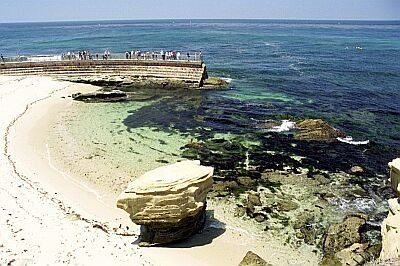
#96 - La Jolla Cove
USA, California, San Diego, La Jolla
The Cove is a rocky reef with an abundance of sea life (Garibaldi, Sea Lions, invertebrates and kelp).
One of the most famous dive area of La Jolla. Don't miss it!
La Jolla Cove is located in the La Jolla ecological preserve (Marine Park). Two dive sites: Kelp Beds and Little Wall.
#97 - Breakwater
USA, California, Monterrey
In many areas the rock blocks are covered with a lush carpet of strawberry anemones, which make interesting subjects for macro photography. Numerous fish eating anemones with their bright red bases, as well as the large green anemones are common near the end of the breakwater, along with some mighty big sea stars. One of the most beautiful creatures found here are the nudibranchs. Members of the dorid family are very common and can be seen grazing on sponges. This group of nudibranchs includes the bright yellow lemon nudibranch, the white-and-black ringed dorid, and the orange-spots-on-white clown nudibranch. The generally more colorful and ostentatious group, the aeolids, are also quite common here including the thick-horned aeolid.
One of the biggest attractions that the Breakwater has to offer is its large colony of California sea lions. The last half of the breakwater is not accessible to people and is a favorite haul-out of these large and noisy mammals. Their barking can be heard for some distance both above and below the water. Divers can get a close up look of the herd as the sea lions sun themselves and an even closer look underwater. While normally shy when on land, the sea lions are at home in the water and lose much of their fear of people. The sea lions will normally dive down and investigate divers. They sometimes charge a diver at full speed, only to veer off at the moment before contact. They also seem to have great fun barking underwater, leaving a belch of bubbles in their wake.
At the base of the breakwater stretches a sand bottom. The sand is dotted with sea pens and white, orange and purple tube-dwelling anemones as well as aggregating anemones. Living among the tube-dwelling anemones can be found the largest California nudibranch—the rainbow nudibranch. These dendronotids are excellent swimmers and feed on, and lay eggs, on the tube-dwelling anemones.
Keep a keen eye for octopuses among the anemones as well. These are most easily found at night, but may be found during daylight by looking under drifting kelp fronds. No matter if the seas are big or flat, you can almost always have a fun dive at the Breakwater.
Dive along the outside of the Coast Guard pier in Monterey.
Breakwater is also known as Coast Guard Pier.
#98 - Mission Bay Jetty North
USA, California
Shallow so longer bottom times. Usually about 25 feet. Vis is fair for the San Diego region. Can be up to 20 foot vis. This is a good backup dive site if the shore diving is to rough and you just have to get in the water.
It can be hard to climb in and out because of the size of the rocks but there is always a lot of snails, stars, cucumbers, some fish and lobster. People fish here so it's good to take a flag to drag with you.
#99 - LA - Old Pier Pilings
California Mid, USA West
The old pier pilings and the jetty. The Palawan and the Sacramento wrecks lie offshore here if you like to dive deep. Closer to shore, there is a small reef off Rat (right after Torrance) Beach.
#100 - Coal oil point
USA, California, Santa Barbara
If you are lucky, you may be able to see actual oil seeps as well as gas seeps, coming from the ocean floor. The oil seeps look like long black sticks from the ocean floor on calm days. These seeps make up the tar accumulation on the beach. Not the oil platforms offshore
Park in IV and follow the bike trail down to the beach.
Coal oil point is also known as Deveroux point.
#101 - Rock Pile
USA, California, Orange County
Sea lions, Nudibranchs, sea Stars
Southern end of Heisler Park
#103 - Mesa
USA, California, Santa Barbara
Cool reef overhangs, fish in the kelp beds... Great place for a summer-time free dive.
Park on Mesa Lane and lug your gear down the stairs. Enter the water between the kelp beds. If you have a boat, you are stoked...
#105 - Fort Ross
USA, California, Sonoma
2 miles South of the Historic Park
Fort Ross is also known as Red Barn, Fort Ross Reef Campground.
#106 - Point Lobos
USA, California, Monterrey
This is a brilliant spot for kelp diving! Lots of fish and the brilliant light shining through the long green hydrophytes offers lots of phantastic scenes for photographers.
But the highlight is definitely the seals (and sometimes puppies) often seen there - when you're lucky! But of course: don't touch or harrass them!
The dive site is part of the Point Lobos National Reserve, park entrance fee approx. 10,- $ / vhcl. Parking lots are just next to the entrance; freshwater rinse is available as well as restrooms.
Entrance is quite easy, just follow the boat slip.
#107 - LA - Lunada Bay
California Mid, USA West
Diving in Lunada Bay can be hazardous to your boat. Not so much by the waves, but by the Bay Boys, a local terrorist group of surfers.
#108 - Hidden Beach
USA, California, Monterrey
A lot if kelp, cannery artifacts. Can be surgy at times. A lot of sea lion interaction; invertebrates.
#109 - Folsom Lake
USA, California
Folsom Lake is a 1.0-star rated scuba dive and snorkel destination in USA, California which is accessible from shore based on 5 ratings.
#110 - McAbee
USA, California, Monterrey
McAbee is a 1.0-star rated scuba dive and snorkel destination in USA, California, Monterrey which is accessible from shore based on 2 ratings.
#112 - Moonstone Cove
USA, California, LA County, Catalina Island
Sandy bottom with Horn Sharks, shovel nose sharks and rays in the sand
South West of Long Point
#113 - The Needle
USA, California, Monterrey
This is a rock pinnacle just outside the Point Lobos boundary.
Access by boat from Monterey Harbor, Point Lobos (Whaler's Cove), or Stillwater Cove. Use a depth finder to find the pinnacle and anchor on top.
#114 - Pirate's Cove
USA, California, LA County, Catalina Island
Horn sharks, Garaboldi and Halibut in the sand
Just South of Long Point
Pirate's Cove is also known as Pirates Cove.
#115 - Fisherman's Cove
USA, California, Orange County
Along the 600 block of Cliff Drive in Laguna Beach.
#116 - Binnacle Rock
USA, California, LA County, Catalina Island
Normally a follow up from Church Rock
South of Avalon
#117 - Frog Rock
USA, California, LA County, Catalina Island
Kelp with Sheepshead and Garaboldi fish
North west from Avalon
#118 - Ship Rock
USA, California, LA County, Catalina Island
Kelp, Sea Lions, fish
Just North of Ismus Cove Western catalina Island
#119 - Blue Cavern
USA, California, LA County, Catalina Island
Blue cavern is a fantastic wide-angle photography site.
Blue Cavern point is located in a marine sanctuary (anchoring is prohibited). It is just S of Bird Rock, along the coastline toward Two Harbors
Blue Cavern is also known as Blue Cavern Point, Blue Caverns, Blue Caverns Point.
#120 - Cherry Cove
USA, California, LA County, Catalina Island
Reef inside Ismus good for fish and some small sharks on sandy bottom some Kelp
Western Side of Ismus Cove, West End Catalina Island
#121 - Gallagher Beach
USA, California, LA County, Catalina Island
Kelp with Callico bass and Garabaldi, some other fish
South of Long Point
#122 - Honeymoon cove
USA, California, LA County, Redondo Palos Verdes
Easy entry/exit in high tides, outgoing tides bring shallow slippery rocks to cross. Viz is excellent at times up to 40ft. Shallow over-all cove, reaching to only 40ft deep in the farther reaches of the kelp. Boat traffic can be close to the outer kelp so be careful there! Lots of marine life!
One cove south of Lanuda Bay, in Palos Verdes, watch the hike down as it is steep, and yet soft in spots and like walking on marbles in others. 7mins down. 3 anchor points to attach a line to, sometimes a line is at the bottom. Balance is a good thing to have, sure footing!
#123 - Stony Point
USA, California, LA County, Catalina Island
Kelp, Garabaldi, big sea Bass, nudibranchs and rays in the sand
West of Arrow Point and Ismus Cove
#124 - Paradise Cove
USA, California, LA County, Catalina Island
Beautiful Cove for lunch off gassing between dives with kelp and a lot of small fish
North west of Avalon on catalina
#125 - Little River
USA, California, Mendocino
Plenty of kelp so keep to the open paths to find the depth you are looking for.
This is one of Mendocino County's best spots for abalone diving.
Be sure to check the current regulations on ab harvesting to avoid fines from the strict enforcement by the good people at the Department of Fish and Game.
Visibility can be limited but the amount of life is abundant, especially if you have access to a kayak or an inflatable.
Just North of Mendocino along HW 1 you can find Little River, or Van Damm state park.
Parking is free and just a small walk across the beach to the ocean.
The access is protected by an offshore reef structure that makes this access the safest along the North Coast.
Little River is also known as Van Damm.
#126 - Cabrillo Beach
USA, California, LA County, Redondo Palos Verdes
Although the visibility is usually poor here, at times it can be good enough to have a great dive. It is the easiest access in Los Angeles county. Little to no surf, packed sand and the reef begins a short distance from shore. Showers and restrooms are right next to the sand. The Cabrillo Marine Aquarium is an interesting visit after diving. It is filled with the local marine life you may have encountered under water. The boat launch at the northeast end of the parking lot has nudibranchs atop the kelp next to the dock in the spring and summer.
The best diving is at the outer edge of the kelp, beyond the swim buoy. It's a long swim, but there is an old military wreck in the middle of the kelp and the low-lyiing reefs are filled with clams, fish, sea lions and harbor seals. Gray whales pass by in the winter and can be seen from shore. Dolphins swim in the kelp most mornings and evenings.
For non-divers there is a fishing pier, the aquarium, parks with playground equipment and tidepools to explore along the base of the cliff.
Take Stephan White Drive from Pacific Avenue in San Pedro.
#127 - Jenny Lynne
USA, California, LA County, Redondo Palos Verdes
On December 6, 2003 the commercial fishing boat Jenny Lynne sank off Long Point, Rancho Palos Verdes. The owner, Vito Terzoli said the boat began taking on water and sank shortly after its crew was picked up by another boat, the San Pedro Pride. Rumors swirled about insurance scamming, but no charges were ever brought.
The wreck sits in 145 feet on its starboard side. Rigging and nets still cover the wreck, but metridium anemones and rockfish soon took over the wreck.
Visibility is usually poor, but can be over thirty feet at times.
#128 - North T-Pier
USA, California, San Luis Obispo
Diving under the pier offers up tons of small marine life. Nudibranchs, sponges, anemones, tunicates, crabs and small fish cover the pilings and bottom. Currents can be extremely strong inside Morro Bay, so plan your dive for slack tide. Visibility can be very poor, so good navigation skills are a must to avoid boat traffic and fishermen.
Check with the Harbor Department office at the pier to let them know you will be diving. They will often allow you access to their dock to avoid a surface swim.
North T-Pier is also known as Morro Bay T-Pier.
#129 - Dead Man's Reef
USA, California, Orange County
Watch for boat traffic in the area.
Dead Man's can be hard to find. It requires a good half-hour surface swim headed south from the end of Crescent cove.
#130 - Mill Creek
USA, California, Monterrey
This spot has a large kelp bed that can be quite thick in the late summer (before the winter storms have ripped it loose). The reef the kelp is attached to has sand channels in between that I have seen sanddabs and halibut lurking. The rocky areas have lots of rockfish (mostly blues, blacks, olives, black/yellows, gophers, kelps), cabezon, lingcod and other regular fare.
The rocks here are covered in low kelps and invertebrates. Pterogophora understorey with Nereo/macro canopy on top is pretty common. Lots of sea stars, anenomes, and sea cucumbers. Most of the rocks are covered in encrusting invertebrates and small mobile invertebrates, so there is always lots to see.
In the late spring the young of year rockfish form good sized schools under the kelp canopy.
This area does see some small scale life fish commercial fisherman. They launch their aluminum boats from the beach here and fish from about Lopez Point down to Ragged Point.
This is a beach access spot on a remote stretch of the California coastline. You can pull off hwy 1 into the Mill Creek free day use area. There are bathrooms, barbecues and plenty of parking. The beach is a short walk from the parking area down a small drop-off to an area with cobble and sand to walk on. You follow this around the cliff face to the North (which may be damp at a high tide) to a sandy beach, with large coarse sand. The beach is a steep drop but is easy to access or to launch a small boat or kayak.
Getting here by boat would take a long time, and you would pass better dive spots on your way.
#131 - Monastery Beach
USA, California, Monterrey
Dive site is really two different locations, North beach, which is the wall dive and you can easily hit 130+ ft. Great for photography. No spearfishing is allowed. This is an Advanced dive site with dangerous surf entry and exits. Do not dive if waves are breaking.
South Beach, best place for divers new to area. Safest entry/exit when any surf is present. Kelp bed diving. Recommend you start here.
It is common to dog walk out during exits as beach is steep and waves break hard. It's known by locals as "The Monastery Crawl". Save plenty of air for exit. A night dive here is for experts only.
You can dive this from shore or you can boat dive the kelp forest. Too far of a swim to the kelp from shore. Drops off very quickly from shore.
If the wash rock (exposed reef, north end of beach) is being swept by waves (as it often is), it is advised that you dive somewhere else as visiblity will be low and dumping surf during entry/exit will make for not very pleasant, and potentially dangerous, dive conditions. If the conditions are calm, however, the north end is my favorite dive site in Monterey. Night diving from shore is difficult, but in calm conditions, can be amazing. It is very dark here (little external light pollution), so turn around early to make the long swim back in if diving from shore as you can't see the kelp and surface swimming is not pleasant at night through kelp.
Monastery Beach is also known as Carmel River State Beach.
#132 - Eagle Reef
USA, California, LA County, Catalina Island
White Abalone over 90 feet. Harbor seals. Garaboldi and sheepshead
Northwest of Ismus Harbor
#133 - Refugio
USA, California, Santa Barbara
It is truly great. Tgher are many fish and the marine life in the kelp is great.
Drive along Highway one southbound past Gaviota State Park until you reach Refugio state Beach. Go into the park and park along the beach by the point. Dive in the kelp beds along the point.
Refugio is also known as rights.
#135 - LA - King Harbor
California Mid, USA West
A good bug spot is the King Harbor break wall in Redondo Beach. Heading south, there is Redondo Canyon, which is a great dive in the Winter when the squid are mating.
#136 - LA - Break Wall
California Mid, USA West
The L.A. break wall is home to every kind of plant and animal you will find on the peninsula, all in a relatively small area. Diving here is from as shallow as one foot to fifty feet. A buddy of mine got an 18 pound lobster in less than two feet of water two years ago, then released it when he noticed it was a female with eggs. The Middle Break Wall can be a great producer of legal size bugs. For the photographer, there are numerous varieties of Nudibranches.
#137 - LA - Gauntlet
California Mid, USA West
South of Drainpipe is the Gauntlet. This is a line of legal lobster traps stretched along the boundary from Rocky Point to Point Dume. Any trap found North of here should be destroyed and reported to DF&G. As you head around the extensive kelp bed of Rocky Point, you can see wreckage of the Dominator on the beach and, at low tide, what remains of the stern section sticking out of the water.
#139 - The Cave
USA, California, San Diego, La Jolla
The Cave is located in the heart of La Jolla. I recommend diving entering from La Jolla Cove, except if you are a very good climber ;-)
#140 - East End Eagle Reef
USA, California, LA County, Catalina Island
White Abalone below 90 feet
West of Isthmus Cove
#141 - Diver's Cove
USA, California, Orange County
Student dive spot: Sand and rock bottom with Moray eels, Lobsters...
Best diving is on the outer edge of the reef between Diver's Cove and Boat Canyon. Cracks in the reef go deep in the rock, some as wide as four feet and as high as fifteen feet. Harbor seals frequently play in these channels.
In Laguna Beach, along the 600 block of Cliff Drive. Park Metered street parking. Sandy beach entry. Reef is in front of the condos.
#142 - Ruby E. Wreck
USA, California, San Diego
The Ruby E. sunk June 18, 1989 (intentional sinking for use as an artificial reef). It sits upright and intact on a sandy bottom, 90ft deep.
Vessel size:
- Length: 165'
- Breadth: 38'
- Tons: 150
Off Mission Bay, San Diego
Ruby E. Wreck is also known as Cyane, WPC-105, Can Am.
#143 - Woods Cove
USA, California, Orange County
Be aware of the swell/waves.
South in Laguna. Enter to the right of the big rock on shore
#144 - Nicholas Canyon
California Mid, USA West
This site has beautiful rock formations and lots of life. This site is extremely beautiful.
Gear up in the parking lot. It cost 2 dollars to park. There are bathrooms in the parking lot and 1/2 mile down the driveway or stairs. At the end of the driveway there are showers, too. You can go straight out from the stairs or enter to the right, down the path. The rock formation is about 72 yards out. The depth ranges from 20-40 feet. The conditions can be very calm and one day extremely ruff. This site is one of the more beautiful sights in California.
#145 - Pebbly Beach
USA, California, LA County, Catalina Island
Mantis shrimp can be found here!
Southeast of Arrow Point
#146 - Hurricane Bay, Tahoe
California North, USA West
60' - 100' Viz! ~800' depth. Giant granite walls and lots of fish. 6,223' above sea level. 40-50 degF, so bring your dry suit!
Lake Tahoe. Contacts: Sierra Diving Center 775-825-2147 (Reno) or Adventure Scuba 775-826-5333 (in Reno) or Tropical Penguins 775-828-3483 (Reno) or Strictly Scuba 775-884-3483 (Carson City)
#147 - Indian Beach
California North, USA West
This site it only diveable a couple of times a year when the wind has died down for a few days. You can go straight out from the beach and kick straight out to the closes rock (Seal Rock). This is a fun dive. If you are more ambitious, there are several other rocks to swim out to explore.
From US-101 take the Trinidad Exit. Follow the main road towards the water, you will go through town and down a big hill to the beach parking lot. On the right, there will be a beach with lots of swell (State Beach) and on the left there is a restaurant, boat launch and calm beach great for diving and kayaking. You can even drive your truck out on the beach and park there.
#148 - Bird Rock Wall
USA, California, LA County, Catalina Island
Off NW corner of Bird Rock. Located in Isthmus Cove on the frontside of Catalina Island.
#149 - Fire Rock
USA, California, Monterrey
California winter diving can best be described as beauty or the beast. When winter storms are raging, divers can certainly experience marginal conditions. The time between storms, however, produces the calmest, clearest and warmest water of the year. Choosing a dive site depends on accessing the various sites against the wind and swell conditions. When a moderate northwest swell is running, a great spot is Fire Rock.
Fire Rock lies south of Pescadero Point at the northern most point of Carmel Bay. The line between Fire Rock and the point defines a shallow reef. On the lee side of this reef is a protected dive site with lots of marine life that offers a comfortable dive even in a moderate swell.
Most of the shallow reef consists of a jumble of boulders, 15 to 40 feet below the surface. The shallow waters are an interesting place to explore for those who enjoy macro photography or looking for tiny invertebrates. The rocks are adorned with an assortment of strawberry anemones, cup corals and sea cucumbers. At least a dozen different species of dorid nudibranchs may be found here on any given day, along with an assortment of crabs, shrimps and little reef fish. Many of the rocks are covered with a layer of colorful encrusting sponges that act as colorful backgrounds for photographers.
At about 40 feet the bottom falls away in a vertical wall that terminates on flat rock-and-sand bottom at 80 feet. On the wall you will fine large, bright red, fish-eating anemones and large sunflower stars. Trees of hydrocoral may be found in deeper waters. Orange cup corals and colorful sponges cover much of the wall. The wall is split with numerous large and small cracks. Numerous species of rockfish take refuge in the shelter provided cracks and by the boulders in deeper water.
The bottom at the base of the wall is mostly flat with piles of small boulders. The ragged bottom offers a shelter to many species of rockfish. Large gopher, black-and-yellow, and brown rockfish may be found tucked into their favorite crack or hole. On my most recent dive, there were a dozen small vermilion rockfish (AKA: Pacific red snapper). This is a particularly good place to see many species of rockfish in one place.
Fire Rock lies south of Pescadero Point at the northern most point of Carmel Bay. The line between Fire Rock and the point defines a shallow reef. On the lee side of this reef is a protected dive site with lots of marine life that offers a comfortable dive even in a moderate swell.
#150 - Marineland
USA, California, LA County, Redondo Palos Verdes
Rocky exit and entry with three distinct dive areas. The near shore reef, known as the Garden is shallow with kelp, sand and the usual reef animals. The 120 Reef is located 120 degrees from the beach. It has more sponges and fish than the Garden and is a relatively short swim from shore. It is a good beginners spot. The Point, in front of the Terranea Hotel is the highlight of Marineland. Pinnacles, gorgonians, dozens of species of nudibranchs and much more invertebrate life than the 120 Reef.
Interests: Nudibranchs (especially between 40 & 65ft off the point), Octopus, Blennies & Sculpins on the shallow pinnacles near the point The reefs consist of large pinnacles covered with invertebrates. Healthy Sea fans with colorful Gorgonians are prolific, Rockfish, Lingcod, Cabezon, Scorpionfish and many schooling fish can be found here. An occasional Bat Ray, Sea-lion, Torpedo Ray, or Guitarfish will often surprise the diver.
Terranea Resort, formerly Marineland of the Pacific. 6610 Palos Verdes Drive South, east of Point Vicente Lighthouse. By boat or alternate access, walk in!
Marineland is also known as Old Marineland.
#151 - Long Point
USA, California, LA County, Catalina Island
Multi-level dive site including several type of dive: Cave, Wall, etc. Snorkeling area is to the East.
Frontside of Catalina Island
#152 - Hen Rock
USA, California, LA County, Catalina Island
Dive Hen Rockock with its rock formations and kelp forest. Great lobster hunting in season.
SE of Long Point on the front side of Catalina Island
#153 - Little Farnsworth
USA, California, LA County, Catalina Island
SE of Avalon
Little Farnsworth is also known as Pinnacle Rock.
#154 - Italian Gardens
USA, California, LA County, Catalina Island
This dive site is a large boulder-strewn area surrounded by sand. Great for Lobstering. Home to a large population of Giant Sea Bass.
West of Long Point, in the front side of Catalina Island.
#155 - Littlerock Dam Reservoir
USA, California, LA County
An altitude of 3000ft+ gives reason to be altitude certified. Sheer rock, and structure verticals give this dive an appealing wall dive. Big thermoclines and visibility changes at depth. Aquatic vegetation and life include super large cottonwood trees, trout, largemouth bass and varieties of carp. Underwater picnic grounds are also a treat. Snow fed into the spring time and early summer. 1.1 billions gals at full level.
Off of Hwy 138 in North LA County is Cheseboro Road, take that to the guard station to Pay $5.00 per car and diver, extra passengers or divers are an additional $2.00, under 12 is free. Continue to the reservoir. Any entry on the West side of the Reservoir is accessible in only minutes.
#156 - Suejac Wreck
USA, California, LA County, Catalina Island
54' Gaff-rigged schooner. Sunk November 14,1980.
Eastern side of Catalina, immediately outside of Avalon Harbor in front of the Casino. Anchor to the eastern buoy of the Casino diving area.
#157 - China Point
USA, California, LA County, Catalina Island
Rocky with kelp and sea Lions
Around the corner from Avalon
#158 - Redondo Beach Artificial Reef
USA, California, LA County, Redondo Palos Verdes
Surplus US Navy barge added to the artificial reef in 1974. Gorgonians, simnia snails and a few nudibranchs on the barge, but the big attraction here is the ever-present sea lions.
Redondo Beach Artificial Reef is also known as Redondo Barge.
#159 - NOSC Tower Wreck
USA, California, San Diego
Those who have dived on the oil platforms know of the abundance of marine life that clings to the vertical steel members. And wreck divers know also how those hard metal surfaces attract much of the same kind of wonderful marine growth—thick, lush, vibrant and colorful. Wrecks and towers make for a bountiful oasis across often barren sand plains. San Diego is lucky. Not only do they have a good amount of wrecks (Wreck Alley), they have a great dive on a former tower and is now a wreck—the NOSC Tower. The twisted metal of the toppled rig is now home to a huge amount of marine life and is one of the best dives in all of San Diego.
Although the resemblance was strong, the NOSC Tower was not in any way connected to oil exploration or production. Rather, this was a research platform, placed by the Naval Ocean Systems Center (NOSC) for oceanic research. Sitting in not quite 60 feet of water, the small steel platform was used by scientists from a variety of institutions for research on the ocean environment before it was toppled by a large storm wave in 1988.
Because much of the platform had already been underwater for over two decades, it was already a great dive site. Now that the rest has been underwater for nearly as long, the entire structure is a cornucopia of underwater scenery and photo opportunities.
The thick growth of mussels attract a large number of pisaster stars including ochre, giant-spined and short-spine stars. They grow to enormous sizes, as much as two feet across, feasting on the abundant food of mussels and other bivalves.
Steel that is not covered in mussels is adorned in anemones. The deeper sections are a patchwork of different color versions of corynactis while shallow portions are home to carpets of aggregating and green anemones.
Amongst the anemones and algae, look for nudibrachs, tiny crabs and small reef fish. This is a good dive site for the macro-photographer. Not only are subjects abundant, but the many angles of the structure allow for shooting in a variety of positions.
Wide-angle photographers will do well at the bottom. Shoot up through the wreckage to capture the blizzard of fish in the colorful labyrinth of twisted steel. Barred sand bass are abundant on the bottom. Cabezon cruise the debris. Hovering mid-water are numerous sheephead and calico bass. Keep an eye out mid-water also for jellies as they seem to be common in this area.
This is a relatively small dive site that can be explored on a single tank. A mooring line marks the wreck and leads down to the shallowest portion at 35 feet. If you are new to the wreck, drop to the bottom and circle the wreckage first, just to get your bearings. Most of the debris is on the east end of the site. Scattered all around are bits of the rig. Seaward you will find the mangled bent over legs. The best part, however, is the multi-leveled section that use to make up the top portion of the small platform. Don't worry if you can't make sense of what used to be what—it is all good and generally easy to pass through. Beware, however, of fishing line and loose rope in the wreckage. Always carry a sharp knife on this dive site. Moving through the wreckage is good practice for buoyancy control and stability.
The NOSC Tower is the only "wreck" in Wreck Alley that was not intentionally sunk. Nearby are the Yukon (100 feet of water) and Ruby E (85 feet down) and others. If you dive a charter boat for Wreck Alley, odds are you will visit one of the deeper wrecks first, saving the Tower for last as a shallower dive. I love diving the Yukon and Ruby E, but if you are going to save the best for last, why shouldn't it be the Tower!
Naval Ocean Systems Tower. About a mile off Mission Beach, San Diego in the area known as "Wreck Alley".
The site is usually marked with a mooring buoy, but if it is gone you'll need a depth finder to help you find this one. Access by boat only. Short boat ride. Launch ramps in Mission Bay.
Based on two different locations for GPS:
32.46'18.94" / -117.16'07.25"
32.7725 / -117.2675
#160 - Point Dume
USA, California, LA County
park at end of lot walk past rock climbing wall to a smaller beach and enter to the left of that beach, continue to rock formations that are less then 50 yards out to dive site
Point Dume is also known as Point Dume Pinnacles.
#161 - Aliso
USA, California, Orange County
Saw a lot of interesting things.
By boat or by shore.
Aliso is also known as Aliso Beach.
#162 - Buchon Reef
USA, California, San Luis Obispo
This is a small pinnacle that comes up to 23 feet deep from nearly 150 feet on the offshore side. At the widest it is less than 0.2miles wide, so it is easy to miss. Once you spot it on your fish finder you may want to drop a marker so you don't lose it. Wind and swell are frequently problems in this area.
The pinnacle can have incredible visibility and it is covered in life.
Fish that are common here are: lingcod, cabezon, rockfish(black/yellow, gopher, blues, blacks, olives, kelps, tree, china, vermilion), kelp greenling, sheephead (big ones), gobies, Bathymasterids, and other standard fare.
The entire pinnacle is covered with invertebrates including purple california hydrocoral.
Amazing for photography.
This is inside the MPA so hunting is 100% off limits. I get checked by wardens about a quarter the time I am out here.
This is an amazing dive! A must see for all divers.
Boat access only! Launch from Morro Bay and Head South. Or Launch from Port San Luis and head up the coast, giving Diablo Canyon a wide berth (1 mile is required by law). I suppose a true die hard could launch a small boat or kayak from Spooners and get here from there.
The Magic is a dive boat which operates out of Morro Bay and makes special trips out here for small groups (6-pack).
Go to the coordinates and look for the pinnacle on your depth sounder. the spot should be just inshore of the red buoy about 0.2nm.
This is within the Pt Buchon MPA, so leave the pole spears at home.
Buchon Reef is also known as Pt Buchon Reef, Buchon.
#163 - Archery Range
USA, California, LA County, Redondo Palos Verdes
Access from shore involse a car shuttle and a long hike down a gated dirt road. The diving is shallow with little to no visibility, but when the vis is good you will find fish and nudibranchs galore. Hopkin's Rose nudis are on nearly every rock in 5-10 feet of water.
From the locked gate at Portugese Bend, the dirt road winds its way down to the cliff below. Entry is from the gravel beach.
Archery Range is also known as Portugese Bend.
#164 - Pt. Vicente Pinnacles
USA, California, LA County, Redondo Palos Verdes
Pinnacles rising from the depths up to just a few feet below the surface. Invertebrates everywhere. Pelagics occur often. I've seen two Thresher sharks here.
Boat only. Because of heavy boat traffic a dive flag is required.
Pt. Vicente Pinnacles is also known as Whale Rock.
#165 - Bourgeoisie Cove
USA, California, Orange County
Lots of small to medium reef structure spread out in the sand.
Bourgeoisie Cove is also known as Rich Man Cove.
#167 - Fishermans Cove
USA, California, LA County, Catalina Island
This site is in a State of California Marine Reserve, anchoring is prohibited and ALL marine life is protected. Dives in the cove range from 30M+ walls to 3M rocky reefs. The cove is managed for the state by the USC/Wrigley Marine Science Center. It is heavily instrumented, with numerous scientific experiments anchored to the bottom. Please don't disturb!
Sandy bottom Halibut, Rays and sand sharks
Western Side of Ismus Cove
Fishermans Cove is also known as Fisherman's Cove.
#168 - Biltmore
USA, California, Santa Barbara
Several low reefs off the beach provide habitat for fish and footing for kelp. Occasionally you'll see horn sharks on the sand.
Traveling South along US 101, take exit 94A to Olive Mill Road. Go straight along Spring Road, and turn right at the first stop sign, onto Olive Mill Rd heading South. Olive Mill Road bends to the right and becomes Channel Drive, along the beach. Park along Channel Drive, preferably on the ocean side across from the Biltmore Hotel. Gear up and take the stairs to the beach. The dive is off the beach and generally to the right (East).
#169 - Harbor Reefs
USA, California, LA County, Catalina Island
Calm spot inside Ismus Cove with kelp and fish. I found an old anchor there but ran out of air and tanks and could not get it...
Southwest of Bird Rock
#170 - Farnsworth Bank
USA, California, LA County, Catalina Island
Great reef dive, purple coral and many fish
Western side of Catalina Island
#172 - Underwater Arch
USA, California, LA County, Redondo Palos Verdes
Under water arch large enough to drive a car through. The reef is coverd with sponges, nudibranchs and scallops.
Treacherous hike and very long swim. Best dived from a boat.
Underwater Arch is also known as Neptune Cove.
#173 - New Hope Rock
USA, California, San Diego
This is a rocky reef that peaks at less than 20 feet deep and drops down to almost 60 feet. There are a ton of cracks and huge caves that hold an unbelievable variety of fish and invertebrate life. The whole reef is less than a quarter mile wide at the widest. It almost seems to have a horseshoe shape of pinnacle rocks.
At the base of the rocks it is a little deep (for me) for freediving, but the tops are easily reached and it is enjoyable to snorkel on a clear day.
Photography here is great as there are a ton of small inverts and a lot of macro algae to frame your shots. The Macrocystis canopy gets pretty thick in the summer, but this is in the vast Point Loma Kelp Beds. Hunting can be okay, and if you shoot calicos there can be some sport here. Lobster are present but most are tiny little crayfish, especially after the commercial guys have put out their pots. Expect to see a few thousand baby little bugs and nothing of any size.
As for life, we have seen: calico bass, sand bass, rockfish(kelp, black/yellow, gopher, brown, tree, etc), sheephead, senorita, garibaldi, blacksmith, banded guitarfish, giant skates, bat rays, thresher sharks, giant seabass, moray eels, silversides, macks, Bathymasterids, lobster, sea stars, urchins, nudis of all makes...pretty much everything SD has to offer.
The rocks are covered with encrusting inverts (c/s tunicates, encrusting bryos, rock scallops, anenomes, etc), kelps (Pterogophora, Eisenia, young Macros) and gorgonians.
Bring a flashlight to have a look in the abundant and sometimes huge caves. Inside you may be rewarded with the sight of a treefish, lobster or male sheepie.
Boat access only. Launch from Shelter Island launch ramp in San Diego Bay, or go down from Mission Bay.
Go to the coordinates and look for some structure on your sounder.
#174 - Lobster Bay
USA, California, LA County, Catalina Island
Kelp and fish.
Just outside Cat harbor. West End Catalina
#175 - Black Point
USA, California, LA County, Catalina Island
Kelp, sand and all the fish you want
West of Ismus Cove
#177 - Crane Point
USA, California, LA County, Catalina Island
Lobsters and Kelp with Calico Bass and Garabaldi
Just West of Ismus Cove
#178 - Rock Quarry
USA, California, LA County, Catalina Island
Kelp with Calico Bass and Garabaldi. Rays in the sand
Rock Quarry
#179 - Church Rock
USA, California, LA County, Catalina Island
Kelp and a lot of fish. Some Abalone
South of Avalon
#180 - Salt Point State Park
USA, California, Sonoma
Hunted for Abalone and spear fished outside the reserve area in Gerstle Cove. Gerstle Cove is a favorite dive training location because of the easy access, parking and picnic areas.
Parking at the point over looking north side of Gerstle Cove, which part of it is a marine reserve. Access road just before the point parking area to south Gerstle Cove access and parking.
#181 - Sea Fan Grottos
USA, California, LA County, Catalina Island
gorgonians and kelp with Calico bass Garabaldi and others. occasional Sea Lions.
#182 - Big Geiger Cove
USA, California, LA County, Catalina Island
Sandy bottom and kelp in the rocks
West of Ismus Cove
Big Geiger Cove is also known as Geiger Cove.
#183 - Sentinel Point
USA, California, LA County, Catalina Island
Kelp and sank. some pelagics. Lobster
Around the backside from Avalon
Sentinel Point is also known as Sentinel Pt..
#184 - Ben Weston Point
USA, California, LA County, Catalina Island
Great night diving for lobster
Backside from Avalon
Ben Weston Point is also known as Ben Weston Pt..
#185 - Tajiguas
USA, California, Santa Barbara
Directly off the beach are large sand flats. Look for pipefish and (at night) cusk-eels. A short underwater swim to the right are low rocky reefs and shelfs. Giant kelp and gorgonians are plentiful. Occasionally you'll spot abalone, giant sea bass, and maybe a cormorant.
Drive North from Santa Barbara and Goleta on US 101. 2.8 miles past the entrance to Refugio State Park, make a U-turn at the turnaround, watching of oncoming traffic. Pull into the turnout on the right. Look for trains, then cross the tracks and carefully walk to the beach. Make a careful surf entry.
#186 - White Cove
USA, California, LA County, Catalina Island
Sand and rocky bottom. Halibut and rays in the sand with lobsters in the rocks.
South of Long Point
#187 - Johnsons Rock
USA, California, LA County, Catalina Island
Kelp forrests and sharks
West of Ismus Cove
Johnsons Rock is also known as Johnson's Rock.
#188 - Arrow Point
USA, California, LA County, Catalina Island
Black and white sea bass on occasion. Lobster at night marching across the sand
West of Ismus Cove
#190 - Iron Bound Cove
USA, California, LA County, Catalina Island
Kelp, sea lions and Harbor seals with many fish
Northwest of Cat Harbor
Iron Bound Cove is also known as Iron Bound Bay.
#191 - Eel Cove
USA, California, LA County, Catalina Island
Kelp around the rocks and a few fish
West of Ismus Cove
#192 - Seal Point
USA, California, LA County, Catalina Island
Barracuda and an occasional White Sea Bass. Garibaldi and Calico Bass
North of Long Point
#193 - Goat Harbor
USA, California, LA County, Catalina Island
Sandy cove with night time lobsters marching by. Halibut and rays in the sand
West of Long Point
#194 - Twin Rocks
USA, California, LA County, Catalina Island
Kelp and associated fish. Can have good current. Sand has rays.
North of Long Point
#195 - Kelp Point
USA, California, LA County, Catalina Island
Kelp sea Lions and occasional pelagics. Abalone and lobster
West of Cat Harbor
#196 - Little Gibraltar
USA, California, LA County, Catalina Island
Kelp and reef fish Girabaldi. Rays in the sand. Abalone and some lobsters in rocky areas
West of Long Point
#197 - Yellowtail Point
USA, California, LA County, Catalina Island
White Seabass, Barracuda. Kerlp with Calico Bass
North of Long Point
#198 - Rippers Cove
USA, California, LA County, Catalina Island
Kelp forrests make home for many beautiful fish.
West of Long Point
#199 - Lions Head
USA, California, LA County, Catalina Island
Kelp and Kelp fishes, Garaboldi
Western side of Ismus Cove
Lions Head is also known as Lion Head.
#200 - San Juan Rocks
USA, California, Orange County
Calico bass some kelp and halibut in the sand with rays.
Western end of Dana Point
San Juan Rocks is also known as Dana Point.
#201 - Doctors Cove
USA, California, LA County, Catalina Island
Rays in the sand and some Halibut. Leopard sharks in the southern kelp.
Northwest of Ismus Cove
#202 - Ribbon Rock
USA, California, LA County, Catalina Island
Sheepshead, garaboldi pelagics, sea bass
ast of Cat Harbor
#204 - Valiant Wreck
USA, California, LA County, Catalina Island
164 foot motor yacht exploded and sank off Descanso Beach, in December 1930. She is listing to Port in 110 feet of sea water.
Just North of Avalon Harbor
Valiant Wreck is also known as Valiant, Valiant Shipwreck.
#206 - Cleo Street Barge
USA, California, Orange County
old barge that sunk in the 40 or 50...good photo opps.
its about .5 of a mile from shore in front of a brown house with white windows...
Cleo Street Barge is also known as Foss 125.
#207 - The Palisades
USA, California, LA County, Catalina Island
Pelagics and big fish
Just around the southern tip of Catalina Island
#208 - Dockweiler Beach State Park
USA, California, LA County
Sand with Halibut and Rays. Some crabs
Just south of Imperial Avenue
#209 - Jewfish Point
USA, California, LA County, Catalina Island
Gariboldi, Octopus and lobsters in the rocks
South of Avalon
#210 - Castle Lake
USA, California, Siskiyou County
Cold water lake dive. good for dry suit training
West of Siskiyou Lake
#211 - Little Geiger Cove
USA, California, LA County, Catalina Island
Big Sea Bass between here and Eagle Reef (out front)
North west from Ismus Cove
#212 - Fourth of July Cove
USA, California, LA County, Catalina Island
Sandy bottom with halibut and Rays
Northwestern side of Ismus Cove
#213 - Palawan
USA, California, LA County, Redondo Palos Verdes
Please visit the California Wreck Divers info page:
http://www.cawreckdivers.org/Wrecks/Palawan.htm
for site information.
#214 - Bird Rock
USA, California, Orange County
Invertebrates, Garaboldi Sheepshead, sea Stars
North End of Main Beach
#215 - Abalone Cove
USA, California, LA County, Redondo Palos Verdes
invertebrates, sheepshead
Short walk from Parking Lot
#217 - Monument Point
USA, California, Orange County
nudibranchs, Garibaldi, sheepshead and Sea Lions
Center of Heisler Park
#218 - Rubicon Point
USA, California, El Dorado County
This is an interesting fresh water altitude dive with not much marine life, just the occasional lake trout. The things to be careful of here is the depth, the cliff runs from above the water line to an amazing 1500+ feet..
Rubicon Point is also known as Lake Tahoe.
#219 - Emerald bay
USA, California, El Dorado County
An interesting fresh water altitude dive with excellent visability, there is not much marine life, though the underwater forest is great to see.
Emerald bay is also known as Lake Tahoe.
#220 - Eric's Pinnacle
USA, California, Monterrey
"Eric's Pinnacle" begins at -20m and goes up to -10m. Great for marine life - crabs, anemones, invertebrates etc. A nice place to dive for beginners and advanced divers.
By boat from Monterey Marina
#221 - Children's Pool
USA, California, San Diego, La Jolla
850 Coast Boulevard
Children's Pool is also known as Seal Beach, The Casa.
#222 - Carlsbad Artificial Reef #1
USA, California, San Diego
Lobster hunting dive site. You can check California Department of Fish and Game Artificial Reef Website for more details.
Access by boat only.
Carlsbad Artificial Reef #1 is also known as Carlsbad Artiicial Reef.
#223 - S.S. Dominator
USA
From outside of the heavy kelp canopy anchor west or northwest of the point. Reefs are rocky shelved and gradually flat, filled with fish and crustaceans in certain times of the year. The wreck SS Dominator grounded in heavy fog March 13 1961 having no modern navigation equipment and getting stranded on the reef, carrying 10,000+ tons of wheat and beef, heavy surf, wind and high tide prevented it's recovery. 2 days of trying the crew abandoned ship It was a WWII Liberty Ship 441 ft long by 57 feet wide. As of now the wreckage is almost gone by eroding forces and salvage. Under water there are only traces of metal scattered. Sections of bilge room may still be found. The overall area is excellent diving, thick kelp forests.
long and I mean real long hike over steep rock cliffs make this an excellent boat dive. Coming from Marina Del Rey it's about 13 miles and from San Pedro it's 13-14 miles. The closest is Redondo Beach's Kings Harbour at 5 miles (it only has a hoist there for private non resident boat entries.)The spot is basically around Rocky Point.
S.S. Dominator is also known as Rocky Point Palos Verdes.
#224 - S.S. Avalon Wreck
USA, California, LA County, Redondo Palos Verdes
269' passenger steam steel ship; sunk september 16th, 1964.
Of Palos Verdes.
#225 - Haggerty's Crane
USA, California, LA County, Redondo Palos Verdes
Haggerty's Crane is a 0-star rated scuba dive and snorkel destination in USA, California, LA County, Redondo Palos Verdes which is accessible from shore based on 0 ratings.
#226 - Hawthorne Reef
USA, California, LA County, Redondo Palos Verdes
Located directly offshore from the end of Hawthorne Blve. in Rancho Palos Verdes. The site used to be called Barber Pole for a line up that used to be at Golden Shores shopping Center.
Hawthorne Reef is also known as Barber Pole.
#227 - Star of Scotland
USA, California, LA County
The Star of Scotland sits in 75 feet about a mile off the Santa Monica Pier. During the summer it is home to more than two dozen giant sea bass.
Visibility is usually poor, but can reach thirty feet or more during good conditions.
#229 - Ballbuster
USA, California, Monterrey
Very nice dive with a lot of marine life.
North of Monterey, in the bay.
#234 - UB88
USA, California, LA County
UB88 was a WWI German submarine sunk after the war in 1921
Approx six miles off Pt. Fermin.
#235 - Mission Bay Jetty South
USA, California
Shallow so longer bottom times. Usually about 25 feet. Vis is fair for the San Diego region. Can be up to 20 foot vis. This is a good backup dive site if the shore diving is to rough and you just have to get in the water.
It can be hard to climb in and out because of the size of the rocks but there is always a lot of snails, stars, cucumbers, some fish and lobster. People fish here so it's good to take a flag to drag with you.
#236 - June Lake
USA, California
Its 7900 ft elevation with late summer surface temps in the 60's with extreme thermoclines at varying depths. Access to the rocky shores by car are possible if scouted alittle. Visibility after 30ft deep is quite low. Sometimes the surface vis is gin clear. Trout, crawdads are part of the aquatic life. There is a winter closure.
Dive access to June Lake can be from Hwy 395 to Hwy 158 going west on June Lake Loop. Go into the campground area for beach entry or the Marina for Dock entry or boat use. Diving is all around the Lake.
#237 - Landing Craft LCM3
USA, California, LA County, Redondo Palos Verdes
Former US Navy Landing Craft Mechanical possibly used by Al Kidman to salvage the Dominator wreck. Not much remains of the wreck, but what is there is home to a small collection of marinelife. Octopus, Blacksmith and Giant Sea Bass make the landing craft home.
#238 - Flat Rock
USA, California, LA County, Redondo Palos Verdes
The toughest trail to climb in Palos Verdes with dive gear! Flat Rock is a vast, healthy kelp forest, home to many local species. It is a great night dive for lobster and wonderful photography site during the day, but shore access is not for the faint of heart.
#239 - Radio Tower
USA, California, LA County
The Radio Tower rests on its side in 100 feet less than a mile off Pt. Fermin. There is some debate as to what the tower actually was, but there is no debate about what a great site it is.
Metridium anemones hang from nets and lines draped across the legs of the tower. Fish, sponges, anemones and nudibranchs cover every inch of the tower.
#240 - Little Corona Beach
USA, California, Orange County
Little Corona Beach is a 0-star rated scuba dive and snorkel destination in USA, California, Orange County which is accessible from shore based on 0 ratings.